snow,sleat and hale

Gravelwasher

Hero Member
Jan 3, 2011
523
689
El Dorado County
🥇 Banner finds
1
Detector(s) used
Minelab
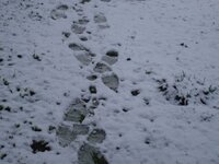
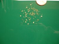
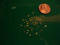
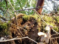
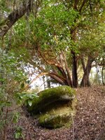
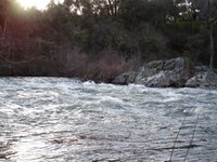
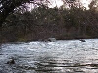
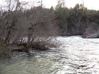
Well I have been itching all week to get out and sluice and finally the weekend is here and I wake up to a few inches of snow and some more falling. Ya like that's going to stop me, just had a couple more cups of coffee :coffee2: and off to the American river, the spot where all the rafters go by..lol. Oh ya I picked up a buddy to , poor sap gave him the fever and heard all about it from his lady. Ran about 16 five gallon buckets classified to 1/2 inch between the two of us. Here's some pics, enjoy..Gravelwasher :laughing7:
 

Attachments

  • snow trail.JPG
    snow trail.JPG
    56.3 KB · Views: 321
  • shiny penny.JPG
    shiny penny.JPG
    20.6 KB · Views: 339
  • green .JPG
    green .JPG
    36.4 KB · Views: 333
  • cold shiny.JPG
    cold shiny.JPG
    36 KB · Views: 344
  • angle.JPG
    angle.JPG
    28.7 KB · Views: 332

freddy williams

Hero Member
Oct 9, 2010
882
92
Alabama/ Ohio
Detector(s) used
GTI-2500, Whites V3, xplorer XS Cortes & XLT Cibola Tesoro Tiger shark Now using a Xterra 705, Ace 350...
Primary Interest:
All Treasure Hunting
Nice gold man HH keep up the gold work...
 

OP
OP
Gravelwasher

Gravelwasher

Hero Member
Jan 3, 2011
523
689
El Dorado County
🥇 Banner finds
1
Detector(s) used
Minelab
Thanks guy's!!

I went back to the American river today,no snow or hale today, panned out 4 pans 3 had color. I will try to get some pics of it downloaded later, finally got some pics of the river and such to. Gotta run time for some dinner, mining all day sure does build an appetite. Gravelwasher!!
 

OP
OP
Gravelwasher

Gravelwasher

Hero Member
Jan 3, 2011
523
689
El Dorado County
🥇 Banner finds
1
Detector(s) used
Minelab
Ok heres some pics of the American river, some of the tailing piles to and some of the dirt, all the good stuff. :icon_sunny: Gravelwasher
 

Attachments

  • more soil.JPG
    more soil.JPG
    124.7 KB · Views: 280
  • granite taco.JPG
    granite taco.JPG
    108.7 KB · Views: 286
  • fallen rock.JPG
    fallen rock.JPG
    105 KB · Views: 279
  • bedrock.JPG
    bedrock.JPG
    96.7 KB · Views: 303
  • amer flo high.JPG
    amer flo high.JPG
    108.3 KB · Views: 296
  • panning spot.JPG
    panning spot.JPG
    101.7 KB · Views: 280

Hefty1

Bronze Member
Dec 5, 2010
1,702
1,477
Hey Gravel
Nice color,
But I myself would not post pics of my diggins.
Wouldnt want to give any ammo to F&G or FS here in Ca.
Just me.

Hefty
 

OP
OP
Gravelwasher

Gravelwasher

Hero Member
Jan 3, 2011
523
689
El Dorado County
🥇 Banner finds
1
Detector(s) used
Minelab
The spot where the slide happened was just that a spot on the trail that gave out no dirt was moved by me, only a couple of rocks were replaced were we thought they went, figured if all the hikers put two rocks back it would be fixed quick. Just to clarify, thanks for looking. Gravelwasher :icon_sunny:
 

63bkpkr

Silver Member
Aug 9, 2007
4,069
4,618
Southern California
Detector(s) used
XLT, GMT, 6000D Coinmaster
Primary Interest:
All Treasure Hunting
Mornin,
Interesting pictures of the American. Right now depending which fork you are on the water is flowing around 2000 cubic feet per second. I've tracked it for many years and therefore know that it hits 20,000 cfs every now and then and likely higher when I was not looking. It was good that you wrote about Putting Boulders back even though you'd never touched them. I'd posted some pictures last year of a site I was working as well as pictures of how I'd reclaimed it at the end of the year. I'm Very interested to get back in there to see what the site looks like this year!

I noticed that the water in your pictures looks clear, is that correct? I've been in on a sierra river in February during a rain storm and the river was roaring and extended from wall to wall. Trees had been ripped out of the ground and were floating quickly down river and the water was milk chocolate brown. This sort of Natural removal of trees, boulders, plants, tons and tons of dirt and such is NORMAL for all spring runoff rivers that have a reasonable tilt to their downriver flow but I've never heard anyone in the forest service talk about what the rivers look like when it is just mother nature causing it. What little additional erosion is caused by our small time mining activities is a joke to what occurs naturally but we do not hear about that. BUT it is wise for us to reclaim our sites when we've finished with them as well as to have photographic proof of the reclaim work that is IMHO.

Regards and good luck with the search, 63bkpkr
 

Top Member Reactions

Users who are viewing this thread

Top