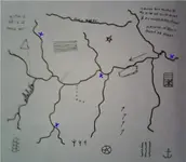
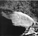
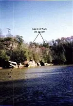
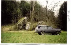
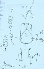
Curtis: the blue map is of beaver creek area. look at teakettle rock photo, the map is pointing northwest from above. the point of the rock is pointing toward the park on top of the ridge and where the 3 ledges are. the square with the X is where the cap stone is. I found a part of a broke silver wedge 20' from the rock. 50' yards past is a tomb stone shaped like an (m). as on the map. at the 101, its across the creek from the rich mine. you know the one. where I was standing, our rich mine is 100 yards down stream or to my left. just behind me on the bank, you have to look close is an arrow made from small rocks pointing to the rich mine. there are two small rocks with drill marks and a line pointing two one drill mark this the indian grave, under the ledge next to the high water line and the other points to the mine on its edge or next to the creek, its half filled with water. go up behind me to the cliff the old path is there, look next to the path and you will find a flat rock with 3 marks. this was before metal det. was a no, no, there is something under. but to many eyes around. P. M. if you need more info