Alessandro
Tenderfoot
- Jul 5, 2012
- 9
- 0
- Detector(s) used
- Minelab. Safari, CTX 3030, Garret GTI 2500
- Primary Interest:
- All Treasure Hunting
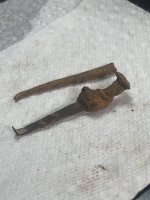
Hello everyone. I'm new here and I wonder if anyone can help me with these images.
Amazon Forum Fav 👍


Last edited: