OP
OP
GreenBranch
Jr. Member
- Feb 7, 2023
- 45
- 97
- Thread starter
- #21
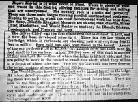
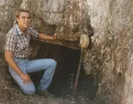
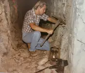
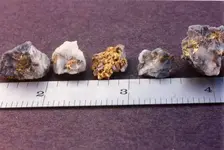
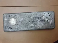
Sorry Clay, I didn't word that very clearly. I panned for gold but found quite a lot of silver, not by panning but just picking it up off the ground. I started noticing some mineralized quartz when we came to a convergence of a stream from the west. My topo map doesn't list a name. I kept picking up the quartz hoping to find signs of gold but there was nothing until we got to Rogers Canyon Spring and then the silver ore suddenly appeared. A few dozen yards further it suddenly stopped. Then again just past the cave mostly on the south side of the stream it picked up again. I didn't bring any samples home, that wasn't what I was after, but I know my son kept some. I'll see if he still has it and see if he'll send me pictures.