Basic signs and symbols you have found

Shortfinger

Hero Member
Apr 7, 2015
569
2,475
Valley Center, CA/Yuma, AZ
Primary Interest:
All Treasure Hunting
Hello Shortfinger ( are you a retired carpenter by chance ) My thoughts are that by the height of the boulder that its a long distance marker, the boulder on top may indicate the direction ( to the left ) possibly a settlement, possibly fifteen leagues or so. May be a Royal Trail if there's a Church in the direction indicates. That's my guess anyway. The 7's limits the meaning to just a couple of things.

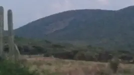
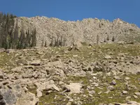
Dsty, no, my short finger came due to an accident with a fishing boat. I have to agree, it does seem to me to be a long distance marker, designed to be seen from far away. The rock on top seems to have been tapered/pointed to point to the right, not to the left, I think. If the trail goes where I think it should, there was a mission about 20 miles away (more or less, depending on the actual trail). Reversing would put you about the same distance from an assistencia (small sub-mission). My guess is, however, that this may be a Mexican trail. It is my understanding that they may not have been as rigid in the rules they used to mark the trails as the earlier Spanish were.

JB
 

Shortfinger

Hero Member
Apr 7, 2015
569
2,475
Valley Center, CA/Yuma, AZ
Primary Interest:
All Treasure Hunting
About how many feet away is your property from the boulder with the symbols?

Quinoa, from the point where I took the picture, about 100 yards and 125' in altitude. From the area where i suspect the trail might have been about 180 yards and 175' in altitude. Of course, the rock may have been visible farther away, but it is clear at those 2 locations. The rock itself (the one on top with the marking) is about 8' to 10' long.

JB
 

dsty

Bronze Member
Dec 2, 2007
1,300
736
Randal County
I try to use the symbol as I would ( when it fits ) a bow and arrow when it is at a 45 degree angle or when its a slight angle has a different distance value, when a arrow points to the ground I believe it will indicate a foot measurement than one that points at a 10 degree angle. there's just so many different factors that seems to be called for, I believe that a symbol that has a its front raised / lowered is for a reason or having daylight under one end and not the other has a meaning that should be considered. Just my thoughts.
 

Quinoa

Bronze Member
Nov 25, 2011
1,890
3,275
Purgatory
Detector(s) used
Garrett atx pi 12+20inch coil, Garrett mh series, Garrett 2500+t-hound attchmnt, fisher tw-6 two box, Pulsestar pro ii with various coils up to 98 inches, pulsemaster pro w/1.2 m coil
Primary Interest:
Other
Shortfinger, did you catch what I said before I edited? Your property is likely a little too far off, but if it has been emptied it could have been split up and reburied in nearby locations. What is on your property that stands out, or seems out of place that you own on the right side?
 

Shortfinger

Hero Member
Apr 7, 2015
569
2,475
Valley Center, CA/Yuma, AZ
Primary Interest:
All Treasure Hunting
Shortfinger, did you catch what I said before I edited? Your property is likely a little too far off, but if it has been emptied it could have been split up and reburied in nearby locations. What is on your property that stands out, or seems out of place that you own on the right side?

Quinoa, no, I missed it. As I said, probably NOT a treasure sign, but there are a couple of unusual things on the property that make me wonder.

IMG_3807.JPG IMG_3810.JPG

The first is a heart, but it could be natural. points to a large pile of rocks with a lot of lichen on them which I haven't cleaned off yet, the other is maybe a very old fire ring, both in the same area with a large rock with a capstone on it that looks like possibly a damaged turtle.
 

Last edited:

Quinoa

Bronze Member
Nov 25, 2011
1,890
3,275
Purgatory
Detector(s) used
Garrett atx pi 12+20inch coil, Garrett mh series, Garrett 2500+t-hound attchmnt, fisher tw-6 two box, Pulsestar pro ii with various coils up to 98 inches, pulsemaster pro w/1.2 m coil
Primary Interest:
Other
The brown stain on the rock in second photo kinda looks like a heart with a cut lobe, but I would need to see more of the surrounding stuff to be sure. Do you have pictures on your properties that show much more area at a time though, with any boulders that stand out or stick up or are propped on top of others, strange trees etc? Also try and take them about 11 pm or 12pm on a sunny day, and take them from a bit of distance. Catch them from an angle casting some shadows. Your other photo there was done by man, but I'm not sure what it is, may be some ritual type thing like an alter, it kinda looks like a heart as well. There is a lot of strange stuff that happens near these sites.
 

dsty

Bronze Member
Dec 2, 2007
1,300
736
Randal County
Hello Shortfinger, when you get this one figured out there's another that's similar about 1/2 way down Palo Duro canyon south of Amarillo Texas, its on top of a stand alone feature kinda like yours about 35 ft high it has 3 facial features looking South, South East and East, the lizard on top has a small boulder in the middle that keeps it on an angle kinda like a tetter totter it sits at about 15 degrees and the head looks to the South possibly San Antonio Where the KGC had a Castle. You can see it using Google Earth, its due West of a Curio Shop and a large parking lot.
 

Shortfinger

Hero Member
Apr 7, 2015
569
2,475
Valley Center, CA/Yuma, AZ
Primary Interest:
All Treasure Hunting
Hello Shortfinger, when you get this one figured out there's another that's similar about 1/2 way down Palo Duro canyon south of Amarillo Texas, its on top of a stand alone feature kinda like yours about 35 ft high it has 3 facial features looking South, South East and East, the lizard on top has a small boulder in the middle that keeps it on an angle kinda like a tetter totter it sits at about 15 degrees and the head looks to the South possibly San Antonio Where the KGC had a Castle. You can see it using Google Earth, its due West of a Curio Shop and a large parking lot.

Gee, thanks, dsty. As if i didn't have enough around here to work on. Here's another one i have found, about 350 miles north of my property.

North side.JPG

South side.JPG

East side.JPG

West side.JPG

Some of this may be natural, but the cross isn't for sure.
JB
 

Shortfinger

Hero Member
Apr 7, 2015
569
2,475
Valley Center, CA/Yuma, AZ
Primary Interest:
All Treasure Hunting
The brown stain on the rock in second photo kinda looks like a heart with a cut lobe, but I would need to see more of the surrounding stuff to be sure. Do you have pictures on your properties that show much more area at a time though, with any boulders that stand out or stick up or are propped on top of others, strange trees etc? Also try and take them about 11 pm or 12pm on a sunny day, and take them from a bit of distance. Catch them from an angle casting some shadows. Your other photo there was done by man, but I'm not sure what it is, may be some ritual type thing like an alter, it kinda looks like a heart as well. There is a lot of strange stuff that happens near these sites.

Quinoa, somehow the pictures got reversed. the stain is actually kind of reddish, and appears to be an upper layer of rock that was left alone while the rest was chiseled out, and is the one I was referring to as the heart. Now that you mention it, the circle of stones does sort of look like a misshapen heart as well, but i still suspect fire ring. Part of the problem at this site is, it is in a developed area, and many of the possible signs have been damaged, moved or destroyed. This is the capstone I mentioned above. You can see the "fire ring" just on the other side of it. This may be natural as well, but...

IMG_3808.JPG

Most of this area is shaded by very large oak trees, so not much sunlight gets through, so very few shadows.

JB
 

Last edited:

Havillah

Jr. Member
May 22, 2005
37
30
San Juan del Río, Querétaro, Mexico
Detector(s) used
Garrett Money Hunter TR;
Garrett GTP-1350;
Garrett AT Pro International
Primary Interest:
All Treasure Hunting
re: Today I spotted a mule symbol!

Hello, my friends. I have really been enjoying this thread, as well as learning a bunch. Thanks!

On my way over to our state capital (Santiago de Queretaro) this evening, I took a back road part of the way to a friend's house. Now, I have been on this road dozens of times. However, this evening I saw it, thanks to this thread! On the face of the mountain several miles in front of me: The clear face of a mule (or perhaps burro) facing East towards Mexico City (approx. 205 kms or 130 miles distance.) The figure would be probably 60 or more feet in height. Even in this blurry picture, you can see the eye and the lower jaw.

I must again apologize for the poor image, as the sun was already going down, and I took it with my cell phone. Hopefully in a few days I can post a better one.

What do you think, my friends?
 

Attachments

  • Donkey-003.jpg
    Donkey-003.jpg
    47.6 KB · Views: 143
  • Donkey-002.jpg
    Donkey-002.jpg
    39.9 KB · Views: 121

Havillah

Jr. Member
May 22, 2005
37
30
San Juan del Río, Querétaro, Mexico
Detector(s) used
Garrett Money Hunter TR;
Garrett GTP-1350;
Garrett AT Pro International
Primary Interest:
All Treasure Hunting

dsty

Bronze Member
Dec 2, 2007
1,300
736
Randal County
Thank you for the post, Havillah and the very important information with it The height of the head as you estimated to be 60 feet high and the distance to be 130 miles, That fits really good with what my theory has been, height = distance, using your distances 130 miles divide 2.5 miles = 52 feet high = close enough for me, Thanks There should be markers along the way, a mule head indicates the start of a trail/ trail for animals / which will be a winding trail following the lay of the land, a slow trail and very possible trail for supplies, I would expect a marker at each turn in the trail indicating a change of direction and a marker with a distance indicator such as less than knee high measure, knee high = a cordel = 190 feet, hip high 600 feet, waist high, shoulder high, head high, each marker should have a mark / on it that identifies it as such. Good post Thank you
 

Last edited:

Barton

Sr. Member
Apr 21, 2005
446
320
Abiquiu, NM
Detector(s) used
What ever is needed for the project I am working on--I am a cache hunter
Primary Interest:
Cache Hunting
Can you explain how to read these markers?

I was looking for some advice on how to read these Spanish markers.

The larger white stone for example looks like a face looking in two opposite directions
I have seen this white stone twice now

I thought the large black stone was a black dog / and a black face

There are triangles in the back ground too.

Barton
 

Attachments

  • 012 (2).JPG
    012 (2).JPG
    1.3 MB · Views: 155
  • 013 (2).JPG
    013 (2).JPG
    1.3 MB · Views: 135

KXMember

Full Member
Dec 19, 2014
233
141
New Mexico
Detector(s) used
OKM
Primary Interest:
All Treasure Hunting
Barton...take a measuring line/tape out to the area and find redundancy in the math. I see a Turtle, books, triangles ect.
 

Barton

Sr. Member
Apr 21, 2005
446
320
Abiquiu, NM
Detector(s) used
What ever is needed for the project I am working on--I am a cache hunter
Primary Interest:
Cache Hunting
Hello KX member--would you be willing to make a sketch--showing an example of redundancy in the math?

It does not have to be any actual site--just an example for everyone, including me to learn from

And Yes--I completely failed to see any books in the photo.

Do you prospect in Northern NM / Southern Colorado ?

[email protected]

Would you like to go to lunch some time?

Barton
 

widomanmx

Banned
Dec 6, 2013
300
97
Chihuahua (mx)
Detector(s) used
Gemini 3
Deepers
Primary Interest:
Cache Hunting
Barton, you need identify all the signs then look for layout/s

Maybe angle of picture from black+white head its not correct, head is somewhat vague
.. too much zoom, you need to get away a little
 

Barton

Sr. Member
Apr 21, 2005
446
320
Abiquiu, NM
Detector(s) used
What ever is needed for the project I am working on--I am a cache hunter
Primary Interest:
Cache Hunting
Widowmanmx--here is a view where I stepped back

ok--here is a broader overview

Barton
 

Attachments

  • 011.JPG
    011.JPG
    2.1 MB · Views: 135
  • 012.JPG
    012.JPG
    2.1 MB · Views: 156
  • 013.JPG
    013.JPG
    1.9 MB · Views: 211

widomanmx

Banned
Dec 6, 2013
300
97
Chihuahua (mx)
Detector(s) used
Gemini 3
Deepers
Primary Interest:
Cache Hunting
Barton, i think black-dog-head is good
.. looks unique, so, search rocks of same type & color

About white-head i dont know, first i think its a white-dog-head but now i dont think so
.. check it close maybe have other sign like black-dot (size/type)
.. maybe its not a head
.. have a big "scratch" like triangle/opening(<) and a black-dot (eye?)

Try to align both sides from opening with rocks in place
.. maybe a triangle layout

View attachment 1167801
 

Last edited:

dsty

Bronze Member
Dec 2, 2007
1,300
736
Randal County
Hello Havillah, My thoughts are there may a in and an out trail, the trail takes you the mule head to the City, the area behind the head may be a Mining area with trails going into the mountains to the left and right to mines, some time they back filled them to keep others from finding them. Sorry about the wrong distance indicator, the mule head be 52 feet high X 2.5 miles = 130 miles.
 

Last edited:

Top Member Reactions

Users who are viewing this thread

Top