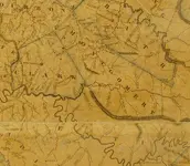
-Ki- Hero Member Joined Feb 12, 2009 Messages 642 Reaction score 583 Golden Thread 0 Location EASTERN KENTUCKY Detector(s) used MD & Handwand "CaveHunter"Hiker" SonyDigital SLR Oct 2, 2009 Thread Owner #1 Clay City, Ky Old maps ---- In this map Clay City was called Iron works pike , and Stanton called Beaver pond Attachments best map 1812-1850.webp 120.5 KB · Views: 709
Clay City, Ky Old maps ---- In this map Clay City was called Iron works pike , and Stanton called Beaver pond
-Ki- Hero Member Joined Feb 12, 2009 Messages 642 Reaction score 583 Golden Thread 0 Location EASTERN KENTUCKY Detector(s) used MD & Handwand "CaveHunter"Hiker" SonyDigital SLR Mar 29, 2010 Thread Owner #2 Re: Clay City, Ky this place used to be bigger than lexington
1320 Silver Member Joined Dec 10, 2004 Messages 3,478 Reaction score 2,312 Golden Thread 0 Location East Central Kentucky Apr 5, 2010 #3 Re: Clay City, Ky What's the date of this map Ki? I've haven't seen this one before, thanks for sharing. Jamie
Re: Clay City, Ky What's the date of this map Ki? I've haven't seen this one before, thanks for sharing. Jamie
-Ki- Hero Member Joined Feb 12, 2009 Messages 642 Reaction score 583 Golden Thread 0 Location EASTERN KENTUCKY Detector(s) used MD & Handwand "CaveHunter"Hiker" SonyDigital SLR Apr 6, 2010 Thread Owner #4 Re: Clay City, Ky This map is from around the 1840-50 era.... This was the best map id found that helped with my research on some old treasure leads from this time period... your very welcome
Re: Clay City, Ky This map is from around the 1840-50 era.... This was the best map id found that helped with my research on some old treasure leads from this time period... your very welcome
Beercanman Full Member Joined Feb 26, 2011 Messages 243 Reaction score 128 Golden Thread 0 Location Lexington, Kentucky Feb 1, 2013 #5 Any chance of pics of this map further west? Specifically Lexington/Versailles? Thanks!