What's new

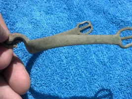
Found this a couple days ago......

johnedoe

Bronze Member
Joined
Jan 15, 2012
Messages
1,497
Reaction score
2,242
Golden Thread
0
Location
Oregon Coast
Detector(s) used
White's V3i, White's MXT, and White's Eagle Spectrum
Cleangold sluice & prospectors pan, EZ-Gold Pan, and custom cleanup sluice.
Primary Interest:
Other
I ran across this site a few days ago and thought I would share it here... I know you have land matters but this is just another tool for the hunt.
https://thediggings.com/
 
Upvote 0
Missing quite a few in Ohio that land matters had on mine. Every tool I can get helps though, thanks for pointing this out.
 
seen it, the satellite images posted on that site for areas I know are just the same image for different claims.
looked up a friends' claim, wasn't there and I am sure my friend keeps up his paperwork.
so, you make up your own mind, I don't think too much of it.
 
seen it, the satellite images posted on that site for areas I know are just the same image for different claims.
looked up a friends' claim, wasn't there and I am sure my friend keeps up his paperwork.
so, you make up your own mind, I don't think too much of it.
What images are you referring to?
 
The lr2000 will do the same except it's accurate and up to date. It would even hold up in court if you were arrested for mineral trespass.
 
you didn't see any satellite images for each claim John?
when I was browsing the site months ago, the same satellite image appeared for a claim on the middle fork as another on the south fork.
I determined the image was the south fork, but not the location described on the site.
can't find my friend Joes' placer claim on the middle fork at all. I'm certain he's filed Nevada county, not Sierra.
I doubt the accuracy of this site.
 
I haven't payed that close of attention to it yet... just found it and been scanning it... I will see if I can find what you are talking about.
 
thediggins comes up a lot if put a claimant's last name first in google
researching the contact for someone that hasn't filed on time but still listed as active.
I've gotten two claims just by calling and asking if they were letting them go.
 
Last edited:
The lr2000 will do the same except it's accurate and up to date. It would even hold up in court if you were arrested for mineral trespass.

This is very wrong JohnnyBravo. The Lr2000 is neither accurate nor up to date. The lr2000 is not a record so although it may be admissible in some courts it will never save you from a criminal trespass charge.

The lr2000 is only the starting point in determining whether you can prospect any particular portion of the public lands. Best to start with the Master Title Plats then the lr2000 then the county recorders office and then boots on the ground to search for new claim monuments. Those are the bare necessities of due diligence before prospecting, sometimes you have to do even more to establish that you have the right to prospect a spot. Relying on the lr2000 will get you the barrel of a gun in many areas and could easily lead to criminal trespass and theft charges.

The U.S. has been giving away discoveries of valuable minerals on the public lands since 1812. That does not mean the minerals are free to all comers - it means with due diligence, hard work and some luck you could find a paying claim. The lr2000 wasn't even thought of until... 2000. Miners were determining land status for 134 years before the lr2000 existed and 110 years before the BLM haqd anything to do with mining claims. But you don't have to take my word on this because it's all explained in very clear language on each and every lr2000 report you have ever opened - right there at the bottom in bold capital letters:

NO WARRANTY IS MADE BY BLM FOR USE OF THE DATA FOR PURPOSES NOT INTENDED BY BLM

You can take that to court. :thumbsup:

Heavy Pans
 

Users who are viewing this thread

Back
Top Bottom