Don Page was also the head of the Forest Service in Arizona.
As far as Gray Oliver.
He initially hired Hoke Construction to do his excavating at the site. I believe he accused Dean Hoke of taking something from the site probably one of the many stones carved with letters and numbers by the old Loco man for which the canyon was named. Or he just could not afford his fees so he came up with the story.
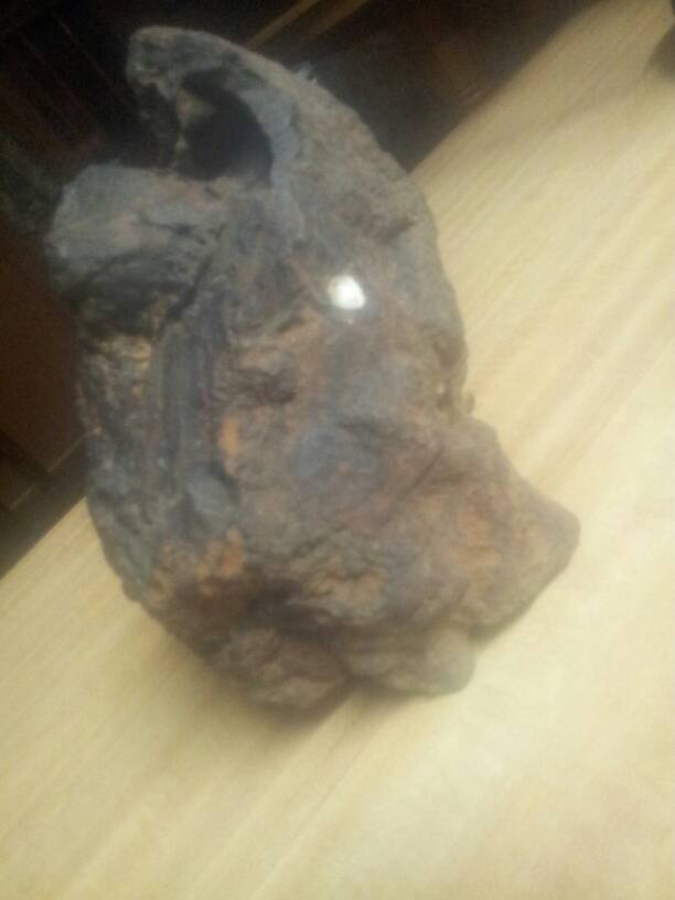
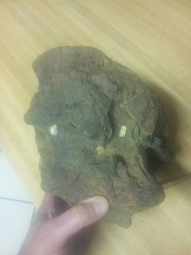
After that he hired Lewis Excavation and Darrel Petitt. I know this because I knew Darrel my Brother in Law worked for him for many years. I asked Darrel to tell me the story one day and he told me they were blowing up half the mountain searching for the an entrance to a tunnel and broke into an old shaft that could not be verified as being man made or natural. It looked similar to a vent shaft and tunnel but he said that he had the Molina Map with him or something similar some sort of map he wouldn't show anyone.
Ron Quinn doesn't think to highly of Mitchell or his fabrications as he witnessed Mitchell selling bogus mining claims out of Arrivaca and wouldn't say much when around him for fear his stories may be hijacked for one of Mitchells fictions.
Spanish Colonial: Jesuit missionary Father Francisco Eusebio Kino entered the Santa Cruz Valley in 1691, converting the natives, building missions, ranches and farms.
By 1732 Tubac was a vista of Mission Guevavi and a mission farm and ranch by 1738. The Pima Revolt of 1751, resulting from a half-century of Spanish domination, caused widespread destruction. In 1752, Spanish troops defeated an army of 2,000 Piman warriors and established the Presidio of San Ignacio de Tubac. Garrisoned with fifty troops and officers, it was commanded by Capt. Juan Thomas de Belderrain.
Apaches Indians, recent migrants, preyed upon Tubac and the surrounding area. The Jesuits were expelled from Spanish possessions in 1767 and replaced by the Franciscans. By 1771, the now-friendly Pimans, were moved from Guevavi to Mission Tumacacori for easier protection. Perhaps Tubac’s most famous person was soldier and explorer Capt. Juan Bautista de Anza II. During his tenure at Tubac (1760-1776), Anza built the chapel of Santa Gertrudis, the foundations of which lie beneath today’s . Anza’s second expedition to the Pacific coast departed from Tubac October 23, 1775. It included approximately 300 soldiers and colonists, and culminated with the founding of San Francisco.
https://www.tubacaz.com/history-of-tubac/
The church and the military were the vanguards of Spanish frontier expansion throughout New Spain. The Jesuit, Eusebio Francisco Kino, established missions from 1687 to 1711 to christianize and control Native Americans in the area. He established nearby Tumacacori in 1691, and Tubac, then a small Piman village, became a mission farm and ranch. Spanish Colonists began to settle here during the 1730s, irrigating and farming the lands along the river and raising cattle, sheep and goats on the northern frontier of Spain's New World empire.
Luis of Saric, a Pima chief stirred by many grievances, led a bloody revolt late in 1751, destroying the small settlement at Tubac. Following a major battle, and subsequent surrender of the Pimans, the Presidio San Ignacio de Tubac was founded in June of 1752. The fifty cavalrymen garrisoned at this remote military post were to prevent further rebellion, protect colonists and the mission, and further explore the Southwest.
Juan Bautista de Anza II, second commander of the presidio, led two overland expeditions to the Pacific, resulting in the founding of San Francisco, in 1776. Several hundred colonists from the provinces of Sinaloa and Sonora, along with sixty from Tubac, made the trip. Over 1,000 head of cattle, horses and mules were also gathered to transport food supplies and tools, provide food on the journey and establish new herds once the colonists settled at their new home on the Pacific.
Following Anza's return to Tubac, military authorities moved the garrison from Tubac to Tucson in 1776, and the unprotected settlers abandoned their homes.
For a decade, Tubac languished from Apache depredation and without military protection. The situation finally resulted in the Viceroy's reactivating the presidio in 1787, this time with Pima Indian troops and Spanish officers. Mexico won her independence from Spain in 1821 and the new Republic of Mexico's flag flew over Tubac until 1848. In that year, a fierce Apache assault caused great loss of life and Tubac was again abandoned. This catastrophe, coupled with the drain of men leaving for the gold fields of California in 1849, turned Tubac into a virtual ghost town.
At the park, visitors can see the above ground remains of structures from the 1920s.
Tubac was part of the Gadsden Purchase of 1853, and was soon being resettled and developed by Eastern entrepreneurs as well as by former landowners. Charles D. Poston was instrumental in forming the Sonora Exploring and Mining Company, and used the abandoned Commandant's house as his headquarters. He performed marriages, granted divorces, baptized children and printed his own money to pay company employees. His company acquired a press in 1859 which printed Arizona's first newspaper.
Tubac's population steadily grew until, in 1860, it was the largest town in Arizona. The American Civil War, however, drained the region of troops, leaving it unprotected from Apaches, and Tubac was again deserted. Although the region was resettled after the war, silver strikes in the Tombstone area and the routing of the railroad through Tucson drew development interests away from Tubac, and the town never regained its earlier importance.
In 1974, archaeologists from the University of Arizona excavated portions of the presidio. In 1976, an underground archaeological display was finished and visitors can now view portions of the original foundation, walls, and plaza floor of the 1752 Commandant's quarters, as well as artifacts representing the various periods of Tubac's unique history.
Two later military installations existed at Tubac. Troop "L" of the 1st California Cavalry established a post in April 1864 and a US Army presence existed until at least October 1867, when reports list seven officers and 237 enlisted men.
One unique military experiment, the heliograph, was a device using mirrors and reflected sunlight. General Nelson A. Miles, in his campaign against the Apache in the 1880's reported that "they (the Apaches) had found troops in every valley, and when they saw heliographic signals flashing across every mountain range, Geronimo and others sent word to Natchez that he had better come in at once and surrender." Tubac was one of the permanent stations in the system including Forts Rucker, Crittenden, Henly and Bowie.
Arizona State Parks: Tubac Presidio: Home
Many versions of the History exist. The top one has the city of Tubac as the Piman village and I found another version that says Tubac was a Ranch Hacienda and Tumacacori was a Presdio so we have numerous stories flaunting various versions of the History down there. Which one is Correct? A little of all of them I suspect.
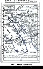
Don Page became interested in archaeology while he was a Tucson employee. His interest was sparked by his discovery of ancient ruins that were found during an excavation in the City of Tucson. Yes, he collected old documents during his lifetime, and he wrote some articles for archaeology periodicals. He appears to be a major source of information on the history of the Santa Catalinas. Page moved to CA after retirement where he continued to pursue his interest as a hobby. He died in 1958. Without documentation proving he owned a "Molina Map", this is just speculation. Santiago Molina did not sell maps, and there is no suggestion that such a map existed until sometime in the 1930s. Rose thought that the map was probably created by Ortiz.
If you look carefully at the map, you can figure out that the time period the map was created was in the last 100 years. Gary Don Oliver was attracted to the Tumacacori area by the stories written by John Mitchell. He made his first visit in 1974. After investigating the Camp Loco site, Gary became convinced that a treasure was buried in the old tunnel. He obtained the proper permits and commenced trying to reopen the old main shaft. He was able to open one entrance, but the evidence of the large tailing pile down into the canyon made him believe that he had not found the main tunnel. Gary did not get a copy of the map until shortly after the publishing of his book in 1991. He was given a xerox copy by someone, and he gave a copy to me. Since then I have seen some similar versions of this map that looked like they had been photo-shopped with some minor alterations.
John Mitchell never mentioned that he had a map. He only talked about the copy of the old document. Someone that was familiar with the Camp Loco site created that map using the directions given in the Molina Derroterro.
A man by the name of Juan Bustmente was also in possession of the Derroterro. He was well known by the treasure story writers, and he took Mitchell to some of the mine sites listed on the old document.
Tumacacori was never a Presidio. It was an old Pima village. Padre Kino had a Visita built there, but no mission building was built by either the villagers or the Jesuits. The current Tumacacori Mission was started about 1787 and never finished by the time it was abandoned. The Pima revolt of 1751 resulted in actions by the Spanish to build a Presidio at Tubac in 1752. Tubac is three miles north of Tumacacori. Over 100 Spanish colonists were killed during the 1751 revolt, and their farms destroyed. It was over fifty years before the area attracted colonists and a return of support by the Franciscan missionaries. Here is a history of Tubac:
Tubac Through Four Centuries: An Historical Resume and Analysis
Mexico won their independence from Spain in 1821. Tumacacori was active as a village and Pima community. Farming and the raising of animals again made the area prosperous, and efforts continued to finish the construction of mission building. The Apache was now a threat to the community, but the Presidio was maintained for protection of the villagers, colonists, and the missionaries. Enough of the mission building was finished and services were started in 1822. A good history of the mission was written by Frank Pinkley:
Mission of San Jose de Tumacacori
There was a Lt. Juan Maria Oliva that served under De Anza, arriving at Tubac in 1752. He was born in 1701 and was in charge of the Post until after the Jesuits were removed in 1767. I doubt if this is the Oliva, but I am sure he would have been knowledgeable about who was doing the mining in the area. Oliva is a common family name in the area. Maybe someone in his family was the one that ran the Galera and created the Molina Derroterro.
The treasure hunters and writers have long tied the treasure tales to the Jesuits. The Jesuits became aware of the expulsion order and hid their weath and church fixtures before they were arrested. The mine and geographical names used in the Derroterro are all Franciscan. The Franciscan missionaries may also have hidden the church fixtures when they were forced to leave.
If you stop and think about it, the mines, their names, and their locations weren't any big secret at the time they were operated. The only thing that would have been kept secret is the hiding of valuables. The missionaries were driven away from Tumacacori in 1824, and the Galera may have been closed at the same time. Research may provide the answers to some of these questions.