Superstition People, Places, & Things.

Status
Not open for further replies.
I seen them ship plyin' the Salt River from long ago..

Driving a boat through sand just ain't economical, but some people never learn.

Desert-Ship-6.webp
 

The Salt

Gentlemen:

Perhaps the time frame we are looking at goes back a bit further. The second migration occurred about 1500 years ago and previous settlement occurred in excess of 10000 years ago.

Interestingly enough as all of this develops there is a great deal of humor that will come from the realization of what sits under a certain suburb of Phoenix. One might say the symbol of Phoenix is very appropriate.

Starman
 

I would love to see what the salt river valley looked like 13,000 years ago. An impressive city? I guess we just need to open the stone doorways in the sups and learn about our past.
 

I would love to see what the salt river valley looked like 13,000 years ago. An impressive city? I guess we just need to open the stone doorways in the sups and learn about our past.

captain,

I have doubts that the Salt River Valley looked much different 13,000 years ago, minus what man has done, than it does today. That would have been well before the Hohokam canals. No large/impressive city could have existed without leaving evidence of its being there.

That's just my personal opinion, so I could, of course, be wrong.:dontknow:

Good luck,

Joe Ribaudo
 

It has been a lesson in geology for sure.
Still wondering about the relationship between these fault lines and gold claims.
Would there be one?

Very interesting map, Hal. Where did it come from, and is there a more comprehensive version?

Believe this is the first map I've seen that labels "El Recortado" so prominently.
 

Hello Hal,

I found a rough map on the flow of intermittent water run off through the Superstition Mts. and possibly other info that might be of interest to you, listed in the 'Arizona Water Atlas Volume 8: Phoenix AMA'.

http://www.azwater.gov/azdwr/Statew...agementAreas/documents/Volume_8_PHX_final.pdf

You'll have to scroll your way down to page 126 for the map (particularly the green lines).

Map is titled;

Figure 8.1 -5
Phoenix AMA
Perennial/Intermittent Streams & Major (>10gpm) Springs

[I'd post the map here myself but I'm having 'computer issues' (code for lack of computer skills on my part).]
 

Last edited:
This one?
 

Attachments

  • 1462062597370.webp
    1462062597370.webp
    22.3 KB · Views: 123
Zoomed in
 

Attachments

  • 1462065538308.webp
    1462065538308.webp
    70 KB · Views: 142
This one?

Aye, aye, Captain, that's the one (but a tad small even when enlarged).

However, the 'Zoomed In' map is off a little to the west, doesn't show the green Superstition drainage lines.
 

Last edited:
Hola, notice the fault line on both sides of the sierra. in the picture. Talk about locations for deposition of precious metals


Fault lines.webp
 

Attachments

  • FN S aults paralell to the  crestof the mt range.webp
    FN S aults paralell to the crestof the mt range.webp
    31.8 KB · Views: 365
Last edited:
starman, Chris Hardaker,

Personally, if I had the resources and the time, I would research the Mowrey claims. They are the most logical source for the material used to cast the Tucson "Artifacts" and what happened to Mowrey there is just too coincidental to ignore IMO.

I hope this inspires you to look...

"It was discovered in 1857 by a Mexican herder, who sold it to Captain Ewell (afterwards General Ewell of the Confederate Army) and Messrs. Brevoort (an error?), Douglass, and Johnson, who gave the Mexican a pony and some other traps for the location."


View attachment 1302952

N 31° 32.452 W 110° 45.193


"The first owners were Colonel J.W. Douglass, Captain R.S. Ewell, Lieutenants J.N. More, Mr. Randal, Mr. Lord, and Mr. Doss - all belonging to the United States Army excepting the last named individual and Colonel Douglass."


"The Patigonia Mining Company, Col. Douglass Superintendent, are progressing with fine success. They have a deep shaft sunk, and over one hundred tons of ore out of the ground."

The Weekly Arizonian., 03 March, 1859


Douglass replaced?

"The Patagonia Mine - At this establishment under the superintendence of Mr. William Godfroy, from five to eight hundred pounds of ore per day is being smelted with one furnace of limited capacity."

The Weekly Arizonian., 28 April, 1859


View attachment 1302947

Richard Stoddert Ewell
(1817 - 1872)
Richard S. Ewell


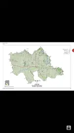
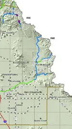
The Patagonia Mine was located close to a well-worn trail used by the Apache who, in 1859, chased off Mexican workers on several occasions. This is a great article:

"APACHES - The country in the vicinity of the Patagonia mine is literally full of Apaches, chiefly Coyoteros. A party of thirty called at the Patagonia mine a few days since demanding provisions. Being interrogated as to where they were going, they coolly answered they "were traveling for their health!" Towards the whites they manifest no hostility, but did not conceal their hatred against Mexicans."

The Weekly Arizonian 05 May., 1859


Apache harrasment continued and the production at the Patigonia began to slip. This ad ran until November of 1859. That same year, Lord and Doss sold their interest in the Patagonia to E. Brevoort (postmaster at Fort Buchanan) who essentially mismanaged the mine. Brevoot's mismanagement resulted in a rift between the remaining owners. Ewell and his partners sold out to Brevoort who, almost immediately, sold out to H.T. Titus.

View attachment 1302982
Henry Theodore Titus
(1822 -1881)
Colonel Henry Theodore Titus

Conditions at the Patagonia did not improve and the mine was sold to Lieutenant Silvester Mowrey in the spring of 1860 for $25,000 cash. Later Mowrey sold one fifth of the mine to "a wealthy capitalist in the East". This is when the mine was renamed the Mowrey Mine.


Hal, I spent a lot of time at the Mowry Mine years ago when I first moved to Tucson. I would camp out in the Patagonia Range (Harshaw Mountains / Fort Buchanan). I discovered the old rock Corrals used by I assume Mexican workers at the Mowry. The main shaft was flooded but looked to go down many levels. Just this Saturday my wife and I drove to Patagonia Lake for a look at the water levels to see if our Pontoon boat would launch with out ruining the tail lights of the trailer. The lake was only down 4 inches from it's high so we're a go for launching. It's a double deck Party Cruiser 32 foot.

We drove past the tailing piles like the ones I posted with the chiseled triangle shaped holes in them.
That was near I10 and the old Sonoita highway. This last Saturday I went out around the old Mammoth Mine which later became the SAN Manuel.
SAN MANUEL.webp


While toolling around in the desert I ran into two guys in a Polaris Ranger moving sort of slow. As the went by I spotted a beach ball sized huge quartz boulder in the back of the quad bed.

I stopped them and asked if they found it at one of the mines near by and whether or not it was an ore sample. They replied that it had no reading on their metal detectors and they found it at the interersection of two roads.

I already knew this as I was just there six weeks ago when I lost the use of my right arm too Carpal Tunnel, Torn Bicep, Torn Rotator Cupp, and Tendinitis with Cubital Tunnel. All that from digging targets Metal Detecting!

The use of my arm is slowly coming back I have about 60% of it now.

Anyways the guy tells me he's been looking at that white quartz boulder for over two years and finally found a spot he could put it in his yard!

While out there I went on a hunt for old mines and by following some very old tracks I found an old Spanish Mine complete with Shrine!

I snapped some photo's of it. It's shaped like a church door and has had back wash from flooding partially fill in the floor. You would still need to bow down for movement.
It's right by a waterfall and next to a cave just on the left out of view. I believe the cave may be the mine as the whole picture is in a rio so you reverse it. Tyipical Jesuit type mapping trickery. The cave looks dangerous and has a large nest of birds in it. I have no picture of the cave but I do have some of the entrance into the mine.


20160501_152455_resized.webp

20160501_152543_resized.webp

20160501_152552_resized.webp
 

Last edited:
Great pictures, Bill! What do you think they were chasing?
 

Great pictures, Bill! What do you think they were chasing?

Indian Maidens!!

It's in an area known for Gold and Silver so I assume it was gold. Many monuments around the site including two head monuments that look almost identical. I'll see if I have them for upload.

20160501_124842_resized.webp20160501_124848_resized.webp20160501_124914_resized.webp

20160501_154400_resized.webp20160501_154401_resized.webp20160501_154356_resized.webp
 

Entering Zlanapah, looking north.

I think that this may be Zlanapah, the actual bend in the river. Not 100% sure. Access to the river here was easy and safe.


Great shots Hal. I ran across these photos myself and was going to post them before realizing that you had already done so.
I suppose a common theme on site is newer members constantly repeating what has already been found, thought of, and posted before, some times many years before.
No wonder some 'older' members are so ornery. :)
---------

Here's a 1910 ca. shot; http://azmemory.azlibrary.gov/cdm/singleitem/collection/ahfglass/id/86/rec/354

Enlarge the picture and notice the stacked stone marker in center of picture.
Wonder what the light vein is (probably reason for the picture) lower left?
Someone thought it worth hauling one of those old heavy (glass negative) cameras up there to photograph.

May not even be in the Superstition. Possibly Papago Park area.
Picture donated by Robert Spude and possibly related to other photos listed on same site, including a ranch house (looks more like edge of a town), which may better pin-point it's location.
http://azmemory.azlibrary.gov/cdm/singleitem/collection/ahfglass/id/364/rec/353

[EDIT; Roadhs2 and Hal tell me the "light vein" is a flaw in the old photos, part of a square pattern of leaking light around the plate holder of the old cameras. A pattern more noticeable in some of the other photos posted here.]
 

Last edited:
Status
Not open for further replies.

Top Member Reactions

Users who are viewing this thread

Latest Discussions

Back
Top Bottom