Superstition People, Places, & Things.

Status
Not open for further replies.
Wild Bill,

Here is a great picture of two miners using a sledge hammer and type of hand-held drill bit you discussed earlier. Notice the candles in the metal holders, (I think some of you have found those artifacts in your searches.)
Make sure to enlarge the picture and drag around for better details.

Interior View of Unidentified Mine :: Arizona Photograph Company Collection - A Centennial Legacy Project
 

ERNIE, CAN'T ENLARGE IT, BUT i HAVE ONE OF THOSE CANDLEHOLDERS, iT HAS A POINTEND END WITH A HOOK ON THE OTHER END. bETWEEN THEM YOU HAVE A SPRING ACTION AND A FLATTENED CUPPED AREA WHERE THE CANDLE GOES. tHEY FORM A SPRNG ACTION TO HOLD THE CANDLE FIRMLY.
 

ERNIE, CAN'T ENLARGE IT, BUT i HAVE ONE OF THOSE CANDLEHOLDERS, iT HAS A POINTEND END WITH A HOOK ON THE OTHER END. bETWEEN THEM YOU HAVE A SPRING ACTION AND A FLATTENED CUPPED AREA WHERE THE CANDLE GOES. tHEY FORM A SPRNG ACTION TO HOLD THE CANDLE FIRMLY.

Real de Tayopa, there should be a - + scale on top of the picture to change the image size. (yellow bar with a small blue square). Move (drag) the blue square to increase/decrease image size.

Then you'll have to left click on picture, hold and drag in the direction you want to center what it is you are interested in viewing. (Same as on the old newspaper sites.) Hope that makes sense.
 

Last edited:
OK, I know I'm posting too many of these. This will be the last today unless I find a picture of the Dutchman himself holding up a chunk of shiny ore.

Wrong mountains, wrong mine, but here's a 1910 ca. picture of what the Dutchman's mine might have looked like half covered over. (If he used worked lumber instead of logs.)
You could probably drive a pack train right over this one as well;

Sierra Prieta Mountains and Hassayampa Mining District :: Arizona Photograph Company Collection - A Centennial Legacy Project

(Again, enlarge for better details.)

Another shot; Miners breaking in shade, jefe in buggy.
http://azmemory.azlibrary.gov/cdm/singleitem/collection/ahfglass/id/170/rec/284

What is the light stripe coming down the bank, under the miners, right down to the mine? water or a vein of quartz, flaw in photo?
 

Last edited:
Like the other picture it is light getting into the camera edge and over exposing the plate, notice they both follow the same square pattern the same as the camera plate holder would be
 

Thanks for the kind words, Hal, and for the clue to a possible Waltz photo. I'll keep my eyes open.
I did slip in another old picture after I said I was done, but it was actually just another shot of the same subject so I should only get half demerits for my 'fhoto faux pas'.

Thanks Roadhs2 (and Hal) for the info on the white streaks in the photos. Good info to know.
 

Earnie, Hal Others,

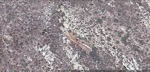
I was searching last night on GE in an area I thin may hold the Lost Dutchman when I came across this strange wall and dug out area. It looks to be a vein somone may have covered up and the wall may be a structure. Could be a damn but it's in an area that has very little flow for water. I left the coordinates on the photo so anyone can look at the structure.


Wierd Wall.webp
 

Earnie, Hal Others,

I was searching last night on GE in an area I thin may hold the Lost Dutchman when I came across this strange wall and dug out area. It looks to be a vein somone may have covered up and the wall may be a structure. Could be a damn but it's in an area that has very little flow for water. I left the coordinates on the photo so anyone can look at the structure.


View attachment 1308996

Hi Bill

What you have seen in the GE is a dam which was raised and finished by rancher John Cox in 1967 .
You can see many pictures of this dam at Matthew Roberts facebook at https://www.facebook.com/photo.php?...545.1073741842.100007819513891&type=3&theater
 

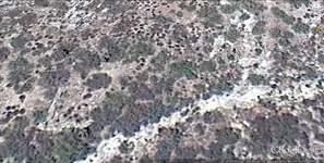
Here's another structure that could've been confused as a two room stone cabin. This is about five miles in from Canyon Lake. The Stone Corral looks like it may have been a two room house at one time. Notice the trail above the corral. That trail goes up canyon and disappears in the tall brush right next to a north opening cave. That's not in this picture but up canyon.


Stone Corral.webp
 

Here's another structure that could've been confused as a two room stone cabin. This is about five miles in from Canyon Lake. The Stone Corral looks like it may have been a two room house at one time. Notice the trail above the corral. That trail goes up canyon and disappears in the tall brush right next to a north opening cave. That's not in this picture but up canyon.


View attachment 1309072

Bill

If you activate the " photos " setting in GE , you will see a picture with this corral close to the spot .
Personaly , i don't believe to be the " roofless two room house in a cave's mouth " clue this spot , maybe because has not a cave near by .
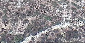
But , this one I believe could be the Dutchman's clue :

place.webp
 

I have a hard time with some GE pictures, sorry Bill I can't see a corral (or house).
 

Bill

If you activate the " photos " setting in GE , you will see a picture with this corral close to the spot .
Personaly , i don't believe to be the " roofless two room house in a cave's mouth " clue this spot , maybe because has not a cave near by .
But , this one I believe could be the Dutchman's clue :

View attachment 1309097

Earnie, Left lower quadrant of the photo. Marius, coorinates aren't posted in your photo but, why would somone put a house on the edge of a cliff up a steep incline? Strange...
 

Here ya go Earnie.


Marius, What Spot?

Close to the same one as the damn or the corral?

I have GE Pro and it shows tons of photo's. Most of the small cabins I've seen are close to springs or old Spanish mining district's main trail in or out along a dry wash only higher up on a bank or cliff. Possibly the ones I've seen were used for the weighing of the Royal Fifth as sort of a guard shack to and from the rich ore mines. Most had door ways off the ground like a Hogan or Egloo I believe. Or possibly as a military look out and protection for a important military trail to and from. Both would serve as those uses but the later would be more temporary. If it's a long way to a trail I would have to say it was used as shelter for a mining operation. Because if it was a look out, you would only be able to use smoke signals or a mirror for passing it on back then.


Stone%20Corral.webp
 

Earnie, Left lower quadrant of the photo. Marius, coorinates aren't posted in your photo but, why would somone put a house on the edge of a cliff up a steep incline? Strange...

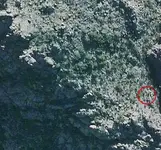
I believe to be close to the gold source . The incline is not so steep . This picture was taken from about the same altitude with the spot . You can see the caves which are close to the house ruins . The ruins are not visible in this picture .

small valley.webp
 

Here ya go Earnie.


Marius, What Spot?

Close to the same one as the damn or the corral?

I have GE Pro and it shows tons of photo's. Most of the small cabins I've seen are close to springs or old Spanish mining district's main trail in or out along a dry wash only higher up on a bank or cliff. Possibly the ones I've seen were used for the weighing of the Royal Fifth as sort of a guard shack to and from the rich ore mines. Most had door ways off the ground like a Hogan or Egloo I believe. Or possibly as a military look out and protection for a important military trail to and from. Both would serve as those uses but the later would be more temporary. If it's a long way to a trail I would have to say it was used as shelter for a mining operation. Because if it was a look out, you would only be able to use smoke signals or a mirror for passing it on back then.


View attachment 1309331

Close to the corral . This is the picture :

8815788.webp
 

Last edited:
OK Bill, I appreciate the outline, thanks.
 

Last edited:
Bill, the Jesuit constructed the mission at Tayopa, in exactly that way, there was just no other way. They cleared an area and went at it

Easily Defended area?
 

Here's a nifty little site that will take your coordinates (such as Google Earth's) and center them in a topo map for you.
Such as placing Markmar's coordinates up La Barge canyon, north of Geronimo Head.
Will save you the 'horrendous agony' and 15 seconds (for you DH wizards) of doing it yourself.

Of course they want to sell you a copy when done, that's up to you...

http://www.mytopo.com/searchgeo.cfm
-------

And this;

http://www.earthpoint.us/TopoMap.aspx
--------


Or;

http://equipped.outdoors.org/2012/12/how-to-add-usgs-topographic-maps-to.html
 

Last edited:
I noticed in some of the old newspapers that people who were in the, I think it was, 'county hospital' (have to go back and check the wording) were publicly humiliated by name, because their "burden" was paid for by the hard working citizens of the Territory. I'm sure it would have been a pride issue to stay out of those places, and their name out of the newspaper because of it.

---------

[EDIT]; I see where people in 1888 Az diagnosed with small pox were taken from the county hospital and placed in the "pest house". (And their name placed in the newspaper, ...again.)

http://chroniclingamerica.loc.gov/l...+pox&andtext=&dateFilterType=yearRange&page=1

Article at top left of page; 'Small-Pox'.
---------------

[Re-EDIT] From Wiki;

"A pest house, plague house, pesthouse or fever shed was a type of building used for persons afflicted with communicable diseases such as tuberculosis, cholera, smallpox or typhus. Often used for forcible quarantine, many towns and cities had one or more pesthouses accompanied by a cemetery or a waste pond nearby for disposal of the dead."
---------------

[Re-Re-EDIT] 'Pest', as in pestilence

From Wiki:
pestilence; plural noun: pestilences

a fatal epidemic disease, especially bubonic plague.
----------------
Lovely!
 

Last edited:
Status
Not open for further replies.

Top Member Reactions

Users who are viewing this thread

Back
Top Bottom