The Peralta Stones

Blindbowman

Bronze Member
Aug 15, 2007
2,042
978
Primary Interest:
All Treasure Hunting
i give up .. you guys are all drunk .. ok lets say your theory is worth looking at .. what did the person that made the stones know about the area .. he knew all the trade routs and every mt and canyon out there ...he knew where the Spanish camped and the past and trail to Mexico .. there is nothing wrong with his spelling ,, you had to know where he learn to write before you could even judge that ..

i would love to give you all a good old number 2 and let you make a map of that area ... go ahead i will wait .. this should be a mass confusion ...

wow .. i wash my hands of this BS .. your so far out there even i wont go that far ...lol

dont you think if some of the smartest people to day could not solve the stones that tells you something .. wake up and smell the genius boys ...your brains are cooking trying to solve the maps .. its not going to happen ...i tried to tell ya that .. you just wont listen to logic ...

latter ...good luck with that..
 

Twisted Fork

Hero Member
Sep 2, 2007
723
52
UTAH
Detector(s) used
tf900 & a good old fashioned willow forked limb
I still remember the fascinating moment wherein mine eyes first laid upon the stone tablets. I remember one of my first assumptions as being that the tablets were engineered to be used in the same manner as engraved money plates, thus designed to be pressed lightly into soft damp clay. There is far more here than meets the eye; pretty fancy mud pies huh? How to outwit anyone with a brain in their head. Ya gotta keep it simple unless you have the education of an ocean going navigator. Child's play will get you there the fastest with this puzzle designed to work well with illiterates. Some parts are forward and some parts are backwards, depending on how you look at it.
 

Oroblanco

Gold Member
Jan 21, 2005
7,838
9,830
DAKOTA TERRITORY
Detector(s) used
Tesoro Lobo Supertraq, (95%) Garrett Scorpion (5%)
Somehiker wrote
I knowed that this was gonna go... "way over" some folks' head.....

Roy:

The problem with the 1847 being a date inscribed for legal purposes is that the maps do not indicate for "what".
The stones themselves? A hogs wallow? A Taco Bell restaurant?
Legal deeds and documents on paper were normally what was accepted back them,just as they are today.

A legal claim to a mine, or several of them. Taco Bell was not issuing franchises at the time.

Somehiker also wrote
Reavis altered and forged many such documents in order to support his claim.Why make a set of stones as proof,and then cover them with confusing gibberish instead of lines of properly formatted and correctly spelled text?

Reavis almost definitely could not have known the stone maps even existed, if they had been his handiwork, there should be a very prominent "PERALTA" name engraved on them, as he did on the other fake inscriptions he made and promptly put forward as "proof" of his land grant. What you refer to as "gibberish" is very likely landmark notation, in a simple form for easy recall of the user.

Somehiker also wrote
Perhaps you can help with the interpretation of the stones and their engravings,and suggest an alternate purpose for the large hole in the stone. Then explain how it would have been used in court to prove legal ownership of a land area.Be as long-winded as you wish.A few photos from your many field trips would help to illustrate your ideas as well.

Maybe I have not mentioned this before, but I have not made one single trip into the Superstitions using the stone maps as a guide to find anything. I simply don't have any faith in them. As for photos, I will see what I have but don't have many and no way to scan them, especially not related to the stone maps. You don't think I have ever been there, done that, but I don't really care what you believe or don't. If you just want to see pix of ME in a desert setting, try page 61 of the July, 1998 issue of Lost Treasure or October 1999 issue of W & E Treasures mag. Unfortunately, I am not too photogenic; whatever that means, I have been complimented by being told that I have a face that would be great for radio, and a singing voice that is truly made for newspaper. If you want some outside evidence, not just my words or pix, look up the crewmembers list for the 2007 PIT project at Pinal. Funny but you are starting to sound just like Jim Hatt.

I have posted several alternate ideas, read prior posts; that large hole you refer to has several possible explanations including that it was just there to start with; the stone maps as evidence to support a mining claim in court would be important on the site where they were found buried, not actually IN court; in the great majority of mining claim dispute court cases, the markers on the ground always carry more weight than anything on paper or presented in court. Hence the very reason for burying them on that spot, with a trail map to the mine (or mines) being claimed. It would even dovetail with that date of 1847, and the state of war that existed at that moment in time; if the discoverer/owner were concerned that his ownership might be in danger due to the USA winning the war, it would be important to establish a prior state of ownership and discovery of the mine(s), so that it could be proven on the ground with markers and map.

Somehiker also wrote
The maps were not made to be confusing to those the stones were intended for.The intention was,that they,and only they,would have known what would have been required in addition to the stones themselves in order to find their way from
one benchmark to the next.A simple ,conventional map on a portable "plane table" and a common alidade of the type in use in the 1700's would have been all that was necessary to precisely re-locate whatever the stone maps lead to. The problem to be solved by the stone mapmakers was related to what was common and conventional in the 1760's.

Regards:SH.

An interesting theory, but based on assumption, like most everything connected with, and engraved onto the stone maps. That prominent 1847 certainly does not suggest a 1760's time period.

Since you are convinced of the complex code and know how to solve it Somehiker, and have photos of the markers you have found, can you tell exactly how to determine whether any of those markers are of the right age, or is it possible that one or more of them were fakes created by earlier Dutch-hunters, like Barry Storm did with the "ORO" example? Be as longwinded as you like in explaining this particular issue, I don't mind reading. A couple of photos of the gold mines and/or the gold bars you found by using your solution would be helpful in illustrating your explanation. It would also be helpful in establishing that you personally were actually there, if one or more of the photos has your personally in it, so we can then know that the rest of the photos were indeed shot by you and not someone else. Thank you in advance; :thumbsup:
Oroblanco
 

Javaone

Full Member
Aug 9, 2010
192
4
Phoenix
somehiker said:
Yup,it went something like that.
With the table set up at each of the three indicated locations.
There may be more,but that will take another outing.


SH.

I'll have to give that one to you SH - Probably one of the more worthy theories I have heard.

Jerry
 

Twisted Fork

Hero Member
Sep 2, 2007
723
52
UTAH
Detector(s) used
tf900 & a good old fashioned willow forked limb
Being a simpleton myself, I have often wished that I could rent the tablets in a viewing room, and then lay thin rice tracing paper over them. Then I would gently and as lightly graze over them with a stick of drawing charcoal. Yep
 

Oroblanco

Gold Member
Jan 21, 2005
7,838
9,830
DAKOTA TERRITORY
Detector(s) used
Tesoro Lobo Supertraq, (95%) Garrett Scorpion (5%)
Twisted Fork said:
Being a simpleton myself, I have often wished that I could rent the tablets in a viewing room, and then lay thin rice tracing paper over them. Then I would gently and as lightly graze over them with a stick of drawing charcoal. Yep

Well I have to respectfully disagree on that first part, for I don't think a simpleton would have any luck at deciphering a code etc but your idea is one that I agree with; I would love to see a rubbing of the stones, done with thin tracing paper. It is surprising sometimes what a rubbing can "raise" and show, that you can't pick out with the naked eye. There is the possibility of extra information that is present, that is not readily visible due to the "invisible" marks not being deep, lighting or even coloration of the stone etc.
Oroblanco
 

Blindbowman

Bronze Member
Aug 15, 2007
2,042
978
Primary Interest:
All Treasure Hunting
ya i know the tail of the snake matches the heart stone...lol

:headbang: :notworthy: :thumbsup: :coffee2:
 

Nov 8, 2004
14,582
11,942
Alamos,Sonora,Mexico
Primary Interest:
All Treasure Hunting
Hola BB mi buddy: What does this mean ? On one of my maps. Fairly simple.

Don Jose de La Mancha
 

Attachments

  • Jesuit code.jpg
    Jesuit code.jpg
    21.4 KB · Views: 172

Javaone

Full Member
Aug 9, 2010
192
4
Phoenix
Javaone said:
mrs.oroblanco said:
Mike,

I'm with you. Actually, the 1847 takes me further away from thinking they are related - the print is SO different than the rest.

Beth

Mike, Beth

I just can't get my arms around the "1847" being a date. It is carved so predominantly on the "map stone", and then again on the "Priest stone". I feel it must be something more meaningful than just a date. A date does nothing as far as solving the map and I feel most everything on the "Stones" are solely ment for that purpose. :help:

Jerry

SH, Roy

WOW! … Sorry, I didn’t mean to start another feud. :icon_profileright: :help: :icon_profileleft: Can’t we all just get along… he he

As far as “1847”, as well as “1751” I am convinced they are not dates. Even though some try so hard to make a case of it – it makes no sense to me. :icon_scratch:

If the “stones” were made by the Jesuits, as I think they were, their only purpose at the time was solely to guide others of their kind to this place and provide a record of sorts to them. The Peraltas never had any knowledge of the “Stones”.

As far as the supposed mistakes go on the stones - Understanding how exacting the Jesuit priests were, if it were another Jesuit Priest doing the deciphering of the maps he immediately would pick-up on those mistakes and look for the clue within it. Just saying.

SH – Again your theory is a very pliable one.

Roy – a “plane Table” really isn’t about a complexity of secret codes; it is a surveyor tool of sorts, with some twists that makes it proprietary to the user at the time. Certainly NOT something I have the time to learn.

SH – when you get it figured out, I’ll be waiting at the end of the trail to shake your hand.

Jerry
Always one step ahead… :laughing7:
 

Javaone

Full Member
Aug 9, 2010
192
4
Phoenix
One other thing.

As far as a picture of SH goes, from the description he gave of himself, I believe one only has to look at his "Avitar". :o :laughing9: :headbang:
 

Cubfan64

Silver Member
Feb 13, 2006
2,986
2,790
New Hampshire - USA
Detector(s) used
Fisher CZ21, Teknetics T2 & Minelab Sovereign GT
Primary Interest:
All Treasure Hunting
Javaone said:
One other thing.

As far as a picture of SH goes, from the description he gave of himself, I believe one only has to look at his "Avitar". :o :laughing9: :headbang:

I've met SH - I'd say his avatar may not be too far off in 20-30 years, but for now it's not too close :)
 

Cubfan64

Silver Member
Feb 13, 2006
2,986
2,790
New Hampshire - USA
Detector(s) used
Fisher CZ21, Teknetics T2 & Minelab Sovereign GT
Primary Interest:
All Treasure Hunting
By the way SH - your plane table/alidade idea sure has the feel of "possible" to it - especially when compared to most of the other theories surrounding the stone maps.

I still have my own personal reservations as to the provenance of the Horse/Priest stone myself, but for the trail maps, I'd say your theory is definitely worth more thought.

Have any luck running across any old bronze alidades out there? :)
 

Nov 2, 2009
483
1
Ok guys lets clarify: 1847 is infact a major date in history, and everyone knows why, in addition to being the date, it is also the range. when i made my discovery, i was at the location on google earth, I had found by scrubbing the ground with google earth i was not able to see the heart priest or horse until i adjusted the range on google earth to 1847m once i was on that location,Adjusted from the exact point of that location. So its simple 1847 is the date it was incribed, which happens to be the range necessary to be adjusted to inorder to see the heart priest and horse which give you the verification of a heart priest and horse. I Truly hope this is clear to All. Sincerely John V. Kemm """""2 things the same "date"/"range" 1847"""" 1847 was inscribed in 1847 period. end of story.
 

Oroblanco

Gold Member
Jan 21, 2005
7,838
9,830
DAKOTA TERRITORY
Detector(s) used
Tesoro Lobo Supertraq, (95%) Garrett Scorpion (5%)
somehiker said:
Hi Roy:
Thanks for your response and I do appreciate your input.

"A legal claim to a mine, or several of them. Taco Bell was not issuing franchises at the time."

I can only ask you to provide an example of a legal claim on stone,similar to the stone maps with removable insert,with which we can compare.Can you cite a case where such evidence was presented as proof of ownership of a mine?

There are a fair number of mining claim dispute cases online, often involving stone markers; I don't have an example with a removable insert (which we could ask, if the example in the Peralta stones is even the original that belongs there) handy. I don't have time to hunt through mining claim case law at the moment either, but a removable insert would be not illogical as a step for the protection of the location of the mine against a chance discovery of the stone tablets, someone finding them and wishing to claimjump would be thus blocked from finding it or them.

Somehiker also wrote
On both of these points we agree."Gibberish" is how I would expect any Justice presiding over the claimant's case to describe most of the markings on the "evidence".I have to doubt that said Justice would accept a "this means this and that means that,your honour" as any kind of legal proof of ownership.
If you know of such a legal precedent,based again on similar circumstance and evidence,provide a link and I will be more than happy to read it.

If you are interested in historical mining claim cases, I suggest some time spent in cases law libraries; however one example I can find in a moment is from the US-Mexico boundary dispute; here is an extract from an online article

Under the terms of the Treaty of Guadalupe Hidalgo, the commissioners' words gave the maps and views an authority equal to the treaty itself.

In practice, needless to say, matters were a little more complicated. Carl Wheat's account notes: "In effect, the maps were the boundary, and remained so for another generation." But Paula Rebert's judgment seems closer to the truth: "The true boundary was the boundary marked on the ground." In subsequent disputes, what was actually on the ground (including the monuments) had stronger legal claim than the maps. Thus it was that, as the 19th century drew to a close, the need for greater precision about what was on the ground became imperative.


Somehiker also wrote
I do not question your having been in the desert,Roy. <snip> That is why I have so many photos that I am able to share.Many topics are of great interest to the majority of those that read these discussions.Many of those making contributions to these topics do not post photos.Photos are the best way to visualize where or what the poster is talking about.If,on reading the post,I know that I have a photo that will help other readers understand the terrain feature or what the cave or other place of interest looks like,I will generally put it up with some sort of description and comment,based on any experience I have that is related.If the photo is not mine,I will say so unless that fact is obvious.My principle beef with this photo issue,is one of comparison.I have trouble,given my own experience and wish to capture every scene possible as part of that experience,finding credibility amongst those that claim "boots on the ground" expertise and familiarity with the Superstitions.If I sound like Jim Hatt,I suspect that it is because he has come to the same conclusion with regard to many of the folks that appear to be mostly negative towards others who do provide personal photos along with their ideas.

I own only one camera, a Canon T-50 35 mm which I have found to be rugged and reliable; I rarely take photos unless it is a particularly nice landscape view, wildlife, or to use in an article (or book) that I am currently working on. Beth has taken many more and owns more cameras, and we have lost almost all of our photos on two occasions; one due to a home fire and more recently due to water damage even though packed in a watertight container. I don't know why you would expect to see photos of my solution to the stone maps illustrated by markers found in situ, when I have not said that I have the solution nor that I even tried to use the stone maps IN the Superstitions at all. Your request then appears to be rather a sarcastic attempt to belittle myself and what ever experience I might have, when I am not making any claim to be "the expert" on the stone maps nor a Superstition Mountain 'sourdough'. Jim Hatt made very similar remarks not long ago, and that approach does not make any sense to me. Suppose that someone had never even seen the Superstitions, does that mean that they cannot then raise questions about the various theories that are being presented as solutions to them?

However to satisfy you (or Jim Hatt, should he even be following this any further) that both Beth and myself have indeed spent time in the Superstitions, I am going to put some photos on the internet; she managed to extricate about a dozen or so from the mass of photos that are stuck together and they are definitely NOT of any stone maps or markers from the Supers, for the very reason that we have zero faith in any of them due to the fact that SOME are definitely the work of earlier Dutch hunters, the same folks who also destroyed and/or removed a number of REAL markers that were there at one time. The only trick now is to borrow a scanner and decide what web site to put them on, for I am not posting them on T-net where the copyright is assumed to be the property of Treasurenet. It will be a somewhat pointless exercise and I really hate to appear to be 'bragging' when I certainly have not found the LDM, but it will at least show that we have in fact "been there, done that" so am not just pretending.

Somehiker also wrote
I have,in fact posted photos that,on occasion have myself in them,here and on the other sites.I generally prefer not to publicise my mugshot too often though.I might look too much like someone on a post office wall.I usually hike solo as well,and setting up for self portraits is time consuming and I am not usually happy with the results...sides,I have a big head that blocks the light.
I have also posted a number of my own photographs,of objects such as you describe,all taken within the Superstitions and surrounding range.The objects are,of course all fake,and predetermined as such by various expert opinions.The potential of the mine,or mines that I may have also posted photos of is purely a matter of speculation.I am not a miner,nor do I wish to become a miner.I also have no intention of filing any sort of claim for any mine that I may find,or have found in the past.I am happy to merely collect a small grab sample for my growing collection.If I do find one that I believe may match the Dutchman's ore,I will pass it to an interested party for analysis.That hasn't happened as yet.

My request was tongue-in-cheek, not that I demand to see you take a photo of yourself when you are the only person there as that is a minor trick in itself, and in direct response to your request to see photos of the monuments that prove my theory of solution to the stone maps when I have made no such claims. Your theory of the alidade/plane is very interesting, my greatest problem with it is that the stone maps ARE stone, a secondary issue being that the work on them does not resemble known Jesuit maps; however it is an intriguing idea that certainly warrants further research and I am interested in hearing you out. I don't really need to see stacks of gold bars, unless someone is claiming to have found the treasure vaults in which case I would only believe such a claim by seeing such stacks. A mine generally only has ore, so even a small sample of ore must have come from a vein originally, hence there is no need to see a railroad car full of it.

Somehiker also wrote
There are many possibles with regard to the stone maps.My theories are just one more rock on the marker.Yours are another.The challenge to be met is to find the one that has the best fit.Regardless of how many theories that you present,only the fieldwork and subsequent interpretive stages will test those theories.

At this point in time, it will take the discovery of mines and/or treasure vaults to prove any particular theory on the stone maps to be truly valid, almost a 'reverse engineering' type of situation as suggested by another of our members here. A major problem exists in that any treasure vault(s) may well have been found and recovered years or decades ago, and we have no way of ever knowing it; in such a case, it would then be utterly impossible to prove beyond dispute that the stone maps ever were valid and genuine, and not a modern fraud.

Jerry - yes I have some concept of what surveying instruments are, I worked for a year as a surveyor's assistant laying out the Richmond VA "beltway" highway as well as a few private jobs, and learned as much as I could from him. Somehiker's theory is indeed fascinating and worthy of further pursuit, despite whatever objections the skeptics (like me) may raise.

Blindbowman wrote
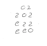
well if your all so much better at brakeing code & Spanish simbolics then i am .. then whats this mean .....

Who is claiming to be better than everyone else at breaking codes and Spanish symbols? I certainly do not make such a claim, and suggest to you that our discussion and the ideas presented are not a contest of who is the smartest, best code breaker etc but simply a discussion of the various theories. In other words, a friendly interchange, not a verbal combat amigo; and I for one do not know the meaning of your symbol.

Good luck and good hunting to you all, I hope you find the treasures that you seek; and I will certainly post a link to my photos as soon as we can get that done. Be forewarned however, you are not going to see pictures of a treasure hunter who resembles Johnny Depp, Matt Damon or Brad Pitt, for although I have been told that I do closely resemble a shorter, fatter version of a particular movie star, (Gabby Hayes) I don't think my mug is that attractive. On the other hand, women frequently break into peals of laughter at one look of my physique and profile, so that may well indicate that they are instantly smitten by what their eyes take in. :o :-[ ;D ::)
Roy ~ Oroblanco


PS - Just noticed the time, have to sign off but will 'stop by' later this evening if I can.
 

NativeOne

Jr. Member
Aug 12, 2010
57
0
It will take the discovery of mines and/or treasure vaults to prove any particular theory on the stone maps to be truly valid. PS - Just noticed the time
 

Attachments

  • usgsaline.jpg
    usgsaline.jpg
    258.5 KB · Views: 370

Javaone

Full Member
Aug 9, 2010
192
4
Phoenix
SH, Oro

Well aaaaa..... How about them Cubs? Cubfan64.

Jerry :dontknow:

Incidentally ^^ is on ignore - I think we know who it is... just sayin >:(
 

Top Member Reactions

Users who are viewing this thread

Top