- #21
Thread Owner
Peerless
Not fight intended on my end.
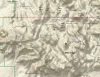
I just don't see why CJ shouldn't be held to the same standards that he holds everyone else to. He says he knows how the maps work. His verbal explanation makes no sense when I put it on a topo.
I just want him to show me how it works when he puts it on a topo.
I see he has added the word "variances" to his explanation. I expect many of them and quite LARGE ones to make his trail fit on a topo.
I gave him my explanation of how the trail works like he asked. (I even drew it on a topo for him so there would be no misunderstanding) Do you think it is unfair for me to now ask for the same thing in return?
El Gato
Not fight intended on my end.
I just don't see why CJ shouldn't be held to the same standards that he holds everyone else to. He says he knows how the maps work. His verbal explanation makes no sense when I put it on a topo.
I just want him to show me how it works when he puts it on a topo.
I see he has added the word "variances" to his explanation. I expect many of them and quite LARGE ones to make his trail fit on a topo.
I gave him my explanation of how the trail works like he asked. (I even drew it on a topo for him so there would be no misunderstanding) Do you think it is unfair for me to now ask for the same thing in return?
El Gato




 , but who can explain the term: "Isogonic drift"?
 He mentions that the Chinese had the compass "by the seventh century". They used that, in conjunction with the timing of the watches as well as Polaris to navigate the oceans. Maybe not the most accurate, but they got around.