Using a drone for recon of potential sites

therobertsmith

Full Member
Mar 4, 2015
136
36
Gaston County NC
Primary Interest:
All Treasure Hunting
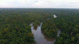
Anyone else here use or have thought about using a drone to scout potential sites? I have thought about this for sometime now. I have a phantom 4 drone and I am thinking about using it to scout my local area for clearings, soil colors and the such. The Phantom has a range of around 3 miles and has really quality video in 4k and nice picture.
I figure this would save me time in having to walk the river or stream to find bends, rock crops, etc.
Anyone else try this and any luck? I may take mine out tomorrow and do some video of the river out front and post it up.
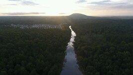
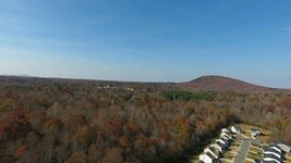
Here are a few pics from a few months back.

RS screen_0a910bd3ec4184a6_1470182369000.jpgscreen_051babf115ba8233_1480266329000.jpgscreen_c7fd2ff921a44a30_1470182290000.jpg
 

Upvote 0
A couple years back i was prospecting up this steep narrow desert wash when one of those drones appeared about 100' over-head and just hovered. Whatever, so i got back to sampling areas of exposed bedrock when i noticed that it was actually following me up the gully! Never one to prospect alone, I consulted with my partner (Strum Ruger) and a decision was made to draw down on it with my .45 Vaquero. Immediately that damn thing took off like a Tomahawk missile and out of sight!

I have no issue with technology but tailing a prospector while he goes about his business on foot or otherwise is lazyness and poaching plain and simple.....not a fan of drones.
 

I think I'd prefer google earth rather than risk a $1K toy, just me.
 

The best way to scout is with a shovel and a gold pan... UAV's have their purpose but they won't go low enough into a canyon to see the lay of the stream bed material. Getting enough satellites locked in to hold it steady takes an open area. The best gold is down in the steepest of canyons under the trees.
 

Wow... I have used Google earth many times and have for the last 6+ months been looking into buying a drone for just this reason. I want the DJI Mavic Pro 4K camera drone.
Gary from Oregon
 

We have someone in our neighborhood who owns one. I can hear it when he is flying. The problem I have is the invasion of privacy in which this guy likes to violate. I will usually take mine up when he is overhead and give chase.
 

Drones are far cheaper than repeated helicopter time, and I watched an episode of Yukon Gold where they used a drone to do exactly what you're talking about. Maybe do a search and see if you can find a copy of the episode. It really depends on what you're looking for, because as others have said, they won't get you in real close to the bottoms of sketchy areas, but they might just be the ticket in rougher, more open country where you want a closer view of land contours and possible older stream courses or old workings, etc.

All the best,

Lanny
 

I am working on a drone design that will actually fly down into mines that are no longer operating to see if any mineral value remains. I know of many mines that the entrance has been removed.
 

Aerial images, from airplanes, can also be used as a substitute for drones. In Sweden they are free and quite useful.
 

I ordered a DJI Mavic Pro 4K camera drone last night. Should be here is less than a week. Want to use it for recon on farm land and along rivers in my area. Cant wait to get it.
Gary from Oregon.
 

Just got a DJI P4 for a similar reason. I will be hiking through the forest to the creek on my claims. I plan to use it as a way to make sure I don't walk into a bear, lynx, moose or some other friendly obstacle and to find the best, easiest way there. No trails or roads to the creek. I have a 3 inch dredge to haul in on my back in pieces and need all the help I can get to make the job easier.

In addition, since google earth is a joke as far as high quality images and current images go, and flash earth is a better but still not good enough for close up pics of the ground at my claims, the drone will help me see the whole creek close up.

Drones do have a purpose and to judge everyone based off someone misusing one is wrong. Not everyone is a bad person. Miners don't like to be all lumped into one group of irresponsible destroyers of the planet right? Drone users aren't all bad either.

As for what the drone can see, it can see through the water to several feet as long as the water is clear but then if it isn't being right there personally your eyes can't see through it either. No reason a drone can't fly a little above the water and look down through it. It's no different than any camera that is hand held.

No need to worry about losing the drone. It can be insured for loss. Even if the loss is from pilot error. It's just $60 a year. Contact State Farm, you may need a Marko Polo for your drone. If you are new to piloting check out Phantom Pilots Forum. All the info you need and help with your drone.

And as far as invasion of privacy goes, that is a myth. The drone cameras don't have some magical ability to see through windows better than every other camera on the market. There are you tube videos proving this. A hand held camera with a telephoto lens is more invasive than anything a drone could do to see through your windows. Drones can't carry heavy lenses like that so they can't zoom in and see things like you might imagine. In addition, the FAA has rules about UAV flying.

The US has rules about flying UAV's. If someone is violating those rules which you can find at: https://www.faa.gov/uas/faqs/. Take the drone down and get the FAA number from it to turn in the violator or contact the FAA about the violator even if you can't take the drone down. Anyone that violates the rules can face huge fines and jail time. Just like protecting mining by turning in those who give miners a bad name, turn in drone pilots who violate the rules. Even if you don't own a drone go to the FAA site and memorize the rules or print them out so you will know if someone is violating them.

For those buying a drone you must get certified. It is only $5 and takes about 5 minutes or less. It is no big deal and anyone over the age of 16 can do it even if you don't have a drone. If you are doing it for a business there is a different process and you must get a FAA license.

Drones are a tool just like a highbanker, dredge or any other piece of mining equipment. I don't have a use for dozers and rock trucks but then the big operations don't have a use for some of the tools I use such as a small dredge or highbanker. So what? Why bad mouth those who have found a good tool and want to use it to their advantage. If someone isn't intelligent enough to use technology to their advantage they will get left behind and they will always cry like a baby and complain about those who do use it.
 

if you got the money hell yes. these things are a game changer for prospecting imo

Sent from my SAMSUNG-SM-G920A using Tapatalk
 

Top Member Reactions

Users who are viewing this thread

Back
Top