C. Kenworthy MONUMENT SITES

usernotfound

Sr. Member
Sep 7, 2011
495
148
Detector(s) used
T-2
Primary Interest:
All Treasure Hunting
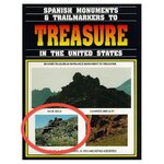
I've seen pictures of the sites in Kenworthy's book posted here before by some of the TNET members. I know they are multiple sites in different mountain ranges. I was wondering if anyone was willing to share their actual locations. GPS or what not. or post pictures.

What Kenworthy says in is book is not really as important as to what he does NOT say... He gives plenty of hints here and there, but does not outright say what he wanted to say. He gives you information, but he does not solve the puzzle for you. If I ever get time, I would like to visit these sites and follow the trail. Anyone here ever done that? AND willing to share any information?

P.S. I am not asking you to "do my due diligence" for me, I am simply asking if you know where I can put my boots down and follow the trial. I can follow many trials, but I am intrested in Kenworthy's trials.
 

dsty

Bronze Member
Dec 2, 2007
1,300
736
Randal County
Hello Found, I think you are on the right track in that you want to follow trails that you can follow and get an idea on how things are worked out, I would venture to say that your best bet to locate your own private trail using Google Earth, zoom untill you can pick out a 5 ft boulder, follow it using 30 degrees or 210 degrees south, west 300 degrees 120 degrees east ( not carved in stone ) for a distance of 2.5 miles, if nothing comes up then find another to follow, they are everywhere, they ( Spanish ) surveyed every thing and left corner markers at each 2.5 mile corner, thats why when you find a symbol generally there's 4 directions to follow. I've seen several with three directions and one with 2 directions, Usually the ones that have 4 directions are in the middle of the 25 mile / league There's trails that are an exception to the rule that follows a road, sometimes they used a 30 ft high to show a location of a city, outpost and such, the knee high boulders are something close and generally will measured in Cordell, smaller ones are measure buy the foot waist high ones are indicating 1/4 mile, sholder high are corner markers, the symbol very possible at the 1st corner may be a rabbit and each one of the corner markers will very possibly be something thats associated with a rabbit. Thats Just My Guess, its not that hard, its very possible that what you seek or something of interest may be located near the N.W. corner, that why its a lot easier to get the corner markers located and once you get started you can find all of them. The U.S. done the same thing except they used Grid and one mile, and 36 miles for township, the Spanish used 2.5 mile sections, and each block used 25 leagues ( Their Township ) Their sections were indicated by Letters that were joined. in the NW corner also. Hope this helps
 

Last edited:

mdog

Bronze Member
Mar 22, 2011
2,324
4,377
Usernotfound,

His book Treasure Secrets of the Lost Dutchman has maps and locations. I'll start looking through it and post some locations later.
 

mdog

Bronze Member
Mar 22, 2011
2,324
4,377
The Massacre Grounds trailhead divides into 5 seperate trails beginning almost immediately upon reaching the area called the Massacre Grounds, shown on most maps. The trailhead monument is on a small hill about 1/2 mile off to the right of "first water trail", after you leave the parking lot and pass through the "ranger gate", walk the easy trail about 800 feet , watch ti your right (1/2 mile), binoculars and telephoto camera will help.


Those are his words and it looks like the monument he is describing is the big Indian head. Good luck.
 

AbTexEx

Full Member
Nov 27, 2008
206
246
America's Dairyland
Primary Interest:
Prospecting
Here are a few along one VERY popular trail

Pig

Pig.jpg

Side profile

FrontCover.jpg

Native American with backpack
2 of them in this picture

BackpackerNativeAmerican.jpg

If you have Google Earth here is a KML
It is the trail towards Weavers Needle on the left

View attachment FirstWaterTrailhead.kml

AJones
 

OP
OP
usernotfound

usernotfound

Sr. Member
Sep 7, 2011
495
148
Detector(s) used
T-2
Primary Interest:
All Treasure Hunting
Here is another KML
Click and hold the street view thingee on the top right and drop it on the street at the bottom
Just above the trash can you can see a mine on the right of center and this in the middle


View attachment 760612

AJones

Notice it is marked by three large rocks in the shape of a triangle and are about 110 feet away or about 33 varas away from each other.
 

Last edited:
OP
OP
usernotfound

usernotfound

Sr. Member
Sep 7, 2011
495
148
Detector(s) used
T-2
Primary Interest:
All Treasure Hunting
I would like to find this location. I have circled it in red. It is called "Pack Mule".

I know the other two pictures are in the Superstitious Wilderness, but I do not know where the Pack Mule is located.
 

Attachments

  • 51FY8J2FWKL._SS500_.jpg
    51FY8J2FWKL._SS500_.jpg
    52 KB · Views: 208

rangler

Bronze Member
Jul 12, 2004
1,320
200
The Land Of The Free Because Of The Brave!
Detector(s) used
for solutions to the jesuit code -email pics to: [email protected]


;[email protected] locations needed! oro bro!
Primary Interest:
Other
The Indian Head, is in the supers, I know I posted the pic I took of this head and was accused of coping kenworthy..i was not , i was just on the same trail..and he is not sporting a backpack, however what KW did not see or show is that this Indian face is a Janus monument..that is another face behind his head..I posted the pic on 101, I think you can find it...also if you want to see this Indian face, it is a minute from the parking lot at "first water" trail head...just north of the lost dutchman campground at Apace Junction...easy to find, awesome up close..We climbed the face to get on top of the c ompass rock, which is shaped like a turtle head...alll very bold and bodacious....like the jesuits were in the early days of the contract with the king of spain..later centuries they made the monuments much much more subtle...
[I do take people [trackers] to the supers twice per yeaf aprill and october..I promise you , you will lealrn more in one week here that you would learn in 10 years on your own...this place played a big part on my breaking of the jesuit code!
oro bro
rangler
 

OP
OP
usernotfound

usernotfound

Sr. Member
Sep 7, 2011
495
148
Detector(s) used
T-2
Primary Interest:
All Treasure Hunting
The Indian Head, is in the supers, I know I posted the pic I took of this head and was accused of coping kenworthy..i was not , i was just on the same trail..and he is not sporting a backpack, however what KW did not see or show is that this Indian face is a Janus monument..that is another face behind his head..I posted the pic on 101, I think you can find it...also if you want to see this Indian face, it is a minute from the parking lot at "first water" trail head...just north of the lost dutchman campground at Apace Junction...easy to find, awesome up close..We climbed the face to get on top of the c ompass rock, which is shaped like a turtle head...alll very bold and bodacious....like the jesuits were in the early days of the contract with the king of spain..later centuries they made the monuments much much more subtle...
[I do take people [trackers] to the supers twice per yeaf aprill and october..I promise you , you will lealrn more in one week here that you would learn in 10 years on your own...this place played a big part on my breaking of the jesuit code!
oro bro
rangler

I've seen your post on the Indian head/"Janus head" and have also seems Gollum's picture of the fish...but I'm interested in the pack mule... which I circled in red.
 

Rawhide

Silver Member
Nov 17, 2010
3,590
2,185
SouthWestern USA
Detector(s) used
Nox 800, Etrac, F75, AT Pro. Last two for sale.
Primary Interest:
All Treasure Hunting
Hi User, appears by terrain the Pack mule is of the same area as the other two monuments. Could be a play by CK or just a good example. Two questions comes to mind on the Pack Mule. One, why this particular spot, do you hope to line up a couple of trails? Two, do you think you could use google earth and find some trails as dsty has stated? I found his book Spanish Monuments and Trails very refreshing and found I had already figured some things out for myself. I looked for the Janus Sex Stone Rangler, didn't find it in the book anywhere. I think CK left the questions open as we all must walk the trail in our own way. It depends what you are looking for. the supers is not for me, but I am left in Awe when signs are found in almost every state and posted here. User, do you think the pack mule posted on the book cover is a Mexican or Spanish sign?
 

OP
OP
usernotfound

usernotfound

Sr. Member
Sep 7, 2011
495
148
Detector(s) used
T-2
Primary Interest:
All Treasure Hunting
Hi User, appears by terrain the Pack mule is of the same area as the other two monuments. Could be a play by CK or just a good example. Two questions comes to mind on the Pack Mule. One, why this particular spot, do you hope to line up a couple of trails? Two, do you think you could use google earth and find some trails as dsty has stated? I found his book Spanish Monuments and Trails very refreshing and found I had already figured some things out for myself. I looked for the Janus Sex Stone Rangler, didn't find it in the book anywhere. I think CK left the questions open as we all must walk the trail in our own way. It depends what you are looking for. the supers is not for me, but I am left in Awe when signs are found in almost every state and posted here. User, do you think the pack mule posted on the book cover is a Mexican or Spanish sign?

It is Spanish. I have looked at sat. pictures. It is time consuming and found many trails and camp spots. the terrain never quite recovers from the movement. Why the Pack mule? because I can locate the others...not the pack mule...yet. And I will tell you later about the rest.
 

AbTexEx

Full Member
Nov 27, 2008
206
246
America's Dairyland
Primary Interest:
Prospecting
One more to whet your appetite

AnotherProfile.jpg

This KML is close to a popular spot with several members on this forum
Check out the pictures posted in the parking lot lower right

View attachment Peralta.kml

The trail through the supers is Dutchman Trail #104
Excellent learning experience
Close to town
Blistering hot in the summer
And I always feel like i'm being watched by...

EagleEyes.jpg

AJones
 

Shortstack

Silver Member
Jan 22, 2007
4,305
416
Detector(s) used
Tesoro Bandido II and DeLeon. also a Detector Pro Headhunter Diver, and a Garrett BFO called The Hunter & a Garrett Ace 250.
Primary Interest:
All Treasure Hunting
I don't think Kenworthy revealed EVERYTHING that he knew or suspected......and I would not blame him at all. No THer would ever reveal the "meat" of his research for free.....or even $10 per book.
 

OP
OP
usernotfound

usernotfound

Sr. Member
Sep 7, 2011
495
148
Detector(s) used
T-2
Primary Interest:
All Treasure Hunting
I don't think Kenworthy revealed EVERYTHING that he knew or suspected......and I would not blame him at all. No THer would ever reveal the "meat" of his research for free.....or even $10 per book.

I plan to start my book off at $50.
 

Rawhide

Silver Member
Nov 17, 2010
3,590
2,185
SouthWestern USA
Detector(s) used
Nox 800, Etrac, F75, AT Pro. Last two for sale.
Primary Interest:
All Treasure Hunting
Hello Found, I think you are on the right track in that you want to follow trails that you can follow and get an idea on how things are worked out, I would venture to say that your best bet to locate your own private trail using Google Earth, zoom untill you can pick out a 5 ft boulder, follow it using 30 degrees or 210 degrees south, west 300 degrees 120 degrees east ( not carved in stone ) for a distance of 2.5 miles, if nothing comes up then find another to follow, they are everywhere, they ( Spanish ) surveyed every thing and left corner markers at each 2.5 mile corner, thats why when you find a symbol generally there's 4 directions to follow. I've seen several with three directions and one with 2 directions, Usually the ones that have 4 directions are in the middle of the 25 mile / league There's trails that are an exception to the rule that follows a road, sometimes they used a 30 ft high to show a location of a city, outpost and such, the knee high boulders are something close and generally will measured in Cordell, smaller ones are measure buy the foot waist high ones are indicating 1/4 mile, sholder high are corner markers, the symbol very possible at the 1st corner may be a rabbit and each one of the corner markers will very possibly be something thats associated with a rabbit. Thats Just My Guess, its not that hard, its very possible that what you seek or something of interest may be located near the N.W. corner, that why its a lot easier to get the corner markers located and once you get started you can find all of them. The U.S. done the same thing except they used Grid and one mile, and 36 miles for township, the Spanish used 2.5 mile sections, and each block used 25 leagues ( Their Township ) Their sections were indicated by Letters that were joined. in the NW corner also. Hope this helps
I have used this formula and found it appears to work. I dont use google earth, I just know where my monuments are. I can show examples of this. This is very good work. It amazes how some folks come up with the info they get. TY dsty.
 

Rawhide

Silver Member
Nov 17, 2010
3,590
2,185
SouthWestern USA
Detector(s) used
Nox 800, Etrac, F75, AT Pro. Last two for sale.
Primary Interest:
All Treasure Hunting
I do find actual sites and research them. I did not have Kenworthy books and just know starting to build a library. I made my own play book with what I knew worked. I still dont understand many things, but I get a lil closer to the hole each time I make a new connection. I do enjoy the tips I can get here on Tnet. Found has figured a lot, and if decides to share his field book, that would be great. I suggest you consider making a few smaller books like Kenworthy and not one big monster volume that I wouldn't carry in my back pack. I was pricing a Kenworthy book I regularly pack into the wilderness with me on Amazon, its going for $900.00 bucks right now. Make your book back packable. Make sure there is plenty of examples. Knowing others who have made books, expect to get a price between $20 to $30 dollars each. You also have to be a charter member here to advertise I believe. Good Luck User.
 

Rawhide

Silver Member
Nov 17, 2010
3,590
2,185
SouthWestern USA
Detector(s) used
Nox 800, Etrac, F75, AT Pro. Last two for sale.
Primary Interest:
All Treasure Hunting
I am constantly upgrading my toys. I have no doubts, just curious as to how you came to that conclusion. I too see the same measurements used over and over. Your observation about height may be the theme i hunt on this summer. My world is getting smaller every day lol.
 

PatrickD

Hero Member
Jul 23, 2012
845
700
Colorado
Detector(s) used
Garrett AT Pro
Primary Interest:
All Treasure Hunting
Hi Casca,

Sorry to jump into a conversation but you really have me curious about your comment " I was pricing a Kenworthy book I regularly pack into the wilderness with me on Amazon, its going for $900.00 bucks right now."

What book is that?

I started a project yesterday that is turning out to be quite a chore... cataloging all of my books into a spreadsheet. Wow, I didn't realize how many I had.

Patrick
 

Top Member Reactions

Users who are viewing this thread

Top