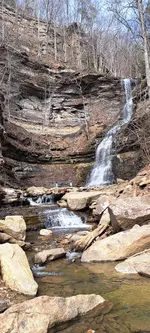
The top photo is the one we found. If you look at the 2nd pic you can see they lined the the creek as well. Our earliest map said there was a (watering stop ) somewhere near here. We're thinking this might have been it, it's only done on the one side of it. Last pic is is over a bigger creek and massive. only about a 1/4 mile or so from the other one. Smaller of the two is 18'-20' above the stream with hella big stones. Gonna try to find as much as possible where the stone came from. There's a strange section where the (blueish) stones stop perfect on both sides like that particular section of stone was quarried somewhere else

Any thgt's y'all