What's new

What happened to the Kidd-Palmer treasure maps?

Cryptid1990

Hero Member
🥇 Charter Member
Joined
Jun 3, 2025
Messages
503
Reaction score
466
Golden Thread
0
This thread is solely to discuss the whereabouts of the so-called Kidd-Palmer treasure maps (or charts) and what happened to them.

For all other discussions of these maps (whether they are authentic or a hoax, ideas on the location of the island depicted on the maps, etc) see the other thread.

History of Palmer-Kidd Maps

1752855700116.webp

Source:
G. J. Bath's website

In the early 1930s, Hubert Palmer of 22 Granville Road, Eastbourne, a solicitor and bibliophile who was also an avid collector of antiques relating to piracy and naval warfare (including Lord Nelson objects) acquired four treasure maps that purported to trace back to Captain Kidd or his shipmates (a few came with pedigree notes) that were found in separate pieces of furniture (accounts by Harold T. Wilkins [1935], Anthony Howlett [1958], and George Edmunds [1996], heavily differ in how the maps came into Palmer's possession, who owned them prior to Palmer, and the sequence/timeline of when the maps were found; all the accounts though agree Palmer was the owner from the early 1930s, until his death and this is confirmed by Palmer's private letters). The four maps are commonly labeled: (1) Coral Island Map, (2) Plain Map [not pictured above], (3) Sarah Kidd Map, and (4) Skeleton Map (a.k.a. "Key Chart"). Palmer in private letters expressed his opinion the maps were authentic and that he wanted to go on an expedition to find the island depicted on the maps. However, World War II (1939-1945), prevented him and by the late 1940s, Palmer was too old and in ill-health to go on a treasure-hunt. Palmer remained until his death largely secretive of the maps. Among the few people he showed some of the maps to was Robert Clark-Hall and Harold T. Wilkins; the latter he met in 1932, and corresponded by letters. Palmer had more or less personally refused to sell the charts, even turning down an offer by Wilkins but Palmer temporarily exhibited one of the maps and a furniture piece in 1947 to help raise money for a War Memorial Fund. Wilkins was refused permission by Palmer to photograph or even copy the maps in his book Captain Kidd and his Skeleton Island (1935).

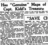
1752881358480.webp

1752881398121.webp

Eastbourne Gazette (13 August 1947)

Palmer died in July 1949 and his estate in Eastbourne near the coast (including a Victorian house with many rooms) was left to Elizabeth Dick as well as his large pirate collection of items (some of dubious provenance) including the four treasure maps (as well as the furniture pieces the maps were inside [two chests, a workbox, and an oak bureau]). Dick, a widow, had been Palmer's housekeeper for several previous years. There is no doubt Dick acquired the maps since several newspapers reported this at the time; she took photos of herself with the maps and various pirate-items, including even appearing on television to show Palmer's collection:

Pirate's treasure. Eastbourne, East Sussex. M/S of two young boys David and John Hume sat with Mrs Elizabeth Dick. She shows them a solid gold watch, part of the treasure of Captain Kidd which she inherited from Hubert Palmer. C/U mechanisms of the watch. She then hands them some pieces of eight. C/U's of a split coin used for carrying secret messages. M/S as they open the original treasure chest and examine the pistols inside, one has notches to show how many kills have been made. Elizabeth turns it around to show the name 'Calico Jack'. She demonstrates how all the levers work on the chest. C/U as they open another treasure chest, and take out a model of a skull attached to a bible. M/S of secret drawer which contains a real treasure map. Camera pans across the rest of the treasure to a portrait of Captain Kidd when he was a boy. C/U inscription of his name on the chest.


1752859157392.webp


1752861827232.webp

Nottingham Journal (22 October 1949)

Dick, who personally believed the maps were authentic, decided to sell the maps in 1950.
Apparently, she could not afford to maintain Palmer's estate ("the house is too big for me to keep up").

1752861251857.webp

The People (US newspaper), 26 March 1950

1752874986760.webp

1752875016405.webp

Evening News (London) (19 July 1950)

1752875833713.webp

Eastbourne Gazette (12 July 1950)

Dick on 20 and 21 July 1950 auctioned a huge lot of items from Palmer's pirate collection including one of the maps. She hired the auctioneers Oakden & Co who carried out the auction in a marquee in the garden at the house Dick inherited (where Palmer used to live). All of the furniture pieces (the maps were found in) were sold at this auction but not the maps themselves. The furniture pieces linked to the maps that sold at auction were the so-called Hardy Chest, Morgan Chest, oak bureau, and Sarah Kidd workbox.

1752883529512.webp

Eastbourne Chronicle (21 July 1950)

One map that was auctioned never sold because the only bid from a local man named Richard Butler was too low (£25) and did not meet her reserve price (£3,000 [equivalent to £131,000 today]). However, Richard Butler bought the so-called Hardy chest (without its map) for £11 (equivalent to £480 today).

1752874491889.webp

1752874527671.webp

Eastbourne Chronicle (28 July 1950)

After the failure at the auction, Dick appears to have wanted to go on a treasure hunting expedition to try to find the island depicted on the maps in the Far East.
However, the outbreak of the Korean War made her sceptical if any expedition could go ahead.

1752876065698.webp

Evening News (London) (8 August 1950)

By the following year she had partnered with some people to hire a schooner (La Morna a.k.a. Lamorna) for the expedition.
At this time, Dick is said to have made photographic copies of the maps and put at least one copy in a Singapore bank.

1752875589462.webp

Daily Herald (22 October 1951)

1752882993180.webp

Daily Mirror (22 October 1951)

The expedition was a failure. Although I can not find the precise details, the schooner crashed or was wrecked. According to Edmunds: "Following the wreck of the ship off the Isle of Wight, she decided to have nothing more to do with any expedition." This is confirmed by an article published in 1953 in Eastbourne Herald (see below). Fast-forward to around 1957, and Dick is stated by multiple sources (namely Rupert Furneaux and George Edmunds) to have sold the four maps to a man named Maurice Taylor of Toronto, Canada (who was acting for and part of a syndicate of Canadian and American sponsors.) Further according to this story, in 1959, Taylor had apparently bought out all the other members of the syndicate and he thus became the sole owner of the maps. According to Edmunds, Taylor was part of the earlier failed expedition (La Morna), so he had known Dick years earlier.

In the other thread, I went along with the above (having read Furneaux [1969, 1977] and Edmunds [1996]) but I have now come to question whether Dick really sold the maps to a Canadian in ~1957.

1752883094891.webp

Eastbourne Herald (16 May 1953)

How reliable are the sources stating the maps were sold to Mr. Taylor? Not very, and I found contradictory sources.

1752891850508.webp

Birmingham Daily Post (26 July 1957)

At least one map was still in the possession of Dick in July 1957 and an American (named John Smith) was attempting to buy it.

We are informed Dick intended selling the maps that same month:

1752893046202.webp

1752893082234.webp


Evening News (London) (23 July 1957)

However, I can find no newspaper source that the maps were sold to a Canadian (Maurice Taylor) in ~1957.
On the contrary, the maps were alleged by another source to have been sold in 1964 (to whom?), a year before Dick died.

1752893811733.webp

Eastbourne Gazette (8 September 1965)

As for the evidence the maps were bought in ~1957, I do not find it to be compelling.

Edmunds [1996] (quoted by Harris, 2002) is presumably relying on Furneaux:

1752892712171.webp


Against the claim Dick sold the maps in 1957 is another article by none other than a relative of Dick:

1752894391049.webp

Eastbourne Gazette (13 October 1965)

Dick's own relative therefore thought she sold the maps in 1964, not ~1957 (although he is mistaken about the chest which was sold in 1950 by the auctioneers Oakden & Co.)

So what happened here? Why the confusion? Were the maps sold in ~1957 or 1964?

Another reason to doubt the story the maps were sold in ~1957 to a Canadian (Maurice Taylor), is repeated attempts to contact Taylor in the 1980s and 1990s by George Edmunds failed. Furneaux claimed (without proof) that in 1967 Taylor responded, to merely state the maps were "fading badly". By hearsay, the maps in the 1970s were said to be stored by Taylor in a safety deposit vault in Winnipeg.
 

Attachments
  • 1752892616190.webp
    1752892616190.webp
    21.7 KB · Views: 145
  • 1752861806335.webp
    1752861806335.webp
    44 KB · Views: 156
Last edited:

Here some newspaper articles.

Canberra Times (ACT : 1926 - 1995), Thursday 25 July 1957, page 7

Canberra Times ACT  1926 - 1995, Thursday 25 July 1957, page 7.webp


Sunday Herald (Sydney, NSW : 1949 - 1953), Sunday 23 July 1950, page

Sunday Herald Sydney, NSW  1949 - 1953, Sunday 23 July 1950, page.webp


Daily Mirror (Sydney, NSW : 1941 - 1955), Tuesday 25 July 1950, page 8

Daily Mirror Sydney, NSW 1941 - 1955, Tuesday 25 July 1950, page 8.webp


News (Adelaide, SA : 1923 - 1954), Monday 27 March 1950, page 8

News Adelaide, SA  1923 - 1954, Monday 27 March 1950, page 8.webp


Barrier Miner (Broken Hill, NSW : 1888 - 1954), Tuesday 28 March 1950, page 2

Barrier Miner Broken Hill, NSW 1888 - 1954  Tuesday 28 March 1950, page 2.webp


In 1949 she was more professed to searching for it?
Sunday Herald (Sydney, NSW : 1949 - 1953), Sunday 23 October 1949, page 3

Sunday Herald Sydney, NSW  1949 - 1950, Sunday 23 October 1949, page 3.webp


Crow
 
Another reason to doubt the story the maps were sold in ~1957 to a Canadian (Maurice Taylor), is repeated attempts to contact Taylor in the 1980s and 1990s by George Edmunds failed. Furneaux claimed (without proof) that in 1967 Taylor responded, to merely state the maps were "fading badly". By hearsay, the maps in the 1970s were said to be stored by Taylor in a safety deposit vault in Winnipeg.
You're wrong, yet again. Do you really think I'd have written what I did if I didn't have the correspondence to back it up?

Note that I decided to get hold of the files of those involved, since I figured that they knew far more about the subject than the newspapers. However, I suppose guessing isn't all bad, as there's always a chance you might hit lucky!
 
You're wrong, yet again. Do you really think I'd have written what I did if I didn't have the correspondence to back it up?

Note that I decided to get hold of the files of those involved, since I figured that they knew far more about the subject than the newspapers. However, I suppose guessing isn't all bad, as there's always a chance you might hit lucky!
I found very little in your book trilogy on what happened to the maps after Elizabeth Dick.

Page 290 of third book:

1956. Mrs. Dick sells the charts to a partnership in Canada.

Which is clearly false based on the newspaper articles posted above. Furthermore, your stated date (1956) contradicts both Furneaux and Edmunds (1957), so you cannot even agree among yourselves when this mysterious Canadian or Canadian-US "syndicate" bought them. It looks to me like a load of baloney. As for correspondence, I searched Maurice Taylor in your books and in the index; I found him mentioned on only page 177 in the first book. You quoted Howlett as saying: "Maurice Taylor, for example, who bought the original charts from Mrs. Dick (and, as far as I know, still have them in Canada.)" No evidence for this statement at all is provided and in light of the contradictory newspapers articles it is doubtful. Furthermore, you yourself conclude Howlett is unreliable.

I appreciate your research but I think you are wrong on the Canadian syndicate thing. If Dick sold the maps in 1956 or 1957 (you and Edmunds cannot even agree) there would likely be records since she previously auctioned Palmer's items. Combined with the fact one of her relatives believed she sold the maps years later, in 1964; there are multiple reasons to doubt the story of the mysterious syndicate.
 
Last edited:

I found very little in your book trilogy on what happened to the maps after Elizabeth Dick.

Page 290 of third book:

Which is clearly false based on the newspaper articles posted above. Furthermore, your stated date (1956) contradicts both Furneaux and Edmunds (1957), so you cannot even agree among yourselves when this mysterious Canadian or Canadian-US "syndicate" bought them. It looks to me like a load of baloney. As for correspondence, I searched Maurice Taylor in your books and in the index; I found him mentioned on only page 177 in the first book. You quoted Howlett as saying: "Maurice Taylor, for example, who bought the original charts from Mrs. Dick (and, as far as I know, still have them in Canada.)" No evidence for this statement at all is provided and in light of the contradictory newspapers articles it is doubtful. Furthermore, you yourself conclude Howlett is unreliable.

I appreciate your research but I think you are wrong on the Canadian syndicate thing. If Dick sold the maps in 1956 or 1957 (you and Edmunds cannot even agree) there would likely be records since she previously auctioned Palmer's items. Combined with the fact one of her relatives believed she sold the maps years later, in 1964; there are multiple reasons to doubt the story of the mysterious syndicate.
You seem to be falling into the trap of believing only what you want to believe and failing to concede that you could be wrong. Research is not about jumping to conclusions based on secondary sources alone. You fail to consider that prior researchers may have had access to primary sources that you don't. You then decide that if they didn't declare that they were quoting primary sources then they weren't.

Now, you're getting overly extreme in declaring the results of other people's research as "baloney" just because you don't want it to be correct. Agendas are fine provided you pick on the right agenda. I take it that you're questioning Furneaux's research simply because his agenda was Oak Island, and you're not open minded enough to consider that he could have been right.

I also happen to hold the personal files of Rupert Furneaux, and I'm sitting here with letters to him from Maurice Taylor that demonstrate that maybe you don't know what you're talking about. You're trying to convince people to believe in falsehoods. You're actually implying that Taylor lied to Furneaux in his letters, without having seen them, that he didn't report that he purchased the maps in 1956 and that he didn't inform him that they were fading. He did, and you should have been prepared to accept this as likely instead of believing everything you read in newspapers.

There's some excellent secondary research here that was unavailable to me, there having been no internet when I set out on this some 50 years ago. Confronted by conflicting secondary sources, I had to try to track down the primary sources, some people even being alive at the time. However, it doesn't occur to you to do the same. If you're going to undertake historical research then perhaps you should first find out how to do it.

So, carry on guessing, you clearly reckon that you don't need others who have researched before you but, sadly, I've found that this is typical of the forums here. There really is no point in trying to discuss matters with those who are convinced that they cannot be wrong, clearly having no interest in discovering what may be right. So, fine, you're on your own, and by all means believe what you want to believe, even though this be wrong.
 
You seem to be falling into the trap of believing only what you want to believe and failing to concede that you could be wrong. Research is not about jumping to conclusions based on secondary sources alone. You fail to consider that prior researchers may have had access to primary sources that you don't. You then decide that if they didn't declare that they were quoting primary sources then they weren't.

Now, you're getting overly extreme in declaring the results of other people's research as "baloney" just because you don't want it to be correct. Agendas are fine provided you pick on the right agenda. I take it that you're questioning Furneaux's research simply because his agenda was Oak Island, and you're not open minded enough to consider that he could have been right.

I also happen to hold the personal files of Rupert Furneaux, and I'm sitting here with letters to him from Maurice Taylor that demonstrate that maybe you don't know what you're talking about. You're trying to convince people to believe in falsehoods. You're actually implying that Taylor lied to Furneaux in his letters, without having seen them, that he didn't report that he purchased the maps in 1956 and that he didn't inform him that they were fading. He did, and you should have been prepared to accept this as likely instead of believing everything you read in newspapers.

There's some excellent secondary research here that was unavailable to me, there having been no internet when I set out on this some 50 years ago. Confronted by conflicting secondary sources, I had to try to track down the primary sources, some people even being alive at the time. However, it doesn't occur to you to do the same. If you're going to undertake historical research then perhaps you should first find out how to do it.

So, carry on guessing, you clearly reckon that you don't need others who have researched before you but, sadly, I've found that this is typical of the forums here. There really is no point in trying to discuss matters with those who are convinced that they cannot be wrong, clearly having no interest in discovering what may be right. So, fine, you're on your own, and by all means believe what you want to believe, even though this be wrong.

Hello Gib What was the date of those letters between Rupert Furneaux, from Maurice Taylor ?

Thanking you in advance.

Crow
 
You seem to be falling into the trap of believing only what you want to believe and failing to concede that you could be wrong. Research is not about jumping to conclusions based on secondary sources alone. You fail to consider that prior researchers may have had access to primary sources that you don't. You then decide that if they didn't declare that they were quoting primary sources then they weren't.

Now, you're getting overly extreme in declaring the results of other people's research as "baloney" just because you don't want it to be correct. Agendas are fine provided you pick on the right agenda. I take it that you're questioning Furneaux's research simply because his agenda was Oak Island, and you're not open minded enough to consider that he could have been right.

I also happen to hold the personal files of Rupert Furneaux, and I'm sitting here with letters to him from Maurice Taylor that demonstrate that maybe you don't know what you're talking about. You're trying to convince people to believe in falsehoods. You're actually implying that Taylor lied to Furneaux in his letters, without having seen them, that he didn't report that he purchased the maps in 1956 and that he didn't inform him that they were fading. He did, and you should have been prepared to accept this as likely instead of believing everything you read in newspapers.

There's some excellent secondary research here that was unavailable to me, there having been no internet when I set out on this some 50 years ago. Confronted by conflicting secondary sources, I had to try to track down the primary sources, some people even being alive at the time. However, it doesn't occur to you to do the same. If you're going to undertake historical research then perhaps you should first find out how to do it.

So, carry on guessing, you clearly reckon that you don't need others who have researched before you but, sadly, I've found that this is typical of the forums here. There really is no point in trying to discuss matters with those who are convinced that they cannot be wrong, clearly having no interest in discovering what may be right. So, fine, you're on your own, and by all means believe what you want to believe, even though this be wrong.
Based on the above, it appears your only evidence the maps were sold by Elizabeth Dick to Maurice Taylor in 1956 are private letters Taylor sent to Rupert Furneaux and Furneaux's personal belief in what Taylor told him (without proof). No correspondence from Dick. This means as I suspected - what you posted is hearsay at best. I do not wish to appear rude but do you even know how to evaluate evidence? Why weigh this hearsay above everything else? This likely stems from your confirmation bias (seeming as you take the viewpoint the maps are linked to Oak Island which as you noted was once Furneaux's belief, although in 1977, he alternatively linked the maps to the Providenciales).

A reasonable summary of why Taylor's hearsay is doubtful (aside from the fact it is unverifiable information):
  • Dick auctioned a huge collection of Palmer's items in 1950 (Oakden & Co.) If the maps were sold by Dick to Taylor in 1956, why is there no record of an auction, like all the previous items? Sullivan (2018) mentions an "auction house" that auctioned the maps to a Canadian/US syndicate but does not name it. Why is it every other auction house is named (with records) in regard to Palmer's other items being auctioned and sold, but not when Taylor is supposed to have bought the maps? If the maps were not sold at an auction, why did newspapers not mention Taylor as having made an offer? Note that various newspapers in the 1950s, reported on different private offers to Dick. Why is everything which could easily confirm the sale to Taylor absent?
  • The few individuals spreading the unproven claim a mysterious Canadian syndicate bought the maps cannot even agree with basics such as the year the maps were sold. You claim, 1956, but George Edmunds (see his 1996 book on p. 28), 1957. Sullivan (2018) states, 1957. This hardly lends credence. Furthermore, all of you are rather vague about the identity of this "syndicate".
  • Your claim the maps were sold in 1956, is contradicted by multiple newspaper articles (see above). You completely ignore these sources despite one Evening News (London) (23 July 1957) actually quotes Dick who was in possession of the maps (at the time you argue Taylor owned them) and was going to sell them. You do not explain this major discrepancy. The aforementioned article is supported by a separate article published three days later in Birmingham Daily Post (26 July 1957) which noted an American man was negotiating with Dick to buy the maps. These independent sources arguably disprove your claim since there is strong convergence of evidence Dick still owned the maps and named buyers were making her offers in 1957 (a year after you claim the maps were sold). Your response to these newspapers amounted to burying your head in the sand.
  • One of Elizabeth Dick's relatives thought she sold the maps in 1964 and had no knowledge of the maps being sold to Maurice Taylor in 1956. How do you explain this? Again, head in the sand. More than one newspaper reported the maps were sold in 1964. If Dick did sell the maps in 1956, she surely would have told her family members or made a note of it somewhere but shortly after her death one of her family members (who was going through her items), found no mention of her selling the maps to a Canadian syndicate. The absence of evidence from Dick's personal records alone is more compelling than Taylor's hearsay.
Oak Island is rather off-topic to this thread, however, since you brought it up - I can say with near certainty the Kidd-Palmer maps have nothing whatsoever to do with Oak Island. Anyone trying to link the maps to Oak Island are opening up both to ridicule. I find this the most annoying part of your books. Furthermore, you have not come up with a novel or interesting hypothesis of your own but are regurgitating an old far-fetched/discredited idea combined with what other posters have described as geometric word-salad. Sorry, but it is boring.
 
Last edited:

Hello Gib What was the date of those letters between Rupert Furneaux, from Maurice Taylor ?

Thanking you in advance.

Crow
I refer you to the response by Cryptid1990 above who claims to be an expert and knows for a fact that these letters are fake and therefore irrelevant, as must be the dates. Ask him, I've had enough of this.
 
I refer you to the response by Cryptid1990 above who claims to be an expert and knows for a fact that these letters are fake and therefore irrelevant, as must be the dates. Ask him, I've had enough of this.
Hello gjb That was unfortunate response regardless of Cryptid1990 opinion. Because I might of found the identity of two that was in this alleged syndicate. It is still to early to tell. I need to confirm date of the correspondence and any addresses to cross reference them. You can PM if you like.

Crow.
 
I refer you to the response by Cryptid1990 above who claims to be an expert and knows for a fact that these letters are fake and therefore irrelevant, as must be the dates. Ask him, I've had enough of this.
Nowhere did I claim to be an "expert". I presented multiple sources that arguably disprove your unverified claim Dick sold the maps to a Canadian syndicate in 1956. My sources are strong converge of evidence and point to Dick still owning the maps in mid-late 1957: (1) An American man in July 1957 said he was negotiating with Dick to buy the maps still in her possession, (2) Dick is quoted in a separate newspaper articles the same month to state she was indeed selling the maps (impossible if she sold them a year prior), (3) one of Dick's relatives thought she sold the maps in 1964 and had no knowledge of the Canadian syndicate buying the maps despite having access to her personal records (as I noted, this absence of evidence alone is compelling). I never said the letters by Furneaux/Taylor are "fake" in the sense I doubted their existence. Despite you have not revealed their contents - I trust these letters do exist because you have published/quoted other private letters by Rupert Furneaux. Instead, my argument is what Furneaux and Taylor wrote is these letters is not correct. At the very least you would have to admit the contents are questionable but you take it as gospel truth since it ties in to your Oak Island crankery.
 
Last edited:

Two more newspaper sources quoting Dick and confirming she still had the maps in 1957, contrary to gjb's misinformation.

1753025161670.webp

Edinburgh Evening News (26 July 1957)

1753036581684.webp

The Canberra Times (25 July 1957)

Also of interest, a legal notice of Dick's death on 20 July 1965.

1753025279976.webp

Eastbourne Herald (31 July 1965)
 
Last edited:

Hello Gib What was the date of those letters between Rupert Furneaux, from Maurice Taylor ?

Thanking you in advance.

Crow
Can you dig up anything on Maurice Taylor and post it here? Appreciated.

I am afraid things are getting bad to worse for gjb. Turns out Taylor had a history of lying about owning Dick's maps.

In 1952, Taylor and Patrick Crowe (his relative) were claiming to have already owned one of the Kidd-Palmer maps and seem to have been trying to con people into paying them a large sum of money (£20,000) into funding another "expedition" to find the alleged treasure (Taylor was involved in a previous dodgy expedition [La Morna] which was a total failure). Dick only ever said she would release a photographic copy of one or more of the maps in a Singapore bank. She certainly never sold an original map to Taylor/Crowe in 1951 or 1952. The following newspaper article also reports Taylor was part of yet another failed expedition; the ship "never left because of a dispute over the cost of fuel". This is the same individual gjb expects us to trust without question. ::)

1753039903286.webp

News (Adelaide) (2 July 1952)
 
Last edited:
Nowhere did I claim to be an "expert". I presented multiple sources that arguably disprove your unverified claim Dick sold the maps to a Canadian syndicate in 1956. My sources are strong converge of evidence and point to Dick still owning the maps in mid-late 1957: (1) An American man in July 1957 said he was negotiating with Dick to buy the maps still in her possession, (2) Dick is quoted in a separate newspaper articles the same month to state she was indeed selling the maps (impossible if she sold them a year prior), (3) one of Dick's relatives thought she sold the maps in 1964 and had no knowledge of the Canadian syndicate buying the maps despite having access to her personal records (as I noted, this absence of evidence alone is compelling). I never said the letters by Furneaux/Taylor are "fake" in the sense I doubted their existence. Despite you have not revealed their contents - I trust these letters do exist because you have published/quoted other private letters by Rupert Furneaux. Instead, my argument is what Furneaux and Taylor wrote is these letters is not correct. At the very least you would have to admit the contents are questionable but you take it as gospel truth since it ties in to your Oak Island crankery.
This is clearly not a search for knowledge. If someone really wants to know what happened to the charts then they should be prepared to consider and assess all potential evidence that's available. You're deciding that the answer to this is what you want it to be based on secondary sources that conflicts with the primary source evidence. However, that's typical of this forum.

Also, why go out of your way to insult and alienate the holder of primary sources fundamental to the research? Furthermore, why not even ask to see or consult those primary sources? Your approach to research is totally unprofessional and I’ll have nothing more to do with it or with a forum that tolerates and promotes such attitudes and abuse.
 
Please everyone be kind to each other. I have nothing but admiration to everyone here who tries to get the truth of those maps.
 
How many dodgy/failed "expeditions" was Maurice Taylor a part of?
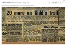
I found another newspaper source, this time mentioning he was part of yet another expedition, La Contenta.

1753055858358.webp

Daily Mirror (7 May 1951)

1753060837777.webp

Sunday Mail (Brisbane) 13 June 1951

The La Contenta expedition ran into legal troubles to the extent the boat was boarded by the police:

1753056323275.webp

Daily Mirror Sydney (25 September 1951)

1753056935899.webp

Daily Express (23 August 1951)

Summary of these dodgy expeditions:
  • May-August 1951 - La Contenta. Funded by Discoveries Ltd, created by George Shepherd, who had chartered the ship and organised the expedition. There were several shareholders but two wanted their money back; the owner and captain of the boat, W. J. Studdard came to the conclusion the Kidd-Palmer maps were not authentic so wanted to abandon the expedition for a "scientific survey" hence there was a legal dispute over a breach of the charter agreement (Shepherd issued a writ against Studdard); the police were further investigating potential fraud since if the maps were indeed fake, were shareholders duped into giving money by false pretenses? (A police officer investigating, reported: "In view of the possibility of money being fraudulently obtained, I took possession of the parchment produced to me and caused it to be sent to the Home Office Forensic Laboratory for examination." [This map was provided by Elizabeth Dick who was involved in the expedition].) Each shareholder gave a large amount of money, >£800 (equivalent to over £32,000 today). Maurice Taylor was leading the crew and planned to also film the expedition. The ship was prevented from sailing by the police who boarded. The expedition was presumably abandoned over the legal dispute and falling-out of some crew members.
  • October-November 1951 - La Morna. Contained a few of the same crew from the previous failed La Contenta expedition including Taylor and Shepherd. The ship owner was A. Coumandareas, a Greek captain. The ship actually sailed this time, but crashed or was wrecked near the Isle of Wight. Elizabeth Dick was involved in this failed expedition.
  • December 1951 - Another expedition involving George Shephard and possibly Taylor (since he accompanied Shephard on the previous two failed expeditions). Few details are available (see Edmunds [1996], p. 57).
  • 1952? - A newspaper I posted above mentioned Taylor was part of another planned expedition but "never left because of a dispute over the cost of fuel."
  • July 1952 - Taylor and his relative Patrick Crowe were trying to get £20,000 to launch another expedition.
  • 1958 - George Edmunds claims Taylor was planning yet another expedition but "it was shelved" in early 1958.
Suffice to say, he does not appear to be a reliable character. Taylor was involved in five or six failed or cancelled treasure hunting expeditions, one of which was investigated for fraud. Furthermore, one of the original maps (Dick provided to police) was forensically investigated in 1951, as part of the legal troubles of La Contenta. The forensic report concluded the map was not authentic: "[M]ap being a comparatively recent production on might very well be an old sheet of parchment." Taylor, must have known about this report but still went on subsequent expeditions to fleece people out of their money including trying to get people to donate £20,000 ("If you have a spare £20,000 there's a man at Port Adelaide who believes he can take you to Captain Kidd's buried treasure." 🤦‍♂️). It seems he was a conman.

In light of the above, and the other lines of evidence I presented, I doubt Taylor ever purchased the maps from Dick (the newspaper sources that quote Dick as still possessing the maps in 1957 are proof beyond reasonable doubt). He likely made that up to dupe people to give him more money for another dodgy expedition. In fact, we know not long after Taylor is alleged (without a shred of evidence [all gjb presented is hearsay]) to have purchased the maps from Elizabeth Dick (1956 or 1957), he was trying to launch another expedition but which was again abandoned in 1958 (Edmunds provides this information). It is therefore probable he made up the claim to own Dick's maps to trick people into giving him money to go on another treasure hunting expedition which had had a history of doing throughout the 1950s. Why is it Taylor never presented physical evidence he owned the maps? We are expected to believe he locked them away in a bank vault, with no one else seeing or having access? Why did he not get the maps scientifically tested? Why did he not take a photo? He never obviously had them.

Edit: Below are a few newspaper sources on the La Morna.

1753194796884.webp

The Mercury
(6 November 1951)

1753195435569.webp

The World's News (2 January 1954)

1753196111997.webp

Western Mail (6 November 1951)

1753196025160.webp

New Milton Advertiser (31 May 1952)
 

Attachments

  • 1753055816344.webp
    1753055816344.webp
    86.6 KB · Views: 177
Last edited:
This is clearly not a search for knowledge. If someone really wants to know what happened to the charts then they should be prepared to consider and assess all potential evidence that's available. You're deciding that the answer to this is what you want it to be based on secondary sources that conflicts with the primary source evidence. However, that's typical of this forum.

Also, why go out of your way to insult and alienate the holder of primary sources fundamental to the research? Furthermore, why not even ask to see or consult those primary sources? Your approach to research is totally unprofessional and I’ll have nothing more to do with it or with a forum that tolerates and promotes such attitudes and abuse.
There are multiple newspaper articles quoting Dick's own words in 1957. She said she still possessed the maps that year. This refutes your source (hearsay from Taylor that Dick sold him or a Canadian syndicate the maps in 1956) since Dick confirmed she had the maps a year after you believe Taylor bought them (furthermore, Dick's nephew thought she sold them in 1964 not 1956). I have further presented multiple sources that show Taylor was a very unreliable character. He was basically a conman who in 1952 (with one of his relatives) was even trying to trick people into giving him £20,000 by saying he could take them to Kidd's buried treasure:

"If you have a spare £20,000 there's a man at Port Adelaide who believes he can take you to Captain Kidd's buried treasure."

Do you believe that? Does this sound like someone who is remotely trustworthy? Furthermore, it turns out he was a crew member of five or six of these dodgy expeditions in the 1950s to find the treasure (all of them either ended in total failure or were abandoned) and one of these expeditions was investigated by the police for fraud. You want me to ignore all this, for hearsay by a grifter? :icon_scratch:

As for insulting you, on the contrary, I said elsewhere you are capable of doing decent research -

To be fair, if you ignore the mumbo-jumbo he writes about Oak Island in his Maps, Mystery and Interpretation trilogy (especially the second book) his books are very useful and informative since he publishes/quotes from various private letters (Hubert Palmer, Harold T. Wilkins, Rupert Furneaux, etc) only he has access to and some of his chapters on Captain Kidd, piracy, and so on are fairly well written. The books also have excellent bibliographies and I came across and bought new books from reading them. Unfortunately, his research went off-the-rails by linking the Kidd-Palmer maps to Oak Island and geometric nonsense. The idea of linking Oak Island to the Kidd-Palmer maps is not even his own; it has been around for many decades, so that is another bad (and quite frankly boring) aspect of his books. He is not actually coming up with a novel hypothesis but regurgitating a far-fetched/discredited idea about Oak Island that traces back to Gilbert Hedden.
Oak Island though is a turd in the punchbowl and it undermines your credibility (which is unfortunate since your books contain useful information on Hubert Palmer, Harold T. Wilkins, etc). You only vehemently believe the maps ended up in Taylor's possession and involve a Canadian syndicate because it links to Oak Island but this is wrong based on the various sources I posted and many others I have read.

A statement from one of your books:

Oak Island has to be the strongest, if not the only, candidate advanced so far that matches...

I strongly disagree but it is clear you are a true believer in the Oak Island identification with the Kidd-Palmer maps and nothing will convince you otherwise; trying to reason with someone with that dogmatic mindset is a complete waste of time. Farewell I guess.
 
Last edited:
I strongly disagree but it is clear you are a true believer in the Oak Island identification with the Kidd-Palmer maps and nothing will convince you otherwise; trying to reason with someone with that dogmatic mindset is a complete waste of time. Farewell I guess.
I guess GJB has his convictions - as we all have to some degree. I do disagree on Oak Island as much as you do but I would suggest to respect his opinion and not to get carried away to much emotionally.

This whole story if the maps history and all the effort and failure to produce any kind of result is by itself more that fascinating. It somehow speaks to some incredibly deep desire in men. I guess the search will never stop no matter the indications of a hoax.

Christmas is a hoax too - there is no Santa...
 
Last edited:
Some more sources and information concerning the whereabouts of the Kidd-Palmer maps.

The following states Dick was still in the possession of the maps but offering them for sale on 23 July 1957 (The Spokesman-Review).

1753218317510.webp


Recap: Hubert Palmer died in 1949 and left the maps in his will to his housekeeper Elizabeth Dick. She auctioned one of the maps in 1950, but withdrew the map after she only received one £25 bid (well below the reserve), so it was not sold. The following year she was involved in two dodgy treasure hunting expeditions (both ended in failure), but by 1953 she lost interest and remarked: "I am tired of the whole [treasure hunting] business." By 1957, she was trying to sell the maps again including negotiating with an American from Rhode Island named John Smith. There is no proof these maps were sold to Mr. Smith. In July 1957, multiple newspaper articles confirm Dick was still in possession of the maps since they quoted her own words to the effect she still owned and wanted to sell them. In 1965, a treasure hunter named Robert Gay claimed Dick auctioned the maps the previous year. Dick's nephew (E. A. Furbear) also believed that Dick sold the maps in 1964 but did not know to who. Dick died in July 1965.

Now we move on a year -

1753216480971.webp

The Calgary Herald (23 September 1966)

1753216545932.webp

Edmonton Journal (22 September 1966)

Eric Seldon, an antique dealer in Eastbourne provided no clues in 1966 to who the mystery buyer was. Secondly, whether he actually knew who the buyer was is questionable. We are not provided a date of when the maps were sold either.
 
Last edited:
How many dodgy/failed "expeditions" was Maurice Taylor a part of?
I found another newspaper source, this time mentioning he was part of yet another expedition, La Contenta.

View attachment 2217681
Daily Mirror (7 May 1951)

View attachment 2217693
Sunday Mail (Brisbane) 13 June 1951

The La Contenta expedition ran into legal troubles to the extent the boat was boarded by the police:

View attachment 2217682
Daily Mirror Sydney (25 September 1951)

View attachment 2217685
Daily Express (23 August 1951)

Summary of these dodgy expeditions:
  • May-August 1951 - La Contenta. Funded by Discoveries Ltd, created by George Shepherd, who had chartered the ship and organised the expedition. There were several shareholders but two wanted their money back; the owner and captain of the boat, W. J. Studdard came to the conclusion the Kidd-Palmer maps were not authentic so wanted to abandon the expedition for a "scientific survey" hence there was a legal dispute over a breach of the charter agreement (Shepherd issued a writ against Studdard); the police were further investigating potential fraud since if the maps were indeed fake, were shareholders duped into giving money by false pretenses? (A police officer investigating, reported: "In view of the possibility of money being fraudulently obtained, I took possession of the parchment produced to me and caused it to be sent to the Home Office Forensic Laboratory for examination." [This map was provided by Elizabeth Dick who was involved in the expedition].) Each shareholder gave a large amount of money, >£800 (equivalent to over £32,000 today). Maurice Taylor was leading the crew and planned to also film the expedition. The ship was prevented from sailing by the police who boarded. The expedition was presumably abandoned over the legal dispute and falling-out of some crew members.
  • October-November 1951 - La Morna. Contained a few of the same crew from the previous failed La Contenta expedition including Taylor and Shepherd. The ship owner was A. Coumandareas, a Greek captain. The ship actually sailed this time, but crashed or was wrecked near the Isle of Wight. Elizabeth Dick was involved in this failed expedition.
  • December 1951 - Another expedition involving George Shephard and possibly Taylor (since he accompanied Shephard on the previous two failed expeditions). Few details are available (see Edmunds [1996], p. 57).
  • 1952? - A newspaper I posted above mentioned Taylor was part of another planned expedition but "never left because of a dispute over the cost of fuel."
  • July 1952 - Taylor and his relative Patrick Crowe were trying to get £20,000 to launch another expedition.
  • 1958 - George Edmunds claims Taylor was planning yet another expedition but "it was shelved" in early 1958.
Suffice to say, he does not appear to be a reliable character. Taylor was involved in five or six failed or cancelled treasure hunting expeditions, one of which was investigated for fraud. Furthermore, one of the original maps (Dick provided to police) was forensically investigated in 1951, as part of the legal troubles of La Contenta. The forensic report concluded the map was not authentic: "[M]ap being a comparatively recent production on might very well be an old sheet of parchment." Taylor, must have known about this report but still went on subsequent expeditions to fleece people out of their money including trying to get people to donate £20,000 ("If you have a spare £20,000 there's a man at Port Adelaide who believes he can take you to Captain Kidd's buried treasure." 🤦‍♂️). It seems he was a conman.

In light of the above, and the other lines of evidence I presented, I doubt Taylor ever purchased the maps from Dick (the newspaper sources that quote Dick as still possessing the maps in 1957 are proof beyond reasonable doubt). He likely made that up to dupe people to give him more money for another dodgy expedition. In fact, we know not long after Taylor is alleged (without a shred of evidence [all gjb presented is hearsay]) to have purchased the maps from Elizabeth Dick (1956 or 1957), he was trying to launch another expedition but which was again abandoned in 1958 (Edmunds provides this information). It is therefore probable he made up the claim to own Dick's maps to trick people into giving him money to go on another treasure hunting expedition which had had a history of doing throughout the 1950s. Why is it Taylor never presented physical evidence he owned the maps? We are expected to believe he locked them away in a bank vault, with no one else seeing or having access? Why did he not get the maps scientifically tested? Why did he not take a photo? He never obviously had them.

Edit: Below are a few newspaper sources on the La Morna.

View attachment 2217873
The Mercury
(6 November 1951)

View attachment 2217874
The World's News (2 January 1954)

View attachment 2217878
Western Mail (6 November 1951)

View attachment 2217877
New Milton Advertiser (31 May 1952)
Maybe of interest to you all regarding the above and the (Failed)Captain Studdard expedition. He sent the 'parchment' to the Home Office forensic Science laboratory in August 1951. I have the report, the parchment in question was the first chart found in the Bureau. They of course did a thorough examination - ink/paper/style etc. It is only necessary for me to part quote the conclusion; ...The only conclusion which is justified on the evidence is that the initials 'W.K' were not signed by Captain Kidd and that other evidence points to the map being a comparatively recent production on what might very well be an old sheet of parchment' Unquote. It is what I have been telling you all for years - THE MAPS ARE FAKE! Does anybody want to argue with the Home Office?
And why all the fuss about what happened to the charts? It is irrelevant! Mrs Dick had them photographed before they were sold - whenever that was - or whoever to, it doesn't matter! I have the negatives for posterity. Wilkins created the charts, including the two in his 'Skeleton Island' book, but he was cunning and crafty, he inserted clues in them to the ultimate treasure - nothing to do with Kidd, - but you had to know about this treasure and therefore know what to look for.
 
THE MAPS ARE FAKE! Does anybody want to argue with the Home Office?
It seems frequently to be assumed that because the medium is fake then so also is the message. I get the impression that many would agree that the maps are probably not original, but they don't reject the possibility that they may be copies of copies of copies. Hence, focus on what they say not the paper they're written on, the ink used, when it was written and who wrote it.
Wilkins created the charts, including the two in his 'Skeleton Island' book, but he was cunning and crafty, he inserted clues in them to the ultimate treasure - nothing to do with Kidd, - but you had to know about this treasure and therefore know what to look for.
I've found no proof that Wilkins created the Palmer maps, otherwise I completely agree. Wilkins doesn't deny that the island outlines of his own maps are his own creations, and he openly claims copyright. However, the same applies: the instructions written on his maps could nevertheless be original, and Wilkins was fully aware that they are just that.
 

Users who are viewing this thread

Back
Top Bottom