What's new

The Treasure of Captain William Kidd.

Crow has done some useful research on Dan Morgan aka Daniel Morgan. According to the pedigree note with the Morgan Chest, he was a captain and aboard The Wanderer. He is alleged to have died in Barnstable, England (in 1932) and lived in Bristol. As I expected this now confirms Morgan was also imaginary (like Pamela Hardy) and is yet more evidence the Kidd-Palmer maps are a hoax.

No captain Dan Morgan/Daniel Morgan in the Lloyd,s register 1890 1891 and 1892. as you can see below. nor the following years till the ship [Wanderer] sank.

View attachment 2215447

View attachment 2215448

There was 1894. record of Wanderer owned or built W.H. Potter & Sons captain J T Brander. She was built in 1891 but did not come into service until late 1893 after a long fit out.

View attachment 2215462

View attachment 2215457

View attachment 2215458

View attachment 2215459
It was sunk in collision in 1907 captain Dunning. The four masted steel barque 'Wanderer', 2903 tons, anchored in an unidentified port [steel 4 mast barque, 2903 tons, ON99311, 309.0 x 46.0 x 25.8. Built 1891 (9) WH Potter and Sons, Liverpool. Owners: Ship Wanderer Ltd. (WH Potter and Sons) registered Liverpool. Sunk when run down by ss 'Gertrud Woermann' when at anchor near Cuxhaven, April 14, 1907. Was the subject of a famous poem by John Masefield].

View attachment 2215454
By 1907 it was looking old and tire and obsolete.

View attachment 2215461

Dan Morgan/Daniel Morgan is common name The only Dan Morgan/Daniel Morgan in Bristol was confectionery maker. There is no records Dan Morgan/Daniel Morgan or dying in Bristol or Barnstable related to being a mariner. between 1891 and 1921 census.

So no death records in Bristol and or Barnstable and the only Dan Morgan in Bristol was a confectionary maker.

Sources searched birth death and marriages and Captains and mates certificate register. 1850 to 1927.
About UK and Ireland, Masters and Mates Certificates, 1850-1927
There is no one qualified as a master or mate with that name in that time period. Dan Morgan/Daniel Morgan? There was a Daniel Morgan mariner but no captaining recorded in Liverpool in 1911. He could of possible crewed in the vessel at one time. But it was not definite and as crew member not being a mate or captain the average lot of sailor back then was not of luxury. source
Daniel Morgan in the UK, City and County Directories, 1766 - 1946 below.

View attachment 2215463
There was one real Daniel Morgan, a sailor in Liverpool in early 20th century mentioned in a record in 1911, but he was not a captain and certainly not the captain of The Wanderer of Liverpool; there is no evidence he was even aboard The Wanderer (sunk in 1907) and he did not die in Bristol or Barnstable. So he is not the Captain Dan Morgan on the pedigree note (Morgan Chest) who was evidently made up.

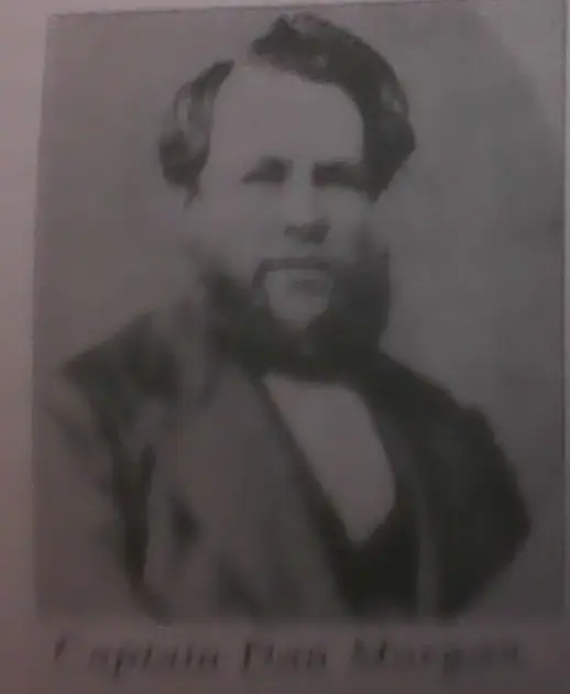
gjb - Any chance you could explain the unverified Dan Morgan photo in one of your books? And what do you make of the above?
1751926027041.webp
 
Last edited:
I think we are going around in circles.
True. You are free to interpret the evidence as you see fit, And we obviously have differing opinions. I choose to trust facts presented by competent researchers over tales from a fantasy and science fiction writer. To counter all your misconceptions (again) would be redundant. So thank you for your input.
 
True. You are free to interpret the evidence as you see fit, And we obviously have differing opinions. I choose to trust facts presented by competent researchers over tales from a fantasy and science fiction writer. To counter all your misconceptions (again) would be redundant. So thank you for your input.
Nah. You were thoroughly disproven but do not have the integrity to admit you were wrong e.g.,

Palmer actually had all the charts examined by Raleigh A Skelton, superintendent of the Map Room at the British Museum who pronounced the charts authentic.
In reality, Skelton himself confirmed he only ever examined a single map:

The only one of the four 'treasure island charts' reported by Wilkins that I have, myself, seen is the one found in a "third chest". This, which was shown to me some 14 or 15 years ago, was drawn on the back of a perfectly genuine will, apparently of the early 18th century...

The British Museum (Map Room) has also confirmed Skelton never "pronounced the charts authentic" (nonsense you made up):

My Colleague Mr. Corfe, who was in the Map Room in 1950 ... does recall details of the visit .... seems to recall Dr. Skelton refrained from making any statement about the authenticity or otherwise of the charts.

:BangHead:
 
Nah. You were thoroughly disproven but do not have the integrity to admit you were wrong e.g.,
In reality, Skelton himself confirmed he only ever examined a single map:

Isn't this contradictory to what you claimed on post #578? "This is demonstrably untrue; he wrote to Wilkins to state he would not have any of the maps tested or analysed by experts."

If you want to make up stories at least try to be consistent. You have a lot to learn about integrity.
When I'm proven wrong, I'll let you know. 😉
 
Isn't this contradictory to what you claimed on post #578? "This is demonstrably untrue; he wrote to Wilkins to state he would not have any of the maps tested or analysed by experts."

If you want to make up stories at least try to be consistent. You have a lot to learn about integrity.
When I'm proven wrong, I'll let you know. 😉
You apparently have a reading comprehension problem.

Palmer died in 1949. Skelton looked at a single map in 1950. Palmer was not then alive.

The only one of the four 'treasure island charts' reported by Wilkins that I have, myself, seen is the one found in a "third chest". This, which was shown to me some 14 or 15 years ago, was drawn on the back of a perfectly genuine will, apparently of the early 18th century...
The above is a snippet from a private letter Skelton wrote in 1965. Do the maths. I think we both know you are trolling me at this point.

Summary -
1. Palmer had none of the maps examined by experts or tested.
2. In 1950, a year after Palmer died, one map was examined ('off-the-record') by Skelton at the British Museum. Palmer's possessions (including the maps) were by then owned by Elizabeth Dick so it was presumably her who contacted Skelton.
3. The British Museum never published a report and has no official record of any Kidd-Palmer map. Staff from the Map Room have repeatedly clarified Skelton only ever offered a private opinion on one of the maps.
4. Skelton's private opinion did not state the map he examined was authentic, only that the parchment appeared to be from the early 18th century. This is not the same as stating the map was drawn in the early 18th century.

All of the above is verified by the private letters, statements by British Museum Map Room staff and other sources I quoted.

In contrast, you have not offered a single source for dubious claims Palmer had the maps tested (contradicted by Palmer's own writings), that Skelton examined the maps when Palmer was alive (contradicted by Skelton's own writings), that Skelton examined more than one map (contradicted by Skelton's own writings), that Skelton and/or the British Museum confirmed the maps were authentic (contradicted by statements made by Map Room staff), and so on. This goes back to my earlier comment wondering if you are intentionally posting these falsehoods in this thread to mislead other treasure hunters (disinformation), or are you are an incredibly inept researcher and gaffe-prone because more or less nothing you have posted is accurate, or is it all trolling to waste my time? Which one is it?
 
Last edited:

View attachment 2215615
Wow, you actually went all the way back to my post #23. To re-establish context, I was explaining that if Wilkins had drawn the Kidd/Palmer maps, then why are the maps not shown in his book. Do you have a copy of Wilkins book? If so could you please share all the places in the book (page numbers, and/or photos) where the actual Kidd/Palmer maps are shown? (FYI, You contradict yourself in your very next post).

You obviously misunderstood the post you referenced. If Wilkins "did not have permission from Palmer to copy the original maps", how can you discredit my statement above, and then confirm you agree I'm correct in your next post?

Wilkins not only believes in UFO's and other nonsense, but his writings are deeply seated in fictional stories. While Edmonds' books are all based on non-fiction.
Unreasonable bashing? Here's a few of Mr Wilkins book reviews:
The anthropologist John Alden Mason has described Wilkins's research as pseudohistory and noted that most of his statements capable of verification turned out to be incorrect.
A review in Western Folklore claimed that Wilkins's Mysteries of Ancient South America reads like a science fiction book owing to its pseudohistoric claims.
His Secret Cities of Old South America was described by The Explorers Club in a review as a "crank book, basing most of its fantastic conclusions on the assumption that Atlantis and Mu did exist... Despite a long bibliography there is little dependable documentation in the book. It is vaporous hearsay."
George Edmunds did not correspond or meet with Hubert Palmer; Harold T. Wilkins did. The simple way to confirm who is correct in terms of the Kidd-Palmer map discoveries (their sequence, who found them, etc), is to see what Palmer himself said. G. J. Bath has published Palmer's written correspondence with Wilkins. Those private letters prove Wilkins [1935] is correct and Edmunds [1996] (who uncritically copied Howlett [1958]) got most wrong, although I am not saying Edmunds should be ignored; on the contrary, he has done a decent amount of research and his book contains useful information despite errors. That is all there is to this but for some bizarre reason you resorted to discussing Wilkins UFO/Atlantis books. They have no relevance. Wilkins was wrong in his belief the charts are authentic pirate maps. I have never taken his claims about the authenticity of the maps seriously; he is only reliable in regards to the sequence of their discovery, who found them and some other relevant details corroborated by Palmer. It is actually yourself who holds Wilkins crank viewpoint the Kidd-Palmer maps are genuine Captain Kidd maps. No scholar has ever supported that notion to best of my knowledge and it has been discredited (proof has already been posted here but you ignored it... something akin to true believer syndrome?).

Can you name a single scholar who believes the Kidd-Palmer maps are authentic Captain Kidd/pirate maps? ::)
 
Last edited:

You write that Wilkins had only Palmer as source for the maps but as I understand he picked up details from some other sources as well. Some of them are similar like the instructions other additional like "death valley". To me this means that both Cutler could not be the one who created those charts!
 
You write that Wilkins had only Palmer as source for the maps but as I understand he picked up details from some other sources as well. Some of them are similar like the instructions other additional like "death valley". To me this means that both Cutler could not be the one who created those charts!
There are more plausible explanations:

1. Maps on the internet are copies (some of copies), so it is possible "Death Valley" was on one of the original maps Wilkins saw but was removed (for whatever reason) when it was copied by photography or redrawing or it was very faint on the original. Someone was certainly tampering with at least one of the maps when they were copied after Palmer's death, although in their defence they could say they were touching up or restoring and not adding new content. The so-called Coral Island map original never had a visible "5" (o "S") on the first line of text; is it really a restoration if illegible?. Someone (possibly Elizabeth Dick?) later added it (George Edmunds in his book also discusses differences in copies of the Skeleton Map). Compare the following:

1752429797640.webp

1752429585540.webp


2. Wilkins was working from memory (he met with Palmer in the early 1930s meaning that he saw the maps a few years prior writing and publishing his book in 1935), so it is possible he forgot or misunderstood the writing on the Coral Island or so-called Skeleton Map and by mistake thought one of the maps mentioned a "Death Valley". Where did he get "Skeleton Island" even from? The legible writing on the so-called Skeleton Map does include the word skele[ton]. There also appears to be a small skull on the so-called Skeleton Map.
 
Last edited:

Wow, this thread has 36K views and counting. When I started this discussion I had no idea the topic of the Kidd/Palmer charts would generate so much interest. It goes without saying that many of the views posted here have no basis in historical fact and that readers should cautiously consider these statements as personal opinions and nothing more. It has been my intent here to post all the known evidence available and to let the reader decide the truth for themselves.
FYI, The name "Skeleton Island" was obviously swiped from Captain Flint's fictional map as described in the most famous pirate novel ever written, Treasure Island. And there's nothing to substantiate that any of the actual Kidd/Palmer charts (shown on post #1) Ever had the words "Death valley", or any other "valley" written on them.
 
Your first post does not show the actual Kidd-Palmer maps but copies of copies. The originals had some illegible handwriting and so someone after Palmer's death (Elizabeth Dick?) made copies to "touch up", to make handwriting clear. In 1969, Rupert Furneaux wrote:

I possess copies of all four charts, which were made by infra-red photography after Palmer's death in 1950 and before the originals were purchased from his housekeeper, Mrs. Dick, by an Englishman now living in Canada who possesses them still.
Therefore as noted, someone after Palmer's death made copies and Dick allegedly sold the originals to a Canadian private collector around 1957 [edit: I dispute this here]. The Coral Island map you posted has been tampered with in the first line. To their credit, George Edmunds as well as G. J. Bath acknowledged these differences and recognised that most published drawings of the maps were not exactly same as the originals. In his 1996 book, Edmunds discusses alterations to the Skeleton Map but claims (p. 226) to reproduce an "exact copy" unlike Furneaux [edit: for clarification Edmunds claims to have restored faded away squiggles].

1752493735795.webp


Considering we know these maps were tampered with and modified (even if slightly and only to touch up and restore fading content), it is possible "Death Valley" was written on one of the maps (edit: see my comments on "DV" on a restored Skeleton Map). Indeed, Wilkins (who saw the maps) was insistent in a letter he published in The Listener [1936] he read Death Valley:

1752497481422.webp


Alternatively, he could have been mistaken since he was relying from memory. :dontknow:

All that said, it is possible Wilkins confused the Death Valley on another chart or map:

1752498129805.webp


This from page 209 of Wilkins Panorama of Treasure Hunting. Can anyone locate the chart mentioned?

FYI, The name "Skeleton Island" was obviously swiped from Captain Flint's fictional map as described in the most famous pirate novel ever written, Treasure Island.
Except it was not only Wilkins who used "Skeleton Island" in his book title. Hubert Palmer referred to "Skeleton Island(s)" in his private letters. Of course, the hoaxer may (and was probably) inspired by Treasure Island, but Palmer appears to have instead got the name from the word skele[ton] being written on the so-called Skeleton Map.
 
Last edited:
Your first post does not show the actual Kidd-Palmer maps but copies of copies. The originals had some illegible handwriting and so someone after Palmer's death (Elizabeth Dick?) made copies to "touch up", to make handwriting clear. In 1969, Rupert Furneaux wrote:


Therefore as noted, someone after Palmer's death made copies and Dick sold the originals to a Canadian private collector around 1957. The Coral Island map you posted has been tampered with in the first line. To their credit, George Edmunds as well as G. J. Bath acknowledged these differences and recognised that most published drawings of the maps were not exactly same as the originals. In his 1996 book, Edmunds discusses alterations to the Skeleton Map but claims (p. 226) to reproduce an "exact copy" unlike Furneaux.

View attachment 2216727

Considering we know these maps were tampered with and modified (even if slightly), it is possible "Death Valley" was written on the Coral/Skeleton Map but was accidentally removed when copies were made. Indeed, Wilkins (who saw the maps) was insistent in a letter he published in The Listener [1936] he read Death Valley:

View attachment 2216728

Alternatively, he could have been mistaken since he was relying from memory. :dontknow:

All that said, it is possible Wilkins confused the Death Valley on another chart or map:

View attachment 2216729

This from page 209 of Wilkins Panorama of Treasure Hunting. Can anyone locate the chart mentioned?


Except it was not only Wilkins who used "Skeleton Island" in his book title. Hubert Palmer referred to "Skeleton Island(s)" in his private letters. Of course, the hoaxer may (and was probably) inspired by Treasure Island, but Palmer appears to have instead got the name from the word skele[ton] being written on the so-called Skeleton Map.
WK2x.webp

It is not only Death Valley that could have come from the poem but also other details like Rockey Pt., Cayse Blanco, Boylers Reef and the surrounding reefs that does not even fit on any of the Palmer charts! Maybe he claims it but I can either see he completely invented those details or had another source he didn't want to mention on whatever reason.

In any case it shows Wilkins as a not too trustworthy source of information.
 
View attachment 2216748
It is not only Death Valley that could have come from the poem but also other details like Rockey Pt., Cayse Blanco, Boylers Reef and the surrounding reefs that does not even fit on any of the Palmer charts! Maybe he claims it but I can either see he completely invented those details or had another source he didn't want to mention on whatever reason.

In any case it shows Wilkins as a not too trustworthy source of information.
It has already been explained why Wilkins Mar Del maps do not closely resemble the Kidd-Palmer maps. Palmer denied him permission to copy the maps so he made a lot up. According to Wilkins, "He [Palmer] was adamant in his refusal to let me copy this chart and I did not blame him." That said, key annotated details still appear (wrecks, reefs, the lagoon, etc) which is what he clarified in his 1937 letter in The Listener, but he notably changed the shape of the island, and added many imaginary aspects. In his own words: "I added a legend for the location of the cache which was totally different from the original. It was meant only as an illustration for my book".
 
It has already been explained why Wilkins Mar Del maps do not closely resemble the Kidd-Palmer maps. Palmer denied him permission to copy the maps so he made a lot up. According to Wilkins, "He [Palmer] was adamant in his refusal to let me copy this chart and I did not blame him." That said, key annotated details still appear (wrecks, reefs, the lagoon, etc) which is what he clarified in his 1937 letter in The Listener, but he notably changed the shape of the island, and added many imaginary aspects. In his own words: "I added a legend for the location of the cache which was totally different from the original. It was meant only as an illustration for my book".
I understood that he had to recreate the map from his memory. But I am still puzzled that he added all those reefs and the valley without any source mentioning their existence. Why would he do this apart from misleading his readers. Assuming the later makes the rest of his writings and letters an unreliable source. I do tend to think that he had more sources than Palmer.
 
Your first post does not show the actual Kidd-Palmer maps but copies of copies.

George Edmunds owns the photographic negatives of the Kidd charts that were photographed by Skelton for Palmer, left to his housekeeper, given to Anthony Howlett and then given to him.
All the copies of the charts in Edmunds' possession, including the Yunnan Parchment carry the "British Museum" imprint.
The problem with the original charts is that they had faded and the parchment had become badly discolored with age making them barely legible.
Mr Skelton was privately commissioned by Palmer in the 1930's to try to obtain the best resolution possible from the originals. He tried numerous photographic enlargements, using both infra-red and ultra-violet filters to bring up the details, but without much real success. Skelton therefore had the charts redrawn by a skilled cartographer in an endeavor to reproduce the originals as faithfully as possible. The bureau chart was copied at actual scale, but the others were traced from 2x photographic enlargements. Notes accompany each drawing referring to conjectural markings and writing, supported by intrinsic evidence, as the cartographer's interpretation of what he thought the markings actually represent.
Therefore, these Skelton reproductions are the best possible copies available today. As this was a private commission, the British Museum has no records in their files regarding the Kidd charts, and they possess no copies of them. The staff have understandably become irritated over the years by people who mistakenly think they have.
 
George Edmunds owns the photographic negatives of the Kidd charts that were photographed by Skelton for Palmer, left to his housekeeper, given to Anthony Howlett and then given to him.
All the copies of the charts in Edmunds' possession, including the Yunnan Parchment carry the "British Museum" imprint.
The problem with the original charts is that they had faded and the parchment had become badly discolored with age making them barely legible.
Mr Skelton was privately commissioned by Palmer in the 1930's to try to obtain the best resolution possible from the originals. He tried numerous photographic enlargements, using both infra-red and ultra-violet filters to bring up the details, but without much real success. Skelton therefore had the charts redrawn by a skilled cartographer in an endeavor to reproduce the originals as faithfully as possible. The bureau chart was copied at actual scale, but the others were traced from 2x photographic enlargements. Notes accompany each drawing referring to conjectural markings and writing, supported by intrinsic evidence, as the cartographer's interpretation of what he thought the markings actually represent.
Therefore, these Skelton reproductions are the best possible copies available today. As this was a private commission, the British Museum has no records in their files regarding the Kidd charts, and they possess no copies of them. The staff have understandably become irritated over the years by people who mistakenly think they have.
Source of the above information?
 
Pages 224 and 225 of the book: "Kidd, the Search for His Treasure",
and author Mr George Edmunds.
 
In his 1996 book, Edmunds discusses alterations to the Skeleton Map but claims (p. 226) to reproduce an "exact copy" unlike Furneaux.

Sorry, but if you are referencing the book "Kidd, the Search for His Treasure",
No discussion, claims, nor any reference to Furneaux appears on page 226, only a pic of the Key chart with the caption: "The 'key chart re-defined with reference to the 'skeleton' original."
 
George Edmunds owns the photographic negatives of the Kidd charts that were photographed by Skelton for Palmer, left to his housekeeper, given to Anthony Howlett and then given to him.
All the copies of the charts in Edmunds' possession, including the Yunnan Parchment carry the "British Museum" imprint.
The problem with the original charts is that they had faded and the parchment had become badly discolored with age making them barely legible.
Mr Skelton was privately commissioned by Palmer in the 1930's to try to obtain the best resolution possible from the originals. He tried numerous photographic enlargements, using both infra-red and ultra-violet filters to bring up the details, but without much real success. Skelton therefore had the charts redrawn by a skilled cartographer in an endeavor to reproduce the originals as faithfully as possible. The bureau chart was copied at actual scale, but the others were traced from 2x photographic enlargements. Notes accompany each drawing referring to conjectural markings and writing, supported by intrinsic evidence, as the cartographer's interpretation of what he thought the markings actually represent.
Therefore, these Skelton reproductions are the best possible copies available today. As this was a private commission, the British Museum has no records in their files regarding the Kidd charts, and they possess no copies of them. The staff have understandably become irritated over the years by people who mistakenly think they have.
Skelton only ever had access to a single map, so any photographic copies by him were only of one map. This is confirmed by Skelton in the private letter I already quoted. To quote G. J. Bath:

Furneaux reports that Skelton gave him "photographic copies of the charts made by infra-red and ultra-violet photography. He adds that "even this expert work failed to recover some of the words and marks." In 1965, Skelton reported in correspondence that he had seen only one of the charts. The Map Library observes that, "it is unlikely that Skelton would have confirmed the authenticity of the charts". They add, it is, of course, possible Skelton gave a private opinion in 1950 (the first year in which he was in charge of the Map Room.)

So Edmunds is mistaken. Skelton only ever saw and examined a single map in 1950 and any photographic copies were not made for Palmer who died the previous year (but presumably Elizabeth Dick, his housekeeper). Note Skelton only became Superintendent of the Map Room at the British Museum in 1950 (a year after Palmer died), so this is further evidence Edmunds got it wrong. The idea Skelton was "privately commissioned by Palmer in the 1930's" is unsubstantiated and clearly erroneous. Skelton first began working in the Map Room from 1945/1946 and he was promoted to Superintendent in 1950 (until retiring in 1967). Edmunds did not even do basic research on this.

Sorry, but if you are referencing the book "Kidd, the Search for His Treasure",
No discussion, claims, nor any reference to Furneaux appears on page 226, only a pic of the Key chart with the caption: "The 'key chart re-defined with reference to the 'skeleton' original."
It is on the previous page discussing page 226:

The 'key' chart drawing you see on page 226 is the only true reproduction in every detail of the Skelton drawing. You will not have seen it before. On previously reproduced copies (probably the Furneaux reproductions) there are three areas which show faint lies and what can only be described as squiggles. Only on the Skelton original (of which I have a copy) are these marks more clearly shown.

Finally, more than one map copy and the Yunnan Parchment had the British Museum ruler/label or name next to it but this is meaningless as already explained because anyone could have put that there without any map or parchment entering the British Museum. This point was made by Peter Barber of the Map Library: "The [British Museum] label could, however, have been obtained by the photographer without the map ever having entered the Museum." Considering we know the British Museum has no official report or record of any of the so-called Kidd-Palmer maps, this seems most likely. Even Edmunds you quoted or paraphrased recognised the British Museum has "no records in their files regarding the Kidd charts, and they possess no copies of them."

Summary
(1) One map was examined by Skelton "off-the-record" in 1950 (likely given to him by Elizabeth Dick; a year after Palmer died).
(2) Skelton made photocopies of the single map.
(3) Skelton never claimed the map was authentic, only that the parchment was old.
(4) The British Museum and Map Library has no records of any map (what Skelton did was private).
(5) Later photos of maps with the British Museum ruler/label are not evidence they were taken at the British Museum.

Edit: I found this source on another expert who realised the maps were a hoax.

1752683533975.webp

- D'Arcy O'Connor, The Secret Treasure of Oak Island

This goes back to what I said above, not a single scholar with relevant expertise or knowledge (cartography, maritime history, etc) has supported the idea the maps are authentic Captain Kidd/pirate maps from the late 17th century. On the contrary, they recognise the maps are not genuine and were very probably drawn in the early 20th century (albeit on earlier dated parchments).
 
Last edited:
Here are various sources on the Kidd-Palmer maps I found, however, some information in these articles is false or inaccurate. It is interesting to note Elizabeth Dick made up the British Museum "authenticating" the charts (this never happened) and exaggerated the discovery of the maps to involve herself for publicity.

"The House of Pirates Secrets", Eastbourne Gazette (16 April 1980), p. 6:

1752709848091.webp


Eastbourne Chronicle (5 August 1949):

1752710852928.webp


Evening News (London) (21 October 1949):

1752711092563.webp


Nottingham Journal (22 October 1949):

1752710532265.webp


Daily Express (22 October 1949):

1752712381701.webp

1752712413360.webp


Evening News (London) (8 August 1950):

1752712094631.webp


Daily Herald (22 October 1951):

1752711973343.webp


Evening News (London) (19 July 1950):

1752711836133.webp

1752711867389.webp


Evening News (London) (23 July 1957):

1752711241459.webp

1752711284450.webp


Article by Robert Furneaux "In the Steps of Captain Kidd", Illustrated London News (2 November 1977), pp. 35-37:

1752707591456.webp

1752707604080.webp

1752707615312.webp

1752707626688.webp


1752707643686.webp

1752707661199.webp


Letter critical of Furneaux's article in Illustrated London News (1 February 1978), p. 26:

1752708663199.webp


Furneaux does not come across as reliable.
 
Last edited:
Edit: I found this source on another expert who realised the maps were a hoax.

1752718783623.webp

1752718616419.webp


Dear esteemed members of Treasure Net. Can I please have your honest opinion on whether you believe the Kidd/Palmer charts were 'modeled' on Robert L Stevenson's map pictured above or not? Thank you.
-Randawg72.
 

Users who are viewing this thread

Back
Top Bottom