What's new

What happened to the Kidd-Palmer treasure maps?

I think it has run out of steam. It might though be worthwhile revisiting in 6+ months to check if there is new information.
I mean I read in several places they were a hoax. Who cares where they went.
 
In regards to Harold T. Wilkins, I think I should clarify -
You want to ignore what's in Wilkins' personal files? You want to ignore his stated aims, his motives, his thinking, strategy and tactics? Fine. Go ahead, you're on your own, but you're sure to fail if you carry on like this.
Wilkins (1935) turned out to be a lot more reliable and accurate than Howlett (1958) in regards to when, where, and how Hubert Palmer acquired the so-called Kidd-Palmer maps. This is not surprising since he met and corresponded with Palmer and his book Captain Kidd and His Skeleton Island even quotes text from Palmer's letters. I only ever said that Wilkins was useful in determining when/where/how Palmer came into possession of the maps including the timeline or sequence the maps were discovered. Beyond that, Wilkins' writings, published or unpublished (personal files) are no use whatsoever in solving the maps:
  • Wilkins believed the Kidd-Palmer maps were authentic treasure maps drawn or owned by William Kidd/Kidd's shipmates.
  • Wilkins believed Pamela Hardy existed and believed in the fabricated provenance of the Hardy Chest.
  • Wilkins came to believe the Kidd-Palmer map instructions have something to do with Oak Island.
  • Wilkins believed Captain Kidd visited and buried a treasure on Oak Island.
  • Wilkins believed he was the reincarnation of a pirate, namely William Kidd.
Needless to say, this is all nonsense. However, if there is information in Wilkins' personal files that can further shed light on when/where/how Palmer acquired the maps - by all means share it although based on what you have already published and my own research such as finding Driscoll's [1930] article - I think we have worked out the sequence Palmer purchased and acquired the maps, who he bought them from, etc.
 
Hi George

With respect, you’re only assuming that Wilkins and Latcham communicated in the 1930s. I did wonder myself but, like you, found no evidence. Surely, Wilkins would likely have found out about Latcham’s Guayacán activities on his own due to his deep interest in treasure hunting.

Also, which Derrotero are you thinking that Wilkins sent Latcham, is there an image? Is this perhaps one of the Coquimbo / Guayacán maps in Latcham (p.102-105) that he reported were among Castro's finds, that "se encontraron entre los documentos" (p.104)?

Concerning Pristarius, I’ve no information at all about why Wilkins picked on this name. For all anyone knows, it could be Prime Star Scorpius (or even Sagittarius). However, I take it that Scorpius was chosen due to the appearance of ‘Altitude Schuba’ in the Anson story, though I assume that you’re aware that Dschubba is the prime star of δ (delta) Scorpii not of the constellation itself.
Hi Geoff, sorry for the delay, a lot on. The Derrotero is 'the map with many lines'. Rectangular shape, grid pattern with map outlines. I don't know if you have my book, but the solution is in there; it gives, in a geometric angular form, the longitude Of Pinaki from Cadiz (Obviously).
 
In regards to Harold T. Wilkins, I think I should clarify -

Wilkins (1935) turned out to be a lot more reliable and accurate than Howlett (1958) in regards to when, where, and how Hubert Palmer acquired the so-called Kidd-Palmer maps. This is not surprising since he met and corresponded with Palmer and his book Captain Kidd and His Skeleton Island even quotes text from Palmer's letters. I only ever said that Wilkins was useful in determining when/where/how Palmer came into possession of the maps including the timeline or sequence the maps were discovered. Beyond that, Wilkins' writings, published or unpublished (personal files) are no use whatsoever in solving the maps:
  • Wilkins believed the Kidd-Palmer maps were authentic treasure maps drawn or owned by William Kidd/Kidd's shipmates.
  • Wilkins believed Pamela Hardy existed and believed in the fabricated provenance of the Hardy Chest.
  • Wilkins came to believe the Kidd-Palmer map instructions have something to do with Oak Island.
  • Wilkins believed Captain Kidd visited and buried a treasure on Oak Island.
  • Wilkins believed he was the reincarnation of a pirate, namely William Kidd.
Needless to say, this is all nonsense. However, if there is information in Wilkins' personal files that can further shed light on when/where/how Palmer acquired the maps - by all means share it although based on what you have already published and my own research such as finding Driscoll's [1930] article - I think we have worked out the sequence Palmer purchased and acquired the maps, who he bought them from, etc.
 
Wilkins conned all of you. He was very good at that. He and Hill schemed to get the charts into furniture sold to Palmer. Being hoax maps created by Wilkins, how else do you think they appeared there? And those 'key' lat and long figures, they are very specific, why do you think they in particular are there? Who put those particular figures there and why? There is only one answer. So those of you with all the answers, explain those particular figures. A direct answer only, please, to a direct question. No side-tracking rubbish.
 
You are right of course. The only question is who and why? And those answers are 'out there'.
desperation, greed, and money makes people do crazy things.
 
Wilkins conned all of you. He was very good at that. He and Hill schemed to get the charts into furniture sold to Palmer. Being hoax maps created by Wilkins
which is just your opinion, I still have to see anything proving this.

, how else do you think they appeared there?
Cutler got some copies or photos of the originals and hid them to sell more furniture to Palmer (and others who read about those maps) - Not much prove neither but a much simpler explanation.

And those 'key' lat and long figures, they are very specific, why do you think they in particular are there?
They aren't very readable but point quite well to the South China Sea, reinforcing the idea that he island is located there. I guess either Cutler or the original author of the maps put them there as a misdirection to those who think the world is just numbers.

Who put those particular figures there and why? There is only one answer.
As with the rest there are a range of possibilities and prudent thinking doesn't take judgement until its really needed and all the facts are available. Neither is the case so everyone (me and you included) are just speculating.

So those of you with all the answers, explain those particular figures. A direct answer only, please, to a direct question. No side-tracking rubbish.
Did you ever answer to any of our responses? Or anything we wrote. I fell you just interested in promoting your own ideas never really looking into what we done here!
 
I found some more newspaper articles.

Rhode Island Pendulum, 1 August 1957:

John L. Smith, florist of Jamestown, R. I. wrote to Elizbeth Dick of Eastbourne, England asking her to set a price on the so-called Captain Kidd maps and codes which she claims are authentic...

1769870487956.webp

1769871011712.webp

- Fall River Herald News, 25 July 1957

John Smith opened negotiations with Elizabeth Dick to buy one of the maps on 24 July 1957.

Can CapnGeorge disclose the date on the legal letter (he claims is in his possession) the Kidd-Palmer maps were supposedly sold?

I have the letter in front of me from the solicitors acting for Mrs Dick.
 
Last edited:
In an earlier post in another thread I noted Harold T. Wilkins published a series of 14 articles "On the Treasure Trail of the Wicked Pirates" in American Weekly (1940). These were republished in various different newspapers.

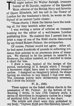
One of these articles (no. 5) was difficult to find but I have now managed to find it having searched a digital newspapers archive.

1770914664858.webp

- The Milwaukee Sentinel (18 February 1940)

This is another source disproving Gjb's claims about the Mar Del map.

Wilkins (1940) again admits the Mar Del map is imaginary:

I designed an imaginary island, its shape having no relation to any island I had ever seen.

The instructions at bottom of the map he also made up:

At the bottom of my drawing I wrote, in late 17th Century style, a series of directions to imaginary caches...

In 1935, Wilkins criticised treasure hunters trying to link Captain Kidd to Oak Island:

1770923785699.webp

- The Listener (19 June 1935), p. 1065

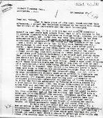
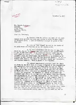
Wilkins at first criticised Hedden's (1937) idea the instructions relate to markers on Oak Island and Kidd visited Oak Island since he knew he himself made up the instructions but over time he became delusionally convinced he drew the instructions subconsciously and there was a paranormal force involved hence he believed he was either the reincarnation of a pirate (namely Captain Kidd) or the instructions were the result of automatic writing. In August 1937, Wilkins was still sceptical about linking his map substitute and the Kidd-Palmer maps to Oak Island and he sent a second letter to Hedden telling him to not "waste any time" with Oak Island:

1770919463421.webp

- Rupert Furneaux (1972), The Money Pit Mystery

Hedden ignored Wilkins original scepticism about Oak Island and visited him and Palmer in Eastbourne.

Letter from Hedden to R.V. Harris detailing his plans to meet with Wilkins and Palmer (15 October 1937):

1770919662691.webp


Hedden traveled to England and met Wilkins and Palmer in December 1937.

R.V. Harris (1957) quoted Hedden's account of meeting Wilkins in which Wilkins admitted the Del Mar Map was imaginary:

He [Harold T. Wilkins] almost immediately admitted that the chart as shown in the Kidd book is simply a figment of his imagination... The legend of the directing measurements simply came out of his mind.

Hedden wrote in a letter to R.V. Harris (17 December 1937) about the visit and commented that Wilkins came to believe he was a reincarnation of Captain Kidd after being convinced by Heden that the instructions on his map are markers on Oak Island:

1770927388408.webp


Hedden had now convinced Wilkins that the instructions pertain to Oak Island in the form of markers (trees and rocks on the island). This left Wilkins with trying to solve this discrepancy that he made up the instructions ex nihilo from his mind and they were real by irrationally believing he subconsciously drew the instructions (e.g., by automatic writing or spiritual guidance) and/or he was the reincarnation of a pirate. In his 1940 article (see above), Wilkins touched upon this ("ghost of Captain Kidd") in a less serious way:

1770925244305.webp


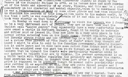
However, this was not a joke and Wilkins actually believed in some paranormal explanation. In a letter to Hedden (23 December 1937) shortly after both met each other, Wilkins wrote about having an "involuntary, and even subconscious" experience:

1770925201135.webp


In 1950, Wilkins elaborated more on his belief in a paranormal force he believed made him subconsciously write the instructions; he wrote about this and automatic writing in his article "Mystery of the Pirates Chart", FATE vol 3, no. 8 (December 1950), p. 29. In the same article, Wilkins clarified that he did not copy the Mar Del map from another map or chart source and that the map legend instructions he made up and they were "totally different from the original [Kidd-Palmer map]". The map and instructions are fiction:

The author drew up the treasure map out of his imagination - then suddenly strange things began to happen [...] I sat down in my den and out of my imagination I drew a chart a 17th century buccaneer might have produced [...] I added a legend for the location of the cache which was totally different from the original [...]

Wilkins (see for example Wilkins, 1935 [quoted above]) originally doubted that Captain Kidd ever set foot on Oak Island but after Hedden's visit, he appears to have changed his mind. In 1939, Wilkins updated his book Treasure Hunting: The Treasure-Hunter's Own Book of Land Caches and Bullion Wrecks, and added a note on page 259 to state he believed Kidd buried a treasure there:

Mr. Gilbert D. Hedden of Chatham, N. J., has acquired the title-deeds to this strange island, and hopes to solve the mystery. Capt. Kidd was in Oak Island, in 1669-70, and I have (May 1938) found strange clues to his unsuspected cache there.

However, by 1940, Wilkins changed his mind again to doubt Kidd buried a treasure on Oak Island:

1770928121245.webp


Instead, he now believed Henry Avery did:

1770928158987.webp


Finally, I am not seeing any evidence Wilkins' Mar Del map drew inspiration from old charts of Juan Fernandez, if that did happen it could have only been minor (there are far more difference than similarities between the island depicted on the Mar Del and old charts of Juan Fernandez). Regardless, that idea is contradicted by his own writings.

To sum up:
  • Wilkins made up the Mar Del map and instructions (they are imaginary).
  • Wilkins changed his mind from denying Captain Kidd visited Oak Island (1935), to believing he did (1938), to believing he did not but Henry Avery did (1940).
  • Wilkins (pre-1937) denied his Mar Del map had anything to do with Oak Island but he changed his mind after Hedden visited him in December 1937. He then delusionally believed he was a reincarnated pirate or a paranormal force caused him to write the instructions.
 

Attachments

  • 1770925865994.webp
    1770925865994.webp
    261.9 KB · Views: 64
  • 1770927280912.webp
    1770927280912.webp
    123.6 KB · Views: 66
  • 1770925145796.webp
    1770925145796.webp
    138.5 KB · Views: 76
  • 1770924949376.webp
    1770924949376.webp
    236.5 KB · Views: 48
  • 1770914939259.webp
    1770914939259.webp
    47.5 KB · Views: 55
  • 1770923182277.webp
    1770923182277.webp
    120 KB · Views: 67
Last edited:
A decade after Wilkins published articles on the Kidd-Palmer maps in The American Weekly - an article was published on the maps named "Widow's Dilemma". The article was republished in The Boston American (9 April 1950):

1771078252099.webp

1771078375222.webp
 
Wilkins' writings, published or unpublished (personal files) are no use whatsoever in solving the maps.
Since you've no idea exactly what's in Wilkins' personal files, this verges on nonsense. Wilkins continued to investigate the maps after 1935 and, as he obtained further information he very sensibly changed his mind. What he wrote and believed in 1935 was not what he believed by 1960.

Harold Wilkins and his brother Gordon maintained a regular correspondence from 1930 discussing many things, particularly the puzzle of the so-called Kidd maps (and, yes, they did see it as a puzzle). I hold a fair portion of the letters from each, enough to understand why they were perplexed, how they responded and what eventually transpired as a result, which included an attempt to solve the maps from what they had gleaned over the years.

The letters reveal how their thinking about the subject progressed and, as they reached out to more and more people, they began to accumulate evidence that caused them to change their minds about a number of facets of the mystery.

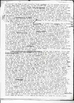
Harold received the instructions on his three maps from a close acquaintance who died without having told him precisely who he got them from, though Wilkins knew that there was more than one person involved and that they lived on the southeast coast of England (presumably Kent or East Sussex).

Following pointers in the letters, I began searching for the group, and was eventually contacted by the son of one of the earlier holders of the file during the 1920s and 30s. This file contained ‘several’ sets of instructions and an outline of the island to which they applied. I was shown some of these ‘originals’ which proved to be the source of the instructions on both Wilkins’ and Palmers’ maps. However, the outline of the actual island involved looked little like those on these maps.

Thus, like it or not, the instructions on the five maps had a source that purports to be a collection of papers and parchments assembled in the last quarter of the 18th century concerning a deposit of considerable value concealed sometime previously on an unidentified island. The file also contains an appreciation of the file’s contents, dated in the 1820s, with additional information uncovered to that date.

Wilkins papers clearly show what he discovered from his further research and how this influenced his attempts to solve the instructions and locate the treasure.

It’s also important to note that the original papers contained nothing that would constitute a treasure map. Some of the instruction sets were accompanied by sketches which I was not allowed to see but which I believe made their way onto the Palmer maps - these being created by combining individual instruction sets from the file with an outline of the island to which the owners believed the instructions applied.

I fully understand that some here claiming to have a deep interest in the maps have no interest whatsoever in potential evidence concerning where they came from and what they mean, but hopefully someone in the future, with a real interest in all the events surrounding the maps, might think to follow this up.

However, do you really believe that you can completely ignore the results of Wilkins' further research into the maps, their origins and their meaning undertaken by him during the mid 1930s to the late 1950s? Wilkins had advantages that we don't have. He was there, talking to the people involved. He was hiding what he discovered because he wanted a shot at the treasure, and his outrageous observations were aimed at deceiving people and putting them off the scent - and he certainly managed to deceive you. You totally took the bait, falling for it hook, line and sinker.

You don't have enough of the background yet and, as a result, you're going way off target simply because you refuse to listen and claim outright to have all the answers. You clearly wish to do this on your own so, as I've said before, go ahead.
 
Since you've no idea exactly what's in Wilkins' personal files, this verges on nonsense. Wilkins continued to investigate the maps after 1935 and, as he obtained further information he very sensibly changed his mind. What he wrote and believed in 1935 was not what he believed by 1960.

Harold Wilkins and his brother Gordon maintained a regular correspondence from 1930 discussing many things, particularly the puzzle of the so-called Kidd maps (and, yes, they did see it as a puzzle). I hold a fair portion of the letters from each, enough to understand why they were perplexed, how they responded and what eventually transpired as a result, which included an attempt to solve the maps from what they had gleaned over the years.

The letters reveal how their thinking about the subject progressed and, as they reached out to more and more people, they began to accumulate evidence that caused them to change their minds about a number of facets of the mystery.

Harold received the instructions on his three maps from a close acquaintance who died without having told him precisely who he got them from, though Wilkins knew that there was more than one person involved and that they lived on the southeast coast of England (presumably Kent or East Sussex).

Following pointers in the letters, I began searching for the group, and was eventually contacted by the son of one of the earlier holders of the file during the 1920s and 30s. This file contained ‘several’ sets of instructions and an outline of the island to which they applied. I was shown some of these ‘originals’ which proved to be the source of the instructions on both Wilkins’ and Palmers’ maps. However, the outline of the actual island involved looked little like those on these maps.

Thus, like it or not, the instructions on the five maps had a source that purports to be a collection of papers and parchments assembled in the last quarter of the 18th century concerning a deposit of considerable value concealed sometime previously on an unidentified island. The file also contains an appreciation of the file’s contents, dated in the 1820s, with additional information uncovered to that date.

Wilkins papers clearly show what he discovered from his further research and how this influenced his attempts to solve the instructions and locate the treasure.

It’s also important to note that the original papers contained nothing that would constitute a treasure map.
Which details of that information can you remember?
Some of the instruction sets were accompanied by sketches which I was not allowed to see but which I believe made their way onto the Palmer maps - these being created by combining individual instruction sets from the file with an outline of the island to which the owners believed the instructions applied.

I fully understand that some here claiming to have a deep interest in the maps have no interest whatsoever in potential evidence concerning where they came from and what they mean, but hopefully someone in the future, with a real interest in all the events surrounding the maps, might think to follow this up.
I have always been open to anything providing that the claims are supported by evidence. I do hope we get more of it and that the facts don't get buried by secrecy. Also even disagreeing on Oak Island doesn't mean that there is no deep interest in solving the maps.
However, do you really believe that you can completely ignore the results of Wilkins' further research into the maps, their origins and their meaning undertaken by him during the mid 1930s to the late 1950s? Wilkins had advantages that we don't have. He was there, talking to the people involved. He was hiding what he discovered because he wanted a shot at the treasure, and his outrageous observations were aimed at deceiving people and putting them off the scent - and he certainly managed to deceive you. You totally took the bait, falling for it hook, line and sinker.

You don't have enough of the background yet and, as a result, you're going way off target simply because you refuse to listen and claim outright to have all the answers. You clearly wish to do this on your own so, as I've said before, go ahead.
Your claim that Wilkins invented his invention is interesting but still I like to see prove of that. Please provide us with the background we are genuinely interested in it.
 
Since you've no idea exactly what's in Wilkins' personal files, this verges on nonsense. Wilkins continued to investigate the maps after 1935 and, as he obtained further information he very sensibly changed his mind. What he wrote and believed in 1935 was not what he believed by 1960.

Harold Wilkins and his brother Gordon maintained a regular correspondence from 1930 discussing many things, particularly the puzzle of the so-called Kidd maps (and, yes, they did see it as a puzzle). I hold a fair portion of the letters from each, enough to understand why they were perplexed, how they responded and what eventually transpired as a result, which included an attempt to solve the maps from what they had gleaned over the years.

The letters reveal how their thinking about the subject progressed and, as they reached out to more and more people, they began to accumulate evidence that caused them to change their minds about a number of facets of the mystery.

Harold received the instructions on his three maps from a close acquaintance who died without having told him precisely who he got them from, though Wilkins knew that there was more than one person involved and that they lived on the southeast coast of England (presumably Kent or East Sussex).

Following pointers in the letters, I began searching for the group, and was eventually contacted by the son of one of the earlier holders of the file during the 1920s and 30s. This file contained ‘several’ sets of instructions and an outline of the island to which they applied. I was shown some of these ‘originals’ which proved to be the source of the instructions on both Wilkins’ and Palmers’ maps. However, the outline of the actual island involved looked little like those on these maps.

Thus, like it or not, the instructions on the five maps had a source that purports to be a collection of papers and parchments assembled in the last quarter of the 18th century concerning a deposit of considerable value concealed sometime previously on an unidentified island. The file also contains an appreciation of the file’s contents, dated in the 1820s, with additional information uncovered to that date.

Wilkins papers clearly show what he discovered from his further research and how this influenced his attempts to solve the instructions and locate the treasure.

It’s also important to note that the original papers contained nothing that would constitute a treasure map. Some of the instruction sets were accompanied by sketches which I was not allowed to see but which I believe made their way onto the Palmer maps - these being created by combining individual instruction sets from the file with an outline of the island to which the owners believed the instructions applied.

I fully understand that some here claiming to have a deep interest in the maps have no interest whatsoever in potential evidence concerning where they came from and what they mean, but hopefully someone in the future, with a real interest in all the events surrounding the maps, might think to follow this up.

However, do you really believe that you can completely ignore the results of Wilkins' further research into the maps, their origins and their meaning undertaken by him during the mid 1930s to the late 1950s? Wilkins had advantages that we don't have. He was there, talking to the people involved. He was hiding what he discovered because he wanted a shot at the treasure, and his outrageous observations were aimed at deceiving people and putting them off the scent - and he certainly managed to deceive you. You totally took the bait, falling for it hook, line and sinker.

You don't have enough of the background yet and, as a result, you're going way off target simply because you refuse to listen and claim outright to have all the answers. You clearly wish to do this on your own so, as I've said before, go ahead.
Murky waters and thick cloud over these 'informative' Wilkins letters and correspondence that nobody can see, so it's all speculation and guesswork. The mysterious 'group' referred to by GB and contacts of Wilkins in those early years, I believe, relate to the expeditions of Charles Howe (Pinaki), George Hamilton (The Treasure of the Tuamotus) and the earlier 'Herman' expedition with Captain Brown, all linked, and it would make sense that Wilkins was in touch with Hamilton/his group/and/or/ family. Wilkins does write about these treasure hunts. The DNA in all of them is Pinaki, and the lat and long of this atoll ends up coded on the Key chart. Just an observation, make of it what you wish, but you can't deny the facts. (I didn't create them!)
 
Since you've no idea exactly what's in Wilkins' personal files, this verges on nonsense. Wilkins continued to investigate the maps after 1935 and, as he obtained further information he very sensibly changed his mind. What he wrote and believed in 1935 was not what he believed by 1960.
I have never been interested in what Wilkins believed in the maps. Wilkins believed there was an extraterrestrial civilisation on the Moon, the Earth is hollow, South America was an Atlantean colony, in the literal existence of cryptids like Bigfoot, that he was a reincarnated pirate, and plenty of other absurdities. You really think he got close to solving the maps or was on the right track? As I explained before: Wilkins' books, articles, private letters, and personal files on the Kidd-Palmer maps are useful in putting together a timeline and to establish the provenance of the maps in the furniture pieces they were found inside (when Palmer acquired them, who sold them to him, etc). In that regard, he turned out to be much more reliable and accurate than Howlett (1958), but beyond that his writings on the maps have no value. For example, Wilkins erroneously believed in the fabricated provenance of the Pamela Hardy and Dan Morgan chests and that the Hardy Chest once belonged to a shipmate of Kidd; he never changed his mind on those fake pedigree notes that came with the chests (see for example his 1947 booklet). You are correct he changed his mind on some things about the Kidd-Palmer maps but in the process he went from making one implausible claim, to another; he first claimed the island depicted on the maps was in the Far-East (somewhere in China Sea) but changed his mind (post-1937) to Oak Island, and went from believing Captain Kidd never visited Oak Island, to believing Kidd or Avery did.

Harold Wilkins and his brother Gordon maintained a regular correspondence from 1930 discussing many things, particularly the puzzle of the so-called Kidd maps (and, yes, they did see it as a puzzle). I hold a fair portion of the letters from each, enough to understand why they were perplexed, how they responded and what eventually transpired as a result, which included an attempt to solve the maps from what they had gleaned over the years.

The letters reveal how their thinking about the subject progressed and, as they reached out to more and more people, they began to accumulate evidence that caused them to change their minds about a number of facets of the mystery.

Harold received the instructions on his three maps from a close acquaintance who died without having told him precisely who he got them from, though Wilkins knew that there was more than one person involved and that they lived on the southeast coast of England (presumably Kent or East Sussex).

Following pointers in the letters, I began searching for the group, and was eventually contacted by the son of one of the earlier holders of the file during the 1920s and 30s. This file contained ‘several’ sets of instructions and an outline of the island to which they applied. I was shown some of these ‘originals’ which proved to be the source of the instructions on both Wilkins’ and Palmers’ maps. However, the outline of the actual island involved looked little like those on these maps.

Thus, like it or not, the instructions on the five maps had a source that purports to be a collection of papers and parchments assembled in the last quarter of the 18th century concerning a deposit of considerable value concealed sometime previously on an unidentified island. The file also contains an appreciation of the file’s contents, dated in the 1820s, with additional information uncovered to that date.
I have read some of your other posts on this forum and a document where you said you met someone from this "mysterious group" in a hotel lobby and they showed you a secret file about the treasure but they refused to disclose their name. It reads like something out of an Dan Brown novel. Even if you were able to confirm this hotel lobby meeting took place, nothing the man allegedly showed you can be proved to be genuine (e.g., the file's contents "dated in the 1820s" could have been fabricated). Why has this man or group not published their findings? Why did the man want to remain anonymous? That said, since you did diligent research on Palmer's letters, I will take your word for it the meeting took place but there is no reason for me to take seriously anything you/the man claim about the file without evidence. I do not believe instructions on the Wilkins/Kidd-Palmer maps are related to an 18th century treasure; this is extremely improbable when you look at the provenance of the furniture pieces the Kidd-Palmer maps came with. We know that pedigree notes for the chests were fabricated (Pamela Hardy never existed and had a false address in Lushington Road, Eastbourne). Why would the hoaxer include real instructions to a pre-existing authentic treasure? The pedigree notes were undoubtably fabricated by the same hoaxer who drew the maps; it simply does not make sense to believe this hoaxer or forger left clues to an 18th century treasure. Furthermore, take into consideration Wilkins repeatedly admitted his instructions on the Mar Del map were imaginary; he did not only say this in his articles but in private during his conversation with Hedden. Are you saying there is unambiguously a letter where Wilkins states he copied the instructions on the Del Mar map instead from a "close acquaintance"?

Wilkins papers clearly show what he discovered from his further research and how this influenced his attempts to solve the instructions and locate the treasure.

It’s also important to note that the original papers contained nothing that would constitute a treasure map. Some of the instruction sets were accompanied by sketches which I was not allowed to see but which I believe made their way onto the Palmer maps - these being created by combining individual instruction sets from the file with an outline of the island to which the owners believed the instructions applied.

I fully understand that some here claiming to have a deep interest in the maps have no interest whatsoever in potential evidence concerning where they came from and what they mean, but hopefully someone in the future, with a real interest in all the events surrounding the maps, might think to follow this up.

However, do you really believe that you can completely ignore the results of Wilkins' further research into the maps, their origins and their meaning undertaken by him during the mid 1930s to the late 1950s? Wilkins had advantages that we don't have. He was there, talking to the people involved. He was hiding what he discovered because he wanted a shot at the treasure, and his outrageous observations were aimed at deceiving people and putting them off the scent - and he certainly managed to deceive you. You totally took the bait, falling for it hook, line and sinker.

You don't have enough of the background yet and, as a result, you're going way off target simply because you refuse to listen and claim outright to have all the answers. You clearly wish to do this on your own so, as I've said before, go ahead.
I never claimed to have 'all the answers' but I do maintain you/CapnGeorge/Randawg are wrong about the maps -

1. Randawg preposterously believes Captain Kidd or his shipmates drew the so-called Kidd-Palmer maps (c. 1700) and that Kidd and/or his shipmates buried a treasure on an island and the maps were handed down many generations until they reached Palmer. His own thread ran for dozens of pages but he failed to provide a shred of evidence for his claims, while simultaneously rejecting a mountain of converging evidence that disprove his belief the maps are authentic which I can only describe as willful ignorance.

2. CapnGeorge used to believe in (1) but was less a 'true believer' than Randawg and changed his mind. He now recognises the reality the maps were not drawn or owned by Captain Kidd and were instead drawn in the early 20th century. However, he now believes that the hoaxer was Wilkins (1920s) who inserted instructions in his maps from an "Anson file" and these point to a buried treasure on the Pinaki atoll (French Polynesia). He provides no credible evidence and plays around with Lat./Long. figures on the Skeleton Map to match Pinaki atoll; Richard Knight arbitrarily messed around with the same figures to produce a different longitude and latitude in Hon Le Tron (Richard Knight's Treasure!: The True Story of His Extraordinary Quest For Captain Kidd's Cache, 1986). I have never wasted my time with this approach.

3. You recognise the reality the maps were drawn in the early 20th century but believe Wilkins and whoever drew the Kidd-Palmer maps included instructions in the maps they copied from earlier documents that point to a buried treasure in the 18th century and you believe this was on Oak Island. You also believe these instructions were part of a set of five, or more. Like George, you have not presented credible evidence for any of this. You also appear to have Oak Island 'tunnel vision' e.g., John S’s Rough Map you claim was inspired by/based on Oak Island, was most likely inspired by/based on Wild Cat Island from Swallows and Amazons (1930).

I think the main problem is that neither of you three want to accept the possibility the solution or answer to the maps is much less complex than what you are saying (or rather daydreaming). The real answer to the maps is not going to sensationally involve faraway islands, pirates, or treasure buried centuries ago. Your and CapnGeorge's far-fetched ideas remind me of the National Treasure films, with cypher mysteries, secret files, and so on. It is good entertainment but it should not be confused with reality.

Like the solution to John S’s Rough Map being a fictional island in early 20th century literature (Wild Cat Island), the hints and references in the fake pedigrees of the Hardy and Morgan Chests point to Treasure Island (Stevenson), Hardy's street address (= Alice in Wonderland, Carrol) while the main 'ingredients' to the Kidd-Palmer maps are likely to also be found in fictional literature of the late 19th/early 20th century. After searching, I believe I may have found something of interest. A rear-admiral in ~1929 wrote a novel about a mystery chest "on the shore of an English coast town". It would be interesting to see if this book contains a treasure map but copies are difficult to obtain.

1771371290213.webp
 
Last edited:
I have never been interested in what Wilkins believed in the maps. Wilkins believed there was an extraterrestrial civilisation on the Moon, the Earth is hollow, South America was an Atlantean colony, in the literal existence of cryptids like Bigfoot, that he was a reincarnated pirate, and plenty of other absurdities. You really think he got close to solving the maps or was on the right track? As I explained before: Wilkins' books, articles, private letters, and personal files on the Kidd-Palmer maps are useful in putting together a timeline and to establish the provenance of the maps in the furniture pieces they were found inside (when Palmer acquired them, who sold them to him, etc). In that regard, he turned out to be much more reliable and accurate than Howlett (1958), but beyond that his writings on the maps have no value. For example, Wilkins erroneously believed in the fabricated provenance of the Pamela Hardy and Dan Morgan chests and that the Hardy Chest once belonged to a shipmate of Kidd; he never changed his mind on those fake pedigree notes that came with the chests (see for example his 1947 booklet). You are correct he changed his mind on some things about the Kidd-Palmer maps but in the process he went from making one implausible claim, to another; he first claimed the island depicted on the maps was in the Far-East (somewhere in China Sea) but changed his mind (post-1937) to Oak Island, and went from believing Captain Kidd never visited Oak Island, to believing Kidd or Avery did.


I have read some of your other posts on this forum and a document where you said you met someone from this "mysterious group" in a hotel lobby and they showed you a secret file about the treasure but they refused to disclose their name. It reads like something out of an Dan Brown novel. Even if you were able to confirm this hotel lobby meeting took place, nothing the man allegedly showed you can be proved to be genuine (e.g., the file's contents "dated in the 1820s" could have been fabricated). Why has this man or group not published their findings? Why did the man want to remain anonymous? That said, since you did diligent research on Palmer's letters, I will take your word for it the meeting took place but there is no reason for me to take seriously anything you/the man claim about the file without evidence. I do not believe instructions on the Wilkins/Kidd-Palmer maps are related to an 18th century treasure; this is extremely improbable when you look at the provenance of the furniture pieces the Kidd-Palmer maps came with. We know that pedigree notes for the chests were fabricated (Pamela Hardy never existed and had a false address in Lushington Road, Eastbourne). Why would the hoaxer include real instructions to a pre-existing authentic treasure? The pedigree notes were undoubtably fabricated by the same hoaxer who drew the maps; it simply does not make sense to believe this hoaxer or forger left clues to an 18th century treasure. Furthermore, take into consideration Wilkins repeatedly admitted his instructions on the Mar Del map were imaginary; he did not only say this in his articles but in private during his conversation with Hedden. Are you saying there is unambiguously a letter where Wilkins states he copied the instructions on the Del Mar map instead from a "close acquaintance"?


I never claimed to have 'all the answers' but I do maintain you/CapnGeorge/Randawg are wrong about the maps -

1. Randawg preposterously believes Captain Kidd or his shipmates drew the so-called Kidd-Palmer maps (c. 1700) and that Kidd and/or his shipmates buried a treasure on an island and the maps were handed down many generations until they reached Palmer. His own thread ran for dozens of pages but he failed to provide a shred of evidence for his claims, while simultaneously rejecting a mountain of converging evidence that disprove his belief the maps are authentic which I can only describe as willful ignorance.

2. CapnGeorge used to believe in (1) but was less a 'true believer' than Randawg and changed his mind. He now recognises the reality the maps were not drawn or owned by Captain Kidd and were instead drawn in the early 20th century. However, he now believes that the hoaxer was Wilkins (1920s) who inserted instructions in his maps from an "Anson file" and these point to a buried treasure on the Pinaki atoll (French Polynesia). He provides no credible evidence and plays around with Lat./Long. figures on the Skeleton Map to match Pinaki atoll; Richard Knight arbitrarily messed around with the same figures to produce a different longitude and latitude in Hon Le Tron (Richard Knight's Treasure!: The True Story of His Extraordinary Quest For Captain Kidd's Cache, 1986). I have never wasted my time with this approach.

3. You recognise the reality the maps were drawn in the early 20th century but believe Wilkins and whoever drew the Kidd-Palmer maps included instructions in the maps they copied from earlier documents that point to a buried treasure in the 18th century and you believe this was on Oak Island. You also believe these instructions were part of a set of five, or more. Like George, you have not presented credible evidence for any of this. You also appear to have Oak Island 'tunnel vision' e.g., John S’s Rough Map you claim was inspired by/based on Oak Island, was most likely inspired by/based on Wild Cat Island from Swallows and Amazons (1930).

I think the main problem is that neither of you three want to accept the possibility the solution or answer to the maps is much less complex than what you are saying (or rather daydreaming). The real answer to the maps is not going to sensationally involve faraway islands, pirates, or treasure buried centuries ago. Your and CapnGeorge's far-fetched ideas remind me of the National Treasure films, with cypher mysteries, secret files, and so on. It is good entertainment but it should not be confused with reality.

Like the solution to John S’s Rough Map being a fictional island in early 20th century literature (Wild Cat Island), the hints and references in the fake pedigrees of the Hardy and Morgan Chests point to Treasure Island (Stevenson), Hardy's street address (= Alice in Wonderland, Carrol) while the main 'ingredients' to the Kidd-Palmer maps are likely to also be found in fictional literature of the late 19th/early 20th century. After searching, I believe I may have found something of interest. A rear-admiral in ~1929 wrote a novel about a mystery chest "on the shore of an English coast town". It would be interesting to see if this book contains a treasure map but copies are difficult to obtain.

View attachment 2244711
Amen.

Wilkins was a con artist in the same ilk as amendsen and muir.
 
Amen.

Wilkins was a con artist in the same ilk as amendsen and muir.
I tend to think they get cognitive biases in their own deluded egocentrism without ever realizing it. Wilkins rode the wave that people were interested in as Treasure stories faded; he moved on.

There was a growth of fictional pulp novels in 2Oth century, present in tabloid newspapers as real treasure stories. Today, tabloid newspapers have been replaced by YouTube. Whats real whats fake. What is fact, what is fiction? The line once again becomes blurred.

Crow
 
Amen.

Wilkins was a con artist in the same ilk as amendsen and muir.
Cryptid, part quote.....provides no credible evidence and plays around with Lat and Long figures......Far-fetched ideas' Unquote.
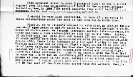
Ideas based on fact! And the evidence: I posed the question earlier: where do you think the figures 9.16 and 31.30 come from on the Key chart? Strange that no one could come up with an answer. No one wants to admit that, of course, when you apply Wilkins simple Key code of one, you get the coordinates of Pinaki when applying the Cadiz meridian. We are, of course, dealing with a Spanish treasure, not Kidd's. The longitude relative to London (not Greenwich) is now 138. Easy so far?? More evidence that is not credible? Read on; the Anson/Webb letters.....Latitude thirty degrees eight minutes...Anson obviously meant to recognise 38, Webb was confirming he went to 138. The Figure 19 appears in the same letter. The Scorpious star clue; when you can read a star chart, the figures 112 and 26 come out, adding to; 138! Well, fancy that! And his rubbish Mar del maps, he made the false 'direction' figures different to draw your attention to them (what's your reason? You claim to have all the answers). First lines on both maps are 69, adding up to 138! Well I never, can't believe it! The figure 19 also appears to confirm. (what's your explanation if you don't agree? I can see your mind working overtime to try and find a way of rubbishing everything so far!). and Wilkins 1940 article, what I call the 'Fat Eel Map'. How do you explain the drawing of a ship blowing up? You can't can you. I can. Read Webb's letters, he describes how he had to blow his ship up. Proving Wilkins knew all about it. The Spanish derrotero? If you know what that is. Geometric construction, i appreciate not everyone can work it out. When you can, 131.30 appears twice to confirm Pinaki and landing place. I didn't create or draw this, so you are going to have a hard time rubbishing this one! Wilkins story relating to Nova Scotia and the totally 'out of place' and obscure reference to the characters 'EIE KIDD 1670'. Wilkins puts his clues all over the place, this is another one, and alphanumeric, ignoring the '0' (nothing), 19 and 139 appear, 139 is the longitude centre of the Pinaki group. Charles Howe spent years on Pinaki at 138 and 19. Why this particular atoll, and not any one of the hundreds of others? The Spanish code signs were here, (another confirmation) but he couldn't understand them. And finally, completing the circle, the monument at Lord Anson's home, having deciphered the code on it, why do you think it decodes out to 138 and 19? What else is that code going to decode out to? So are you going to say that all the above is coincidence and rubbish? I didn't make any of the figures up. They are there, staring you in the face. You should open your eyes and look at the bigger picture and recognise that whilst Wilkins could tell a good story, he knew how to pull the wool over your eyes. He fooled you and everybody else. I will also point out that all the arguments about Wilkins and Palmer's letters etc, play no part whatsoever in the above, proving what I have said all along, to get to the centre of what these charts are all about, and to solve the 'treasure' puzzle, you just need the numbers!
 
I tend to think they get cognitive biases in their own deluded egocentrism without ever realizing it. Wilkins rode the wave that people were interested in as Treasure stories faded; he moved on.

There was a growth of fictional pulp novels in 2Oth century, present in tabloid newspapers as real treasure stories. Today, tabloid newspapers have been replaced by YouTube. Whats real whats fake. What is fact, what is fiction? The line once again becomes blurred.

Crow
I notice this is a common theme in many treasure stories/legends. I prefer to hunt down local legends and stories to try and see if they are in fact real or not. Not an easy task, but if there is a shred of truth it might be what you need to get started.

These letters seem false and were proved to be false.
 

Users who are viewing this thread

Back
Top Bottom