
You are using an out of date browser. It may not display this or other websites correctly.
You should upgrade or use an alternative browser.
You should upgrade or use an alternative browser.
The Treasure of Captain William Kidd.
- Thread starter Randawg72
- Start date
CapnGeorge
Full Member
Cadiz meridian is WEST of Greenwich, you ADD to the coded chart long to give location relative to LONDON Give your glasses a clean. 138 appears as the decoded answer (many times) because, for his expedition, Anson required the location relative to London (Now Greenwich).Continuing this from the https://www.treasurenet.com/threads...kidd-palmer-treasure-maps.712534/post-7363409 off-topic post:
'Lat. dmd.' is a common term on charts which means that the Latitude (and Longitude) is encoded as "degree, minute, decimal" - there are other form of encodings like 'dms.' see: https://www.maptools.com/tutorials/lat_lon/formats
I am supprised of you claiming:
this is a standard term on older charts and Wilkins just copied it without the actual coordinates of the island he took as sample. Same thing with 'Mar del' which could have been "Mar del Sur" etc. in his sample chart.
no secret here - unless you want to make thinks more complicated as they are already
Btw.
> you have to subtract not add the six degrees if you take Cadiz as reference!
And 'DMD'? Why would he put LAT DMD here? it's absolutely meaningless and unnecessary, there are no lat and long figures to be seen anywhere, useless information in this case don't you agree? It was there to be recognised only by those in the know, that he was aware of the Anson link via the cipher on his monument. The hoax islands? you don't need over thirty. Only two fit the bill, JFI (or Robinson Crusoe Island) anyone who cannot see that the charts are based on this island needs to go back to their colouring board. B Keiser believes the treasure is here. Why don't you challenge him? When you know how to decode the figures, you don't have to spend time trolling around the world looking for one that might fit. It is Hai Ling Chou (I may have incorrectly mentioned Hon Le Tron earlier, thought I was Richard Knight!). The location decodes exactly here, shape and orientation also conforms to the charts. In other words 'Solve the clues first!' Anyone can waste time looking through an atlas, And it's in the China Sea, another deploy, this is where the perpetrator is sending you. Wilkins is having fun sending you all on a wild goose chase. The person who says he knows where the island is and is planning a trip, - join the queue, many prior to you have done/said the same. Look at Paul Hawkins as a prime example, he had all the answers, he was off, spent a lot of money, armed with a crew and bucket and spade. Where's the treasure?? He wouldn't listen to common sense either. Wilkins knew all about the Spanish Captain General who buried his galleon's' treasure on a lone atoll. He also knew he could never get to it - middle of the South Pacific, WW2 looming. Then and now, to get to it requires expensive, extensive planning, expensive detectors, expensive flights and boat charter, And! only if you can get permission to go there! Wilkins sows the seeds and clues in nearly all his books, they jump out at you when you know what you are looking for.

Any idea what happened to Mr. Hawkins? I linked to an archive of his website (it went offline around 2017).Look at Paul Hawkins as a prime example, he had all the answers, he was off, spent a lot of money, armed with a crew and bucket and spade. Where's the treasure??
On his website, Hawkins said:
Who really has egg on their face? He never found the treasure, was clueless about the maps, and ended up deleting his website.I have visited the island site and can verify the maps and content to be absolutely genuine. There will be many people left with egg on their face when I publish my full account in the near future.

Last edited:
He also knew he could never get to it - middle of the South Pacific, WW2 looming. Then and now, to get to it requires expensive, extensive planning, expensive detectors, expensive flights and boat charter, And! only if you can get permission to go there!
Wilkins died in 1960, fifteen years after WW2 ended; so your "WW2 looming" excuse does not make sense. It also makes little to no sense why Wilkins would provide any clues in his books to the treasure for other treasure hunters to find if he was searching for it himself.

Only two fit the bill, JFI (or Robinson Crusoe Island) anyone who cannot see that the charts are based on this island needs to go back to their colouring board.
More nonsense.
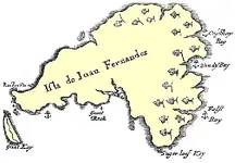
 Most old maps of Robinson Crusoe Island do not closely resemble the map shape on the Kidd-Palmer maps (including the Skeleton Map), even if you rotate or turn them upside down by distortion. I noticed you cherry-picked one map to show a fairly strong resemblance, however, arbitrarily you can identify many different islands worldwide by doing the same thing. It is a rather pointless exercise.
What evidence is there the maker of the so-called Kidd Palmer maps had access to this fairly obscure Spanish Survey in 1795?
Compare the above to different old maps you completely ignored showing quite different shapes:
Basil Ringrose's map of Juan Fernandez Island (1685) [cannot find the original drawing].
Attachments
Last edited:

Bocaj
Sr. Member
- Joined
- Dec 4, 2024
- Messages
- 424
- Reaction score
- 269
- Golden Thread
- 0
- Detector(s) used
- Left and right side of the brain
Sorry but you are clearly wrong here:Cadiz meridian is WEST of Greenwich, you ADD to the coded chart long to give location relative to LONDON Give your glasses a clean. 138 appears as the decoded answer (many times) because, for his expedition, Anson required the location relative to London (Now Greenwich).
If you take Cadiz as prime meridian (which lies 6.3W of Greenwich) then Greenwich would be at 6.3E in an old Spanish map right? To translate this coordinate to modern you would subtract 6.3 to get 0E (6.3E - 6.3 = 0E) again right?
Same thing with the 131.3E - 6.3 = 125E.
(Not an opinion but basic math!)
I do not know about the other decoding but clearly the Key Map has nothing to do with them.
Yes I do agree - only he didn't put it there in the first place as it was already written on his sample chart! Including the coordinates but he cut those out so dmd. (not DMD) was a leftover. Same with "Mar Del" which is meaningless too and the same kind of leftover.And 'DMD'? Why would he put LAT DMD here? it's absolutely meaningless and unnecessary, there are no lat and long figures to be seen anywhere, useless information in this case don't you agree?
He was either to lazy to cut it out or he thought it looks more authentic - who knows. To make my point clearer I colored green the parts he probably added to an old chart of a similar island he found. I colored red those parts he removed as they would of course not fit the Kidd island!
the coordinates and 'Sur' are of course only a sample of what could have been written in the removed parts.
Do not copy this or otherwise it will trigger another century of new treasure hunting fantasy coordinates!
I probably would if he was here. In any case I know of many islands that fit better the orientation, shape and details (even the coordinates in some cases) then Robinson Crusoe Island but everyone has different preferences - especially what details they choose to ignore (or "decode" the way that fits them).It was there to be recognised only by those in the know, that he was aware of the Anson link via the cipher on his monument. The hoax islands? you don't need over thirty. Only two fit the bill, JFI (or Robinson Crusoe Island) anyone who cannot see that the charts are based on this island needs to go back to their colouring board. B Keiser believes the treasure is here. Why don't you challenge him?
This is true for everyone - including you (and me)! Until we find it, mine and everyone else's guess is as good (or bad) as yours. Its speculation - which is a fine thing but its just that.When you know how to decode the figures, you don't have to spend time trolling around the world looking for one that might fit. It is Hai Ling Chou (I may have incorrectly mentioned Hon Le Tron earlier, thought I was Richard Knight!). The location decodes exactly here, shape and orientation also conforms to the charts. In other words 'Solve the clues first!' Anyone can waste time looking through an atlas, And it's in the China Sea, another deploy, this is where the perpetrator is sending you. Wilkins is having fun sending you all on a wild goose chase. The person who says he knows where the island is and is planning a trip, - join the queue, many prior to you have done/said the same. Look at Paul Hawkins as a prime example, he had all the answers, he was off, spent a lot of money, armed with a crew and bucket and spade. Where's the treasure?
Well I found it very hard to get people researching new ideas if they have already made up their mind. Are you different?He wouldn't listen to common sense either.
P.S. I found your Pinaki Atoll and its SW not NE as in the Key Map. For this you calculation of the offset is "correct" but of course you took the liberty of exchanging E for W and N for S. This and taking the further liberty of using Cadiz as prime meridian for an island that in all probability had never been charted by the Spanish but by either the French or the English. And of course changing 9N to 19S because of your 'dmd.' interpretation that comes from a completely different chart! If you continue this path you probably prove that your treasure is buried below St Peters in Rome!
Last edited:
To his credit, CapnGeorge changed his mind concerning the authenticity of the maps. In his 1996 book (p. 221), he took the view:Well I found it very hard to get people researching new ideas if they have already made up their mind. Are you different?
However, in the late 2000s or early 2010s he did a 180 to accept the reality the maps are a 20th century hoax. This appears to have upset or at least annoyed Paul Hawkins by 2014, a dogmatic believer in the charts authenticity. Hawkins then criticised CapnGeorge on his website for changing his mind. Hawkins arrogantly dismissed what scholars such as Peter Barber had to say about the maps, and then delusionally claimed he was right while everyone else wrong, that he had deciphered the maps, further, he had identified the island, and was going on an expedition (of course, he never found any treasure). A few quotes from his (now deleted) website:'Are they [the Kidd-Palmer maps] really genuine'? I am often asked. I have to answer that as far as my researches and continuing investigation will allow me - yes they are. I am 99% convinced; it is the remaining 1% that bothers me.
🤦♂️If only he realised how his pomposity, arrogance and blind belief in his new stupid scenario will shortly come back to haunt him when I publish the FULL solution. This will not be long coming, as I now have permission to conduct a full survey and excavation of the island I discovered from deciphering the maps.
🤦♂️When I complete and publish my work, Edmunds, who continues to adopt a caustic, competitive reaction to my work, and his partner will be ridiculed by every other serious researcher!!
🤦♂️I have visited the island site and can verify the maps and content to be absolutely genuine. There will be many people left with egg on their face when I publish my full account in the near future.
Last edited:
Bocaj
Sr. Member
- Joined
- Dec 4, 2024
- Messages
- 424
- Reaction score
- 269
- Golden Thread
- 0
- Detector(s) used
- Left and right side of the brain
Yes he accepted them as a hoax only to come up with some unbelievable story that could compete with Alice in Wonderland but unfortunately he didn't intent to write fiction.To his credit, CapnGeorge changed his mind concerning the authenticity of the maps. In his 1996 book (p. 221), he took the view:
However, in the late 2000s or early 2010s he did a 180 to accept the reality the maps are a 20th century hoax. This appears to have upset or at least annoyed Paul Hawkins by 2014, a dogmatic believer in the charts authenticity. Hawkins then criticised CapnGeorge on his website for changing his mind. Hawkins arrogantly dismissed what scholars such as Peter Barber had to say about the maps, and then delusionally claimed he was right while everyone else wrong, that he had deciphered the maps, further, he had identified the island, and was going on an expedition (of course, he never found any treasure). A few quotes from his (now deleted) website:
If Hawkins did dismiss his acceptance of the hoax idea than for the new far fetched idea he presented in his new book. Honestly looking deeper into Edmunds ideas makes my head spin. I miss any form of a critical or analytical approach. Calling it free association would flatter the work!
I still have to see facts and every time I ask for prove of his claims I get the door slammed into my face! He is a Guru that need to be revered and believed in!
I appreciate your work even I disagree on you conclusion that the Palmer maps are a proven hoax. But you do put the facts and proves on the table and it does help enormously to get this riddle solved. I just wish everyone here would take that approach.
Anyway I would really like to find out what happened to Hawkins. The conclusions that he failed with is expedition is not proven maybe he had health problems?
I agree and I think a reviewer of his book summed it up best:Yes he accepted them as a hoax only to come up with some unbelievable story that could compete with Alice in Wonderland but unfortunately he didn't intent to write fiction.
If Hawkins did dismiss his acceptance of the hoax idea than for the new far fetched idea he presented in his new book. Honestly looking deeper into Edmunds ideas makes my head spin. I miss any form of a critical or analytical approach. Calling it free association would flatter the work!
....the author has started with the answer and bent the evidence to match this already decided solution. This is the absolute opposite of the scientific principle and clearly is indefensible as a method of arguing a position.
It will be noted CapnGeorge never responded to my comments refuting his claim Wilkins drew the maps. This is impossible based on the timeline since Wilkins did not know of the maps until May 1932. By then, Palmer had already acquired two or three of the maps (but not yet the Skeleton Map). Wilkins certainly had no knowledge of the maps until Palmer invited him to inspect the Hardy Chest at his home in Eastbourne. Palmer first wrote to Wilkins (not vice-versa) since he was familiar with him as an author on buried treasure (Wilkins published Hunting Hidden Treasures in 1929 and prior to 1932 had written numerous articles about pirates and treasure hunting in Popular Mechanics). Wilkins, in contrast, had no idea who Palmer was until Palmer contacted him by letter. This further explains why Wilkins did not mention Palmer in Hunting Hidden Treasures. Wilkins first mentioned Palmer in an article published in 1933 (The Passing Show) and in the book Modern Buried Treasure Hunters (1934), although only on a single page.
I am working on new lines of investigation and will post an update in the near future.I still have to see facts and every time I ask for prove of his claims I get the door slammed into my face! He is a Guru that need to be revered and believed in!
I appreciate your work even I disagree on you conclusion that the Palmer maps are a proven hoax. But you do put the facts and proves on the table and it does help enormously to get this riddle solved. I just wish everyone here would take that approach.
Anyway I would really like to find out what happened to Hawkins. The conclusions that he failed with is expedition is not proven maybe he had health problems?

CapnGeorge's claim the hoaxer and drawer of the maps was Harold T. Wilkins is easily disproven by Wilkins' writings.
"In that year [1932], I was invited by a gentlemen - a complete stranger to me to me to look at an old sea chest and a few charts on ancient yellowing and mottled vellum." (Wilkins, 1936)
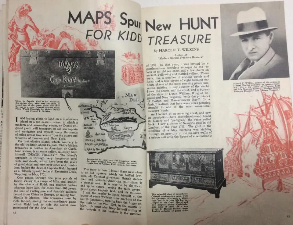
"In that year [1932], I was invited by a gentlemen - a complete stranger to me to me to look at an old sea chest and a few charts on ancient yellowing and mottled vellum." (Wilkins, 1936)
Last edited:
Bocaj
Sr. Member
- Joined
- Dec 4, 2024
- Messages
- 424
- Reaction score
- 269
- Golden Thread
- 0
- Detector(s) used
- Left and right side of the brain
To play the devils advocate: One could argue that he wasn't completely honest in what he wrote. He in theory could have created those charts, sold them to Cutler and then he just waited until they resurface. His "Mar Del" charts are very different of Palmer's but he could have done this to clearly evade any form of suspicion that he himself created a hoax.CapnGeorge's claim the hoaxer and drawer of the maps was Harold T. Wilkins is easily disproven by Wilkins' writings.
"In that year [1932], I was invited by a gentlemen - a complete stranger to me to me to look at an old sea chest and a few charts on ancient yellowing and mottled vellum." (Wilkins, 1936)
View attachment 2225180
Far fetched maybe but not impossible.
He also mentioned both the Manila - Mexico and China - Europe trade routes. The only place those trade routes intersect are the Philippines (the coordinates point to them as well) - which means he must have located his island close to them! I always wondered were he planed his expedition to go to...
Last edited:
Update
Some good and bad news.
I have confirmed the National Maritime Museum collections has a letter from Arthur Hill-Cutler dated 1933 (it accompanies the items: TXT0309.1 and TXT0309.2). I now have a photo (or digitised scan) of this letter after I contacted the NMM collections department. It cannot be uploaded publicly because of copyright but I can presumably quote its contents under fair dealing:
The disappearance of the Hardy letter adds to the mystery to the Kidd-Palmer maps, could it be someone has taken the letter deliberately to try to conceal the hoax? Or was it accidentally misplaced or lost? The Hardy letter is very important because it should be compared with Arthur Hill-Cutler's and Hubert Palmer's handwriting to determine the hoaxer. Thanks to Gjb we have examples of Palmer's handwriting and I now have access to a letter written by Cutler. It is unfortunate I could not so far compare them.
Some good and bad news.
I have confirmed the National Maritime Museum collections has a letter from Arthur Hill-Cutler dated 1933 (it accompanies the items: TXT0309.1 and TXT0309.2). I now have a photo (or digitised scan) of this letter after I contacted the NMM collections department. It cannot be uploaded publicly because of copyright but I can presumably quote its contents under fair dealing:
Now for the bad news. The NMM collections has (or had?) a receipt from Cutler and a signed letter by Pamela Hardy for another Lord Nelson item of dubious provenance; I know this because I found this mentioned in a 2005 book published by Rina Prentice (see The Authentic Nelson, page 87), who formerly worked at the NMM as the Curator of Antiquities (she is currently retired but a curator emeritus), who had access to the receipt and Hardy letter and quoted a line from it in her book. Her book is strongly copyrighted with a copyright disclaimer at the front page and I do not think I can even quote from it without her permission, although limited pages are quoted on Google Books (see my comment here). You would have to buy her book for the information and quotation. I bought a copy for only £6. Anyway, I contacted NMM collections to read the receipt and letter but it has vanished. The NMM can no longer find it. Rina Prentice certainly had read the letter and receipt in 2005 when doing research for the publication of her book but it has gone missing since then. Prentice was the first person to mention the Hardy letter publicly, so this could have prompted someone to gain access and steal it. Alternatively, it may have been misplaced or moved outside of the collections department, perhaps to the museum library (the NMM collections are considered separate to the NMM Library and Archive). I asked someone to check but they could not find anything. However, the records manager is now investigating what happened concerning the disappearance.A. Hill Cutler (Ye Oak Room: Antiques, Curios, Bric-a-Brac, Prints, Engravings, etc.)
January 17th 1933
Dear Mr Elliott,
The beaded covers were purchased by me from Miss Pamela Hardy's collection of Nelson & other relics which were handed down
to her from her father.
Yours faithfully,
A. Hill-Cutler
The disappearance of the Hardy letter adds to the mystery to the Kidd-Palmer maps, could it be someone has taken the letter deliberately to try to conceal the hoax? Or was it accidentally misplaced or lost? The Hardy letter is very important because it should be compared with Arthur Hill-Cutler's and Hubert Palmer's handwriting to determine the hoaxer. Thanks to Gjb we have examples of Palmer's handwriting and I now have access to a letter written by Cutler. It is unfortunate I could not so far compare them.
Last edited:
Bocaj
Sr. Member
- Joined
- Dec 4, 2024
- Messages
- 424
- Reaction score
- 269
- Golden Thread
- 0
- Detector(s) used
- Left and right side of the brain
Starting to compare Cutler's handwriting to the maps would be a good first step. Of course Pamela Hardy's handwriting would be even better as she most certainly was involved in most if not all fakes surrounding Nelson and I guess Kidd too!Update
Some good and bad news.
I have confirmed the National Maritime Museum collections has a letter from Arthur Hill-Cutler dated 1933 (it accompanies the items: TXT0309.1 and TXT0309.2). I now have a photo (or digitised scan) of this letter after I contacted the NMM collections department. It cannot be uploaded publicly because of copyright but I can presumably quote its contents under fair dealing:
Now for the bad news. The NMM collections has (or had?) a receipt from Cutler and a signed letter by Pamela Hardy for another Lord Nelson item of dubious provenance; I know this because I found this mentioned in a 2005 book published by Rina Prentice (see The Authentic Nelson, page 87), who formerly worked at the NMM as the Curator of Antiquities (she is currently retired but a curator emeritus), who had access to the receipt and Hardy letter and quoted a line from it in her book. Her book is strongly copyrighted with a copyright disclaimer at the front page and I do not think I can even quote from it without her permission, although limited pages are quoted on Google Books (see my comment here). You would have to buy her book for the information and quotation. I bought a copy for only £6. Anyway, I contacted NMM collections to read the receipt and letter but it has vanished. The NMM can no longer find it. Rina Prentice certainly had read the letter and receipt in 2005 when doing research for the publication of her book but it has gone missing since then. Prentice was the first person to mention the Hardy letter publicly, so this could have prompted someone to gain access and steal it. Alternatively, it may have been misplaced or moved outside of the collections department, perhaps to the museum library (the NMM collections are considered separate to the NMM Library and Archive). I asked someone to check but they could not find anything. However, the records manager is now investigating what happened concerning the disappearance.
The disappearance of the Hardy letter adds to the mystery to the Kidd-Palmer maps, could it be someone has taken the letter deliberately to try to conceal the hoax? Or was it accidentally misplaced or lost? The Hardy letter is very important because it should be compared with Arthur Hill-Cutler's and Hubert Palmer's handwriting to determine the hoaxer. Thanks to Gjb we have examples of Palmer's handwriting and I now have access to a letter written by Cutler. It is unfortunate I could not so far compare them.
Bocaj
Sr. Member
- Joined
- Dec 4, 2024
- Messages
- 424
- Reaction score
- 269
- Golden Thread
- 0
- Detector(s) used
- Left and right side of the brain
To prove that the map on the photo is the same we use (coral island map) I improved the map part of the photo and overlay-ed the coral island map to show that all details are the same:
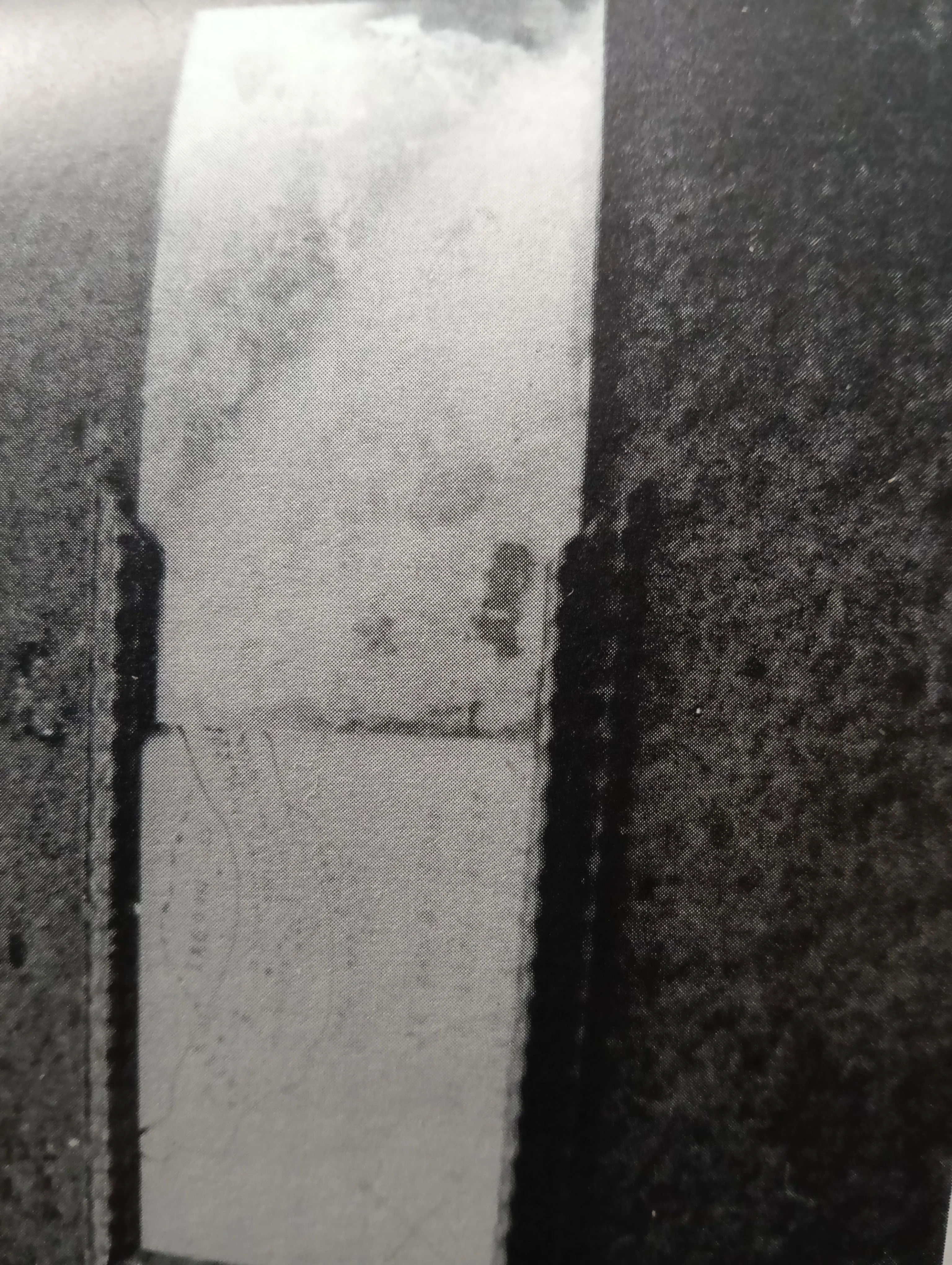
original photo
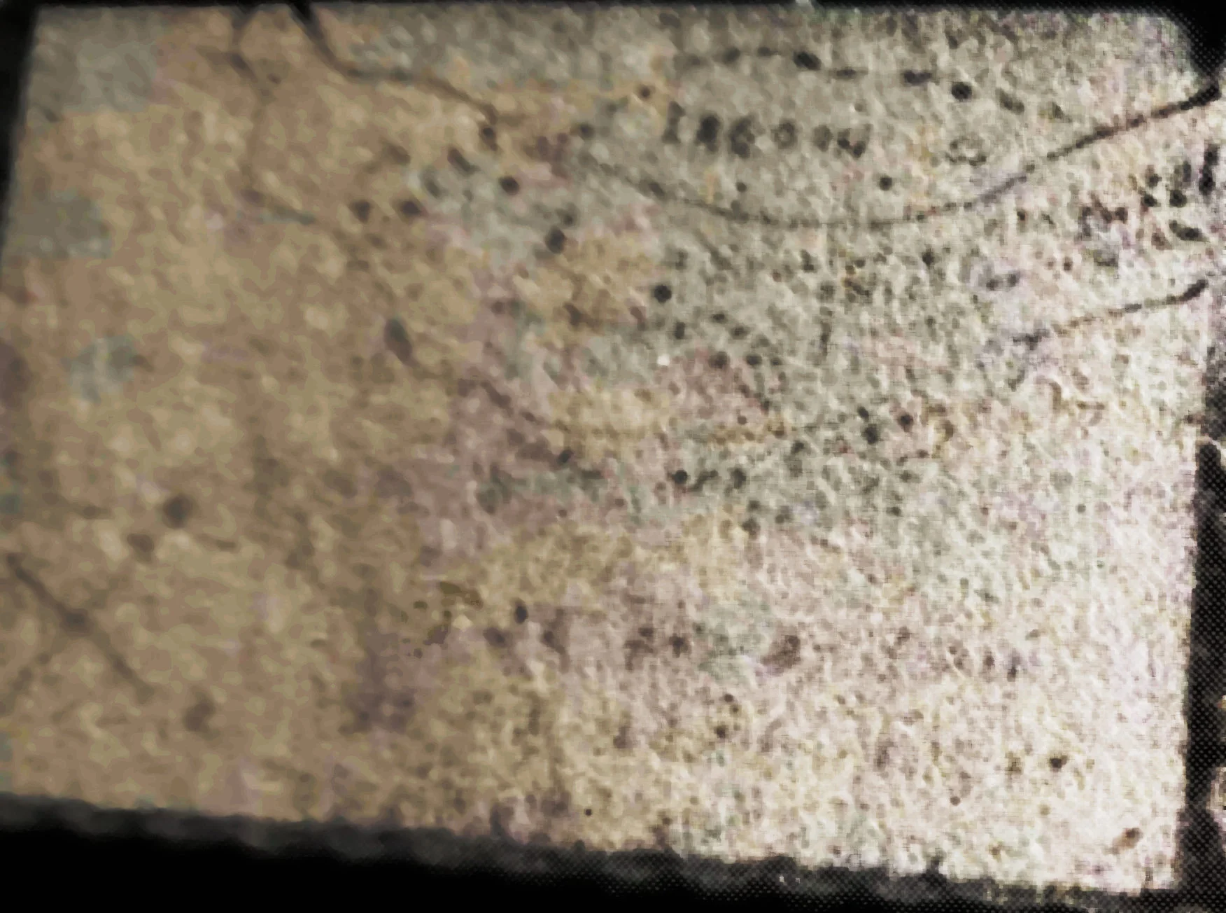
improved map by applying filters to the image
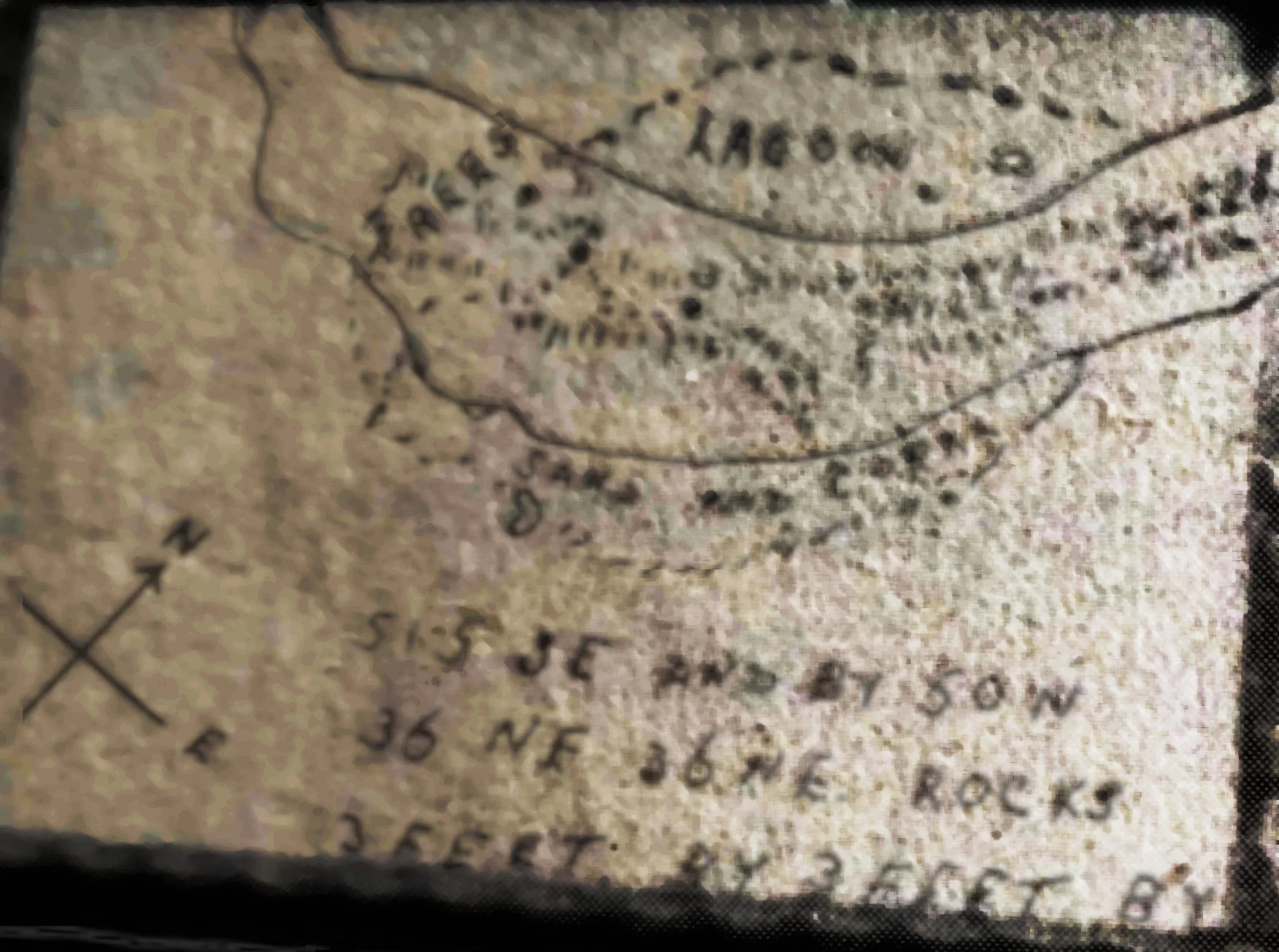
the above with an overlay of the coral island map
Well I don't know when and by whom this photo was done and if the map and the mirror are really the right combination...
original photo
improved map by applying filters to the image
the above with an overlay of the coral island map
Well I don't know when and by whom this photo was done and if the map and the mirror are really the right combination...
Last edited:

Randawg72
Sr. Member
- Joined
- Nov 18, 2024
- Messages
- 399
- Reaction score
- 434
- Golden Thread
- 0
- Detector(s) used
- ACME Bottlecap 6000
- #774
Thread Owner
Maps aside, do you believe Kidd really hid a larger stash than at Gardiner's?
We know for a fact that Captain Kidd buried some of his treasure on Gardiner's Island. (Est. value £10,000 to £20,000 pounds). That event was well documented by Gardiner, Bellomont and Kidd himself.
But what about the second treasure that Kidd claimed he secreted that had "the value of one hundred thousand pounds"? Captain Kidd took only one "Treasure ship" in his career, The Quedagh Merchant. But in a sworn statement, Kidd said that none of the Gardiner's stash was taken from the Quedagh.
Transcript:
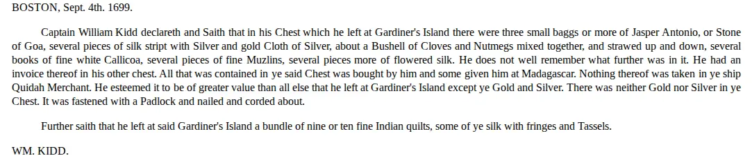
So, if none of the Quedagh's treasure was part of the Gardiner's Island stash, or otherwise accounted for, then where is it? Some say that Kidd made up the story to try to save himself from the noose. But we know the Quedagh carried a substantial treasure, and we know that Kidd sold some of her cargo for additional gold and silver. So logically, this treasure had to actually exist. But did it just disappear? Sure it could have already been found centuries ago, but what if it hasn't?
We know for a fact that Captain Kidd buried some of his treasure on Gardiner's Island. (Est. value £10,000 to £20,000 pounds). That event was well documented by Gardiner, Bellomont and Kidd himself.
But what about the second treasure that Kidd claimed he secreted that had "the value of one hundred thousand pounds"? Captain Kidd took only one "Treasure ship" in his career, The Quedagh Merchant. But in a sworn statement, Kidd said that none of the Gardiner's stash was taken from the Quedagh.
Transcript:
So, if none of the Quedagh's treasure was part of the Gardiner's Island stash, or otherwise accounted for, then where is it? Some say that Kidd made up the story to try to save himself from the noose. But we know the Quedagh carried a substantial treasure, and we know that Kidd sold some of her cargo for additional gold and silver. So logically, this treasure had to actually exist. But did it just disappear? Sure it could have already been found centuries ago, but what if it hasn't?
Bocaj
Sr. Member
- Joined
- Dec 4, 2024
- Messages
- 424
- Reaction score
- 269
- Golden Thread
- 0
- Detector(s) used
- Left and right side of the brain
I think 10-20k is a bit high, if I remember correctly it was auctioned and about 6k went into building a new hospital.Maps aside, do you believe Kidd really hid a larger stash than at Gardiner's?
We know for a fact that Captain Kidd buried some of his treasure on Gardiner's Island. (Est. value £10,000 to £20,000 pounds). That event was well documented by Gardiner, Bellomont and Kidd himself.
maybe it was converted from the goods of the QM so technically it wasn't from the QM and who could prove otherwise?But what about the second treasure that Kidd claimed he secreted that had "the value of one hundred thousand pounds"? Captain Kidd took only one "Treasure ship" in his career, The Quedagh Merchant. But in a sworn statement, Kidd said that none of the Gardiner's stash was taken from the Quedagh.
What about the crew, I guess they took quite a bit...But we know the Quedagh carried a substantial treasure, and we know that Kidd sold some of her cargo for additional gold and silver. So logically, this treasure had to actually exist. But did it just disappear? Sure it could have already been found centuries ago, but what if it hasn't?
Randawg72
Sr. Member
- Joined
- Nov 18, 2024
- Messages
- 399
- Reaction score
- 434
- Golden Thread
- 0
- Detector(s) used
- ACME Bottlecap 6000
- #776
Thread Owner
Several online sources estimate it was worth $30,000 but nobody really knows for sure do they? Kidd's estate valued at £6,472 was forfeited to the Crown. But there is no mention of what became of the Gardiner's Island stash after the trial.I think 10-20k is a bit high
Kidd was truthful about taking the Quedagh and assaulting his gunner. I doubt he would have perjured himself by swearing to something that was seen as insignificant at the time.who could prove otherwise?
What about the crew,
The trial transcript mentions that only some of Kidd's men were paid their share. Regardless, there could have easily been £100,000 pounds worth of treasure remaining.
Kidd never drew a map for the treasure he buried on Gardiners Island and 'pirate treasure maps' are a literary trope and fiction which first appeared in the 19th century and were popularised by Robert Louis Stevenson; meaning the so-called Kidd-Palmer maps are completely irrelevant to Kidd's buried treasure. There are no known or verified authentic treasure maps* by pirates that date to the 17th-18th centuries. If Captain Kidd drew a treasure map, why was he the only pirate (or privateer) from the 17th century to do so?
*A few years ago, I thought I came across a single exception. However, I did some research and I now doubt the map is genuine. A photograph of the map appears in the 21 July, 1952 issue of Life Magazine and in one of Edward Rowe Snow's books. Snow claimed to have purchased the map and believed it was drawn by the pirate Edward Low.
*A few years ago, I thought I came across a single exception. However, I did some research and I now doubt the map is genuine. A photograph of the map appears in the 21 July, 1952 issue of Life Magazine and in one of Edward Rowe Snow's books. Snow claimed to have purchased the map and believed it was drawn by the pirate Edward Low.
Bocaj
Sr. Member
- Joined
- Dec 4, 2024
- Messages
- 424
- Reaction score
- 269
- Golden Thread
- 0
- Detector(s) used
- Left and right side of the brain
Kidd never really was a pirate and everything surrounding his capture of the QM and trial was a bit of an exception from the rule! So the argument that because no pirate at the time is known to have drawn a treasure map is quite weak. In any case it is true that mostly treasure is just buried with some marker and maybe a description but no maps. Maybe there was first a description and the maps were drawn by some third person joining all the known facts. Could be his family. Sarah - was the name of both his daughter and his wife! Or even much later.Kidd never drew a map for the treasure he buried on Gardiners Island and 'pirate treasure maps' are a literary trope and fiction which first appeared in the 19th century and were popularised by Robert Louis Stevenson; meaning the so-called Kidd-Palmer maps are completely irrelevant to Kidd's buried treasure. There are no known or verified authentic treasure maps* by pirates that date to the 17th-18th centuries. If Captain Kidd drew a treasure map, why was he the only pirate (or privateer) from the 17th century to do so?
*A few years ago, I thought I came across a single exception. However, I did some research and I now doubt the map is genuine. A photograph of the map appears in the 21 July, 1952 issue of Life Magazine and in one of Edward Rowe Snow's books. Snow claimed to have purchased the map and believed it was drawn by the pirate Edward Low.
The maps themself never claim to be authentically drawn by himself (one says:" by me Sarah ~W"). There never was any signature on them - only initials. The only direct association with him are the furniture they were found in but as we have seen here they it is very questionable that they belonged to him or his relatives.
All that doesn't invalidate the maps. Nothing is proven either way!

THE TRUE SEEKER
Jr. Member
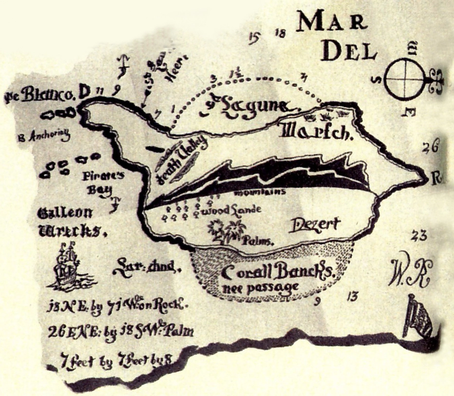
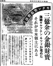
In February 1937, a letter arrived at Japan's Ministry of Foreign Affairs in Tokyo. The sender was a private detective living in Connecticut, USA, who claimed that Captain Kidd's treasure—valued at 100 million dollars—was hidden on one of the islands in Japan's Nansei Islands. He urged the Japanese government to conduct a search, with the intention of receiving a fair share if the treasure was actually discovered.
The private detective enclosed with the letter a copy of the map (the Wilkins Map) that writer Harold T. Wilkins had submitted to Modern Mechanix magazine in 1936. The Ministry of Foreign Affairs ignored the matter. However, when Ministry officials casually mentioned the letter from the private detective in conversation with newspaper reporters, the journalists eagerly latched onto the story.
As the tale spread among the public, the island where Kidd had hidden the treasure was identified as Takarajima in Tokara Islands. Ever since, to this day, treasure hunts have continued on Takarajima, carried out by people dreaming of unearthing Kidd's fortune.
The private detective enclosed with the letter a copy of the map (the Wilkins Map) that writer Harold T. Wilkins had submitted to Modern Mechanix magazine in 1936. The Ministry of Foreign Affairs ignored the matter. However, when Ministry officials casually mentioned the letter from the private detective in conversation with newspaper reporters, the journalists eagerly latched onto the story.
As the tale spread among the public, the island where Kidd had hidden the treasure was identified as Takarajima in Tokara Islands. Ever since, to this day, treasure hunts have continued on Takarajima, carried out by people dreaming of unearthing Kidd's fortune.
Randawg72
Sr. Member
- Joined
- Nov 18, 2024
- Messages
- 399
- Reaction score
- 434
- Golden Thread
- 0
- Detector(s) used
- ACME Bottlecap 6000
- #780
Thread Owner
Interesting story True Seeker.
However we know that Kidd didn't travel that far east,
and that the Wilkins' maps are fictitious.
Thank you for posting it.
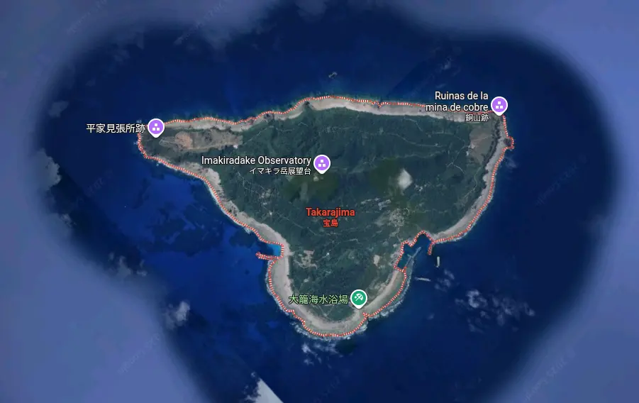
The inverted view does look familiar..
However we know that Kidd didn't travel that far east,
and that the Wilkins' maps are fictitious.
Thank you for posting it.
The inverted view does look familiar..



Featured Treasure Finds
Featured Treasure Finds
Similar threads

- Replies
- 29
- Views
- 4K
- Replies
- 218
- Views
- 20K

Users who are viewing this thread
Total: 4 (members: 0, guests: 4)














