What's new

The Captain Kidd Treasure Maps and Oak Island

I'm not showing you anything; do your own search. Anson ensured his expedition was secret. Do you know what SECRET means? It means there is no reference to anyone or anything. By the way, were you not going to have authoritative words with Lord Litchfield? What did he have to say? Also, why not have a word with Bernard Keiser, who has spent millions on his search for treasure on Juan Fernandez Island. Ask him about the Webb letters, and tell us what he says. While you are at it, have a word with the family on JFI that holds the letters, and tell us what they say! You are so quick to cast aspersions. Let's see how quick you are at getting those letters off!
The only positive evidence that Wilkins drew the maps would be his own confession or somebody looking over his shoulder whilst he drew them. You obviously have not seen his 'Postcard sketch' where he clearly states - 'but not as on my chart'. I suppose you are going to tell everyone now it wasn't his postcard! And anyway, anyone with any sense knows Wilkins created the charts based on the Spanish map of JFI. You are so clever, so tell us who created them and where is the island? Answers on a postcard, please. If you get stuck, have a look at 'Anson's Gold', it's all there 😇 Nobody is interested in your boring waffle about letters. The only thing that matters is the numbers on the Key chart. No amount of letters can change those figures, which clearly, by so many clues, all decode out to 138 and 19, all clear in black and white, you can't change it, and did I mention 'I didn't make any of it up!' All Wilkins work, based on the original Anson/Spanish information, he was a clever devil. Nothing you can say or waffle on about can change it.
You misinterpreted what Wilkins wrote on the postcard:

"Confidential.
The Pamela Hardy Chart of Cap. Kidd.
Yellow Parchment.
This is one of four charts identical in shape but not in detail and topography.
Legend at base (but not as on my chart)."

This was not an admission by Wilkins that he drew the map in the Hardy Chest. Rather, he was saying the legend at the bottom of the map ("base") from the Hardy Chest was not the same as on the map he drew - the Mar Del map (chart). You do not present any credible evidence in your book Wilkins drew the Kidd-Palmer maps. These maps have nothing whatsoever to do with Juan Fernandez Island. Your book fails to even get basic information about Wilkins correct. For example, you incorrectly state (on page 536) he died in 1962, when he died in 1960.

1784228146220.webp

The only thing that matters is the numbers on the Key chart.
As I already explained and was the first to demonstrate (see here and here), the latitude on the Skeleton Map was copied from Louis Tracy's (1903) Rainbow Island map and/or tin can map - 9.16 N - is identical on these maps - while the longitude is similar. Nothing to do with JFI, Lord Anson, a "secret expedition", Rennes-le-Château, the Shugborough inscription, or whatever other nonsense you are claiming.
You are so clever, so tell us who created them and where is the island? Answers on a postcard, please.
There is no real island. The Kidd-Palmer maps were based on a fictional island (Rainbow Island). I have put together a lot of evidence to identify the hoaxer but I am not posting more of my research/findings here until I get a peer-reviewed article published. If I named the hoaxer this would result in another incident of my research being copied without getting any credit. I am not going to put myself in that position again. I should point out there is already an indication of something similar going on concerning the question of who was involved in the hoax. Last year, I repeatedly explained to you that Arthur Hill-Cutler was a plausible suspect or at least was involved in the hoax (this is something, at the time, you dismissed and you actually said I should "bury my head" in letters of Cutler...); my comment (12 September):
You never did in-depth research on the provenance of the maps (who owned and sold them, the sequence of when Hubert Palmer acquired them, the general timeline, etc [e.g., you incorrectly stated the bureau was first acquired by Palmer when the Hardy Chest was and there are many more errors in your books]), nor did you do much, if any, research on Hubert Palmer and Arthur Hill-Cutler. You are not going to get close to knowing who the hoaxer was (it was not Wilkins) or solving the maps if you do not look extensively into the lives of Cutler/Palmer.
Your reply (13 September 2025):
Not interested, my job was to solve the charts.... Go and bury your head in letters/docs of Palmer/Cutler/Skelton and Aunty Mary etc. if that's your thing. Who cares? it doesn't alter what's on the hoax charts!
It is clear that last year your position was you were not interested in Cutler, stated he was irrelevant and even denied to me you thought he had any involvement in the hoax (only Wilkins). Fast forward to 9 January 2026, and you wrote (doing a 180-degrees turn):

Who do you think secreted these hoax maps into the furniture? It was Wilkins in collaboration with Hill Cutler, the dealer ideally positioned to do so
Your view presumably changed in response to reading the huge amount of evidence I posted between late September and December 2025 that showed Cutler was almost certainly the individual who planted the maps inside the furniture pieces (anyone can search my comments where I detailed this evidence especially in November 2025). Your 2016 book does not argue Cutler had any involvement in the hoax and last year you never held this view when we debated. Why the recent change in viewpoint (only after I posted a huge amount of evidence)?

Update: having re-read Anson's Gold, there are examples of you erroneously claiming to have discovered, solved, or come up with a new groundbreaking theory and proclaiming you were the first but when I checked other sources - it turns out you have been blatantly copying (or adopting) other people's hypotheses, ideas, concepts, or proposed solutions without giving them credit/recognition out of courtesy.

TURTLES
In Anson's Gold on pages 228-229, you claim you first found that TURTLES on the Skeleton Map means you have to turn the map upside down. You go on to describe this as a "revelation", claim it was "completely overlooked" by everyone before you. Everyone you claim had "missed" it and you boast you first worked it out... The problem is, years, even decades before your book, multiple individuals had suggested exactly what you were saying about TURTLES. Lost Treasures of the World by Michael Groushko [1993], page 20, for example notes: "The writing around the border [Skeleton Map] is assumed to contain instructions on how to locate the treasure, while the cryptic reference to '20 turtles' may be a clue that the map is in fact upside down."

1784247262253.webp


The idea TURTLES has a hidden meaning that you have to invert the Skeleton Map you evidently never first came up with, and it had been suggested in multiple books on treasure in the 1990s and 2000s before your book (Groushko is just one example). Further, the same idea that TURTLES on the Skeleton Map meant a map inversion had been discussed online blogs and message-boards referencing Groushko before your book. I came across these dated 2012. Did you really not expect readers to check? Yet you falsely claim in your book everyone else missed it and somehow it is a "revelation"; you go as far as to say "all other researchers, treasure hunters and students of Kidd's charts" missed it. This is demonstrably untrue and I have little doubt you copied the TURTLES invert map theory from Groushko (who repeated it in several of his books on treasure in the 1990s). All that said, this theory is incorrect. There is no valid reason to turn upside down the Skeleton Island map and the most obvious meaning of TURTLES is simply because it was copied (albeit rephrased) from the RI map (TURTLE BEACH).

Juan Fernandez Island
On the same pages (228-229) you state you were the first to recognise the resemblance of a map of Juan Fernandez Island to the Kidd-Palmer maps and boast of finding this before any other researcher or treasure hunter who all "missed" it. However, three years before your book was published, Geoff Bath [2013] published Maps, Mystery and Interpretation (Bath published the same book in 1998 under a different title). Bath discusses the Kidd-Palmer maps in relation to old maps of Juan Fernandez Island (aka Robinson Crusoe Island) and he did this years before you. There are far more differences than similarities between these maps and JFI has nothing to do with the Kidd-Palmer maps (we now know this in light of the Rainbow Island map). Nevertheless, it seems that Geoff Bath was the first person to try to link JFI to the Kidd-Palmer maps (as well as Mar Del map) but you do not give him credit for the theory nor referenced his [1998] 2013 book as a source.

Concerning Wilkins' Mar Del map, below is a page from Bath's Maps, Mystery and Interpretation [2013] (page 126):

1784287404104.webp


The following is a page from Anson's Gold [2016] (page 218):

1784287487967.webp


It is pretty clear, you (George Edmunds) copied what Bath earlier wrote but did not name him as the source. Bath claimed "Wilkins drew inspiration from the charts of Juan Fernandez" while you repeated this claim rephrasing it: "Wilkins got a lot of inspiration from [Juan Fernandez] for some of his maps". The same image of the JFI map even appears at the top of the page in both books. Care to explain?

I have a dozen more examples, but it would take too much time to list them.
 
Last edited:
I searched through lloyds list of ships 1760 -1761

There were only three vessels by the name of Unicorn. One was a British warship built in 1748 and was broken up in 1771. Its history is well known.

Screenshot 2026-07-17 102609.webp


There were two cargo vessels. One sailed from Liverpool to Baltimore. Another vessel, Unicorn, was wrecked on the Barking Shelf on a voyage from London to Philadelphia. Captain Dun. Berking shelf a well-known sandbank and navigation hazard located in the River Thames in East London.

Screenshot 2026-07-16 212708.webp


There is another vessel arrived in Kent from Greenland, Captain Clark.

Screenshot 2026-07-17 102148.webp


In lloyds list of ships 1760 -1761 there are 37 references to the unicorn. None sailing from or to South America. No, Captain Webb was connected to any of the vessels called Unicorn.

Through birth, death, and marriages in the UK, Europe, or the United States, there is no record of Cornelius Patrick Webb.

The Royal Society has no records of any such mission or expedition. So a lot of faith has been put in an alleged letter with poor provenance. Anson has private records that are also available. There is no record or any mention of any expedition, nor any connection to a vessel called Unicorn or any alleged captain by the name of Cornelius Patrick Webb.

Crow
 
Last edited:
Through birth, death, and marriages in the UK, Europe, or the United States, there is no record of Cornelius Patrick Webb.
Thanks, very useful information. If Webb existed, there would be a birth or death record somewhere or at least a document that mentioned him if he was the captain of a ship and had a naval background. I also did some searches and could not find anything. He is clearly fictional.
 
What's better than a map being deciphered without the cartographer stating it required such?
Hi releventchair, Both Captain Kidd and John Ware drew several maps probably for different reason, to relieve boredom, over excitement, or simply to just to deceive and confuse the frustrated person who is reading it, it still works.
I will try again to lead you in the right direction yet I feel I am wasting my time. (Insult deleted).
The China Sea map has about 90% of false miss leading information on it so you can dismiss all the things like, China Sea, Smuggers Cove, turtles, palm trees, and compass bearings they are are - false.

Fortunately the overconfident writer could not resist putting some genuine information on it. This secret and vital clue is contained with the compass set in the lower left corner and the legend written around the edge on the map. Let me reiterate that from this I have deciphered enough information that will lead to the recovery of the Treasure of Oak Island. Now all you guys if I can do it so can you but only if your shelve your own theories and if you take of your blinkers.
The China Sea Map.
All I will say to researchers with open minds (insult deleted) is this, the last word drawn around the edge of the China Sea is not Lib it is £16 mean an estimate of sixteen millions in contained down in the Repository. (see CAD) Any reference to a tree or stumps are useless now because they are obvious long gone, I have no idea what the word widely assumed to be skeleton is but it's certainly not that.

The Deadman Island map.
This map was drawn, dated, and signed by Captain William Kidd in 1699 when he had just successfully transported the great treasure to the repository on Oak Island. The proof of this completely relies on his hand writing on it, and this can only be determined by genuine professional hand writing expert.

Oak Island Sage
 
Last edited by a moderator:
For those interested, the following are a few sources that mention the dubious Webb letter(s):

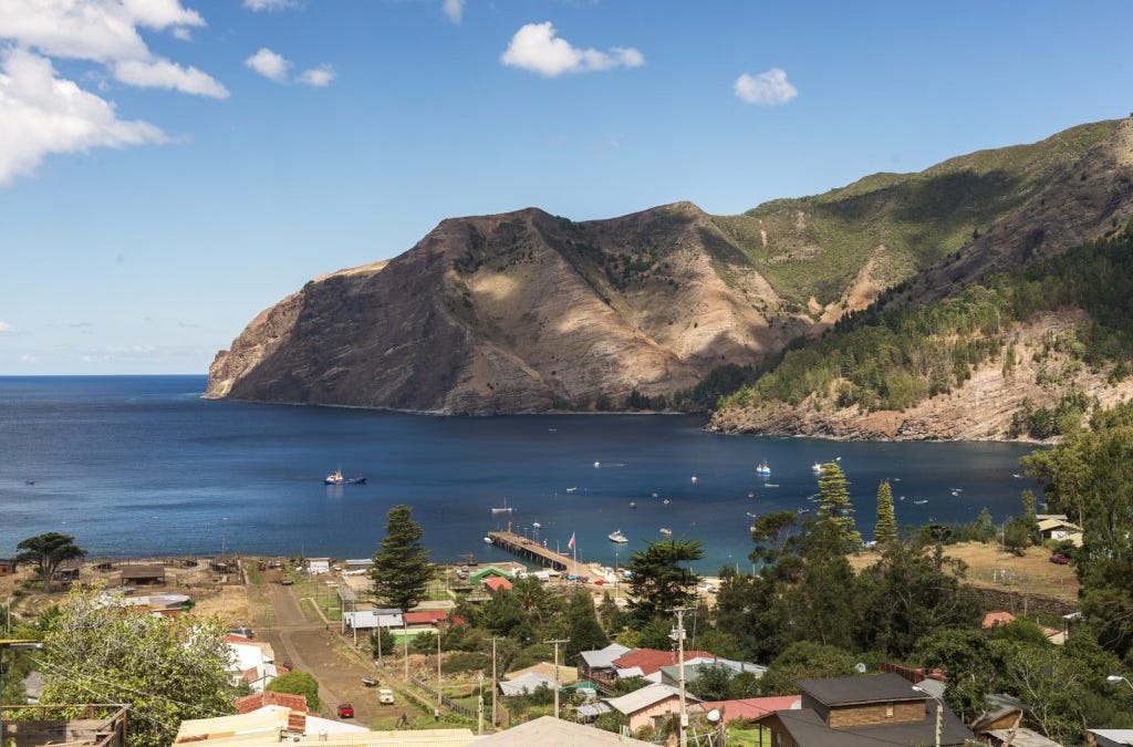
According to historical record, Ubilla accumulated the hoard – said to be worth $10bn – on his travels along South America’s Pacific coast in the early 18th century. He buried it in the remote Juan Fernández Islands when his ship was intercepted by the British navy admiral Lord Anson in 1714. The haul is rumoured to contain original gold statues from Peru – including a necklace belonging to the wife of the last Inca emperor, Atahualpa – as well as 800 barrels of gold and silver coins. A crew sent to recover the treasure in 1761 under the command of the British navigator Cornelius Webb found the hoard and loaded it aboard their ship. However, a mast split in bad weather as they were leaving the island and Webb was forced to turn back and rebury the hoard. Webb then drew two treasure maps and wrote out coded instructions, one of which he sent back to England [to George Anson]. Keiser acquired the second copy in 1998 from the family of the Chilean politician Luis Cousiño.

Webb wrote two letters to Lord Anson, describing that he found the Ubilla treasure—including 864 bags of gold, 200 bars of gold, 21 barrels of precious stones and jewelry, and 160 chests of gold and silver coins—and that he reburied it. The second letter included the code words “yellow stone” and “Dschubba” (ancient name of a star in the Scorpio constellation). But Anson died before receiving them, and Webb died the following year.

The Ubilla story—and treasure, if there is any—sat dormant until 1950, when the letters came into the hands of Luis Cousiño, at that time the richest man in Chile. Cousiño decided to hunt for the treasure himself. He anchored his yacht in the island harbor, and excavated a portion of the hillside at San Juan Bautiste, the only village. Finding nothing, Cousiño gave up. The letters were passed down to his ex-daughter-in-law, Maria Beéche, who still lives on the island today.

Decades later, Beéche was interviewed for the buried treasure documentary. Keiser met with Beéche, and she shared her letters in exchange for a percentage of any treasure. He spent the next two years securing excavation permits from the Chilean government, and started digging in 1999. He’s coy about costs, but some say he’s spent millions of his own money.
Legend has it that Spanish navigator Juan Esteban Ubilla Echeverria stashed a fortune on the island in 1715. British sailor Cornelius Webb is said to have found the treasure and taken it to another area of the island to be reburied.

The Webb letter(s) hoax are linked to another hoax - "Arturito" in 2005. A company called Wagner Technologies claimed they had located the buried treasure by Ubillia* on Robinson Crusoe Island. The company claimed they used a ground-penetrating radar robot (Arturito) to find the location of the treasure deep underground. However, the company refused to provide proof of the discovery. Scientists have since concluded the robot was a sham - its technology was incapable of distinguishing between metals and standard rock at such depths.
*There is no historical evidence Ubilla buried a treasure on Robinson Crusoe Island.
 
Last edited:
People have had difficulty making sense of Anson's Gold but here is my summary of its claims:

1. Ubilla in the early 18th century buried a treasure on Juan Fernandez (Robinson Crusoe) Island near Chile but it was dug up and relocated by Cornelius Patrick Webb in the late 18th century to Pinaki Atoll (French Polynesia) a distance of approximately 3,745 miles.
2. Webb's expedition to relocate the buried treasure was secretly commissioned by George Anson.
3. Webb wrote one or two letters to Anson about the treasure and its relocation to Pinaki. One of these letters was written in Latin and includes clues to the Pinaki location by geographical coordinates. These letters went missing until they were acquired by Luis Cousiño in 1950 (but were not mentioned in a publication until the 1990s). In 1998, one of these letters was shown to Bernard Keiser.
4. George Anson hid the coordinates to the treasure on Pinaki in a cryptogram on the Shepherd's Monument at Shugborough.
5. Somehow Harold T. Wilkins, learnt of the coordinates, not by deciphering the Shugborough inscription but coming across a secret "Anson file" at the British Museum that was lost or destroyed.
6. Wilkins then drew four maps (the Kidd-Palmer maps). These maps depict Juan Fernandez (Robinson Crusoe) Island where the treasure was originally buried but Wilkins included clues and the Pinaki geographical coordinates on the Skeleton Map (where the treasure was moved to). Wilkins did not dig up the treasure or launch an expedition because of the outbreak of WW2.
7. The Skeleton Map has to be turned upside down based on the clue TURTLES and this matches old maps of Juan Fernandez Island.
8. Somehow two other islands are related to the Kidd Palmer maps, and Wilkins provided clues to them in the maps, including a real island in the south China Sea. This island may have been used as a stopping point during Webb's 3,745 mile journey to Pinaki Atoll.

Suffice to say, there is not a shred of evidence for (1)-(8) and some of these preposterous claims have been disproven by the Rainbow Island map: for example (7) is demonstrably false since TURTLES on the Skeleton Map was copied (albeit rephrased) from the RI map [TURTLE BEACH]. It has nothing whatsoever to do with Juan Fernandez Island (JFI) or arbitrarily inverting/distorting maps; (6) is disproven since the hoaxer who drew the Kidd-Palmer maps did not base the maps on JFI but Rainbow Island. So Edmunds has been proven wrong about these maps. Furthermore, (8) has been disproven. Edmunds erroneously was looking for a real island in the southern China Sea (he was always on a false trail), when in reality, the hoaxer had based the maps on a fictional island from a novel set in the south China Sea (Rainbow Island).
 
Last edited:
All I will say to researchers with open minds that are not empty headed and self opinionated like Cyptid1990 is this, the last word drawn around the edge of the China Sea is not Lib it is £16 mean an estimate of sixteen millions in contained down in the Repository. (see CAD) Any reference to a tree or stumps are useless now because they are obvious long gone, I have no idea what the word widely assumed to be skeleton is but it's certainly not that.
For clarification, I never said the last word reads "lib". What I actually said (post #33):

1784316217825.webp

"E skeleton [or stele] of [illegible]."

I said the last word is illegible. However, I think it is very unlikely this word is £16 (or sixteen million).
 
Last edited:
The China Sea map has about 90% of false miss leading information on it so you can dismiss all the things like, China Sea, Smuggers Cove, turtles, palm trees, and compass bearings they are are - false.
Also the wrecks, lagoon, rocks, reef, the general shape of the island, and the latitude & longitude. The rectangular borders, however, are accurately depicted.
 
I have taken a look again at the conspiracy theorist website The Great Lost Treasure. This is one of the few sites to discuss the Webb letter(s). One thing I immediately noticed is Anson's Gold rephrases (in many places) a large amount of text from the website but the site is not referenced anywhere in the book. The website appeared online two or three years before Anson's Gold was published. (removed for rule violation link), "The person behind this website is Ron Justron". In the (Link removed for rule violation) of that webpage, it is noted that "Ron Justron (McKenzie) and Mike Neon" are the same person. This is significant because George Edmunds mentions the name Mike Neon ("MN") in his book. According to Edmunds, he fell out with Mike Neon aka Ron Justron after he accused MN of copying his "intellectual property but his new work was void of any recognition". However, MN denies this and has accused Mr. Edmunds of the exact same thing. In light of the evidence I have already presented, I think MN is more believable on this point. This seems to be a recurrent complaint against Mr. Edmunds by multiple individuals and Paul Hawkins independently made the same complaint about Edmunds in the 2000s. MN claims that Edmunds copied his proposed solution to the Shugborough inscription. That solution appeared 2-3 years earlier online on "The Great Lost Treasure" website before Edmunds published his book Anson's Gold (2016) repeating the same proposed solution from the website:

1784473806665.webp

The above is from Ron Justron's website that appeared in 2013-2014 (meaning 2-3 years before Edmunds' book).

Edmunds' book repeats Ron Justron's exact same proposed solution involving hidden geographical coordinates - 19 degrees latitude and 138 degrees longitude. The below are pages 518-519 from his book:

1784474330498.webp

How does Edmunds explain Ron Justron proposed the same solution ~3 years earlier than him? :icon_scratch: Edmunds now claims that he first proposed the above solution but this is contradicted by Justron's website (with the same proposed solution) years before Edmunds' book.
 
Last edited:
Cryptd, per our rules you can NOT post links to websites that have comments on treasure subjects found here. Please do not repeat.
 
How does Edmunds explain Ron Justron proposed the same solution ~3 years earlier than him? :icon_scratch: Edmunds now claims that he first proposed the above solution but this is contradicted by Justron's website (with the same proposed solution) years before Edmunds' book.
I contacted Ron Justron, who has now responded to me by email. Ron states he first told George Edmunds the latitude/longitude proposed solution to the Shugborough inscription:
I played around with a coding permutation I had encountered before and saw the result then was giving a lat and long that indicated Pinaki and told GE this.
Ron further states that he wrote the vast majority of a manuscript he passed to Edmunds. It was Edmunds who then copied Ron's writings and ideas, only adding one or two chapters of his own:
The first manuscript was all my writing that he was supposed to bash/edit into a form to present to a publisher when finished. I'd write a chapter and send it to him. He tried to write one or two in an effort to say he did something but the results were not acceptable. As said, due to his screwing around and not doing it I told him it was all off: any chance of ever being old time published was lost after the internet took off.
Ron states that he fell out with Edmunds because Edmunds did little to no research and was relying too much on him:
GE [George Edmunds] was supposed to take all the research [I gave him] and bang it into manuscript form. I was working on one or two outstanding issues yet to be solved. What happened though was that over the following years it was I who was doing all the writing, queries to publishers/TV producers & the like while the other party [GE] was doing all the vacationing, 'just not doing it this summer', too busy and not following up leads etc... I ended the project partnership with GE due to lack of progress and informed him I was just putting some info out as a website for those few interested in the subject. This was 2012-2014.
Ron then created his website at the end of 2012 and by 2013-2014 posted content on the site from his manuscript (he gave to Edmunds). This explains why Edmunds' (2016) book reads so similar (in some places verbatim copied text) to Ron's website.
I did the website in 2014 & you'll see he backdates things till then. To try and play catch up he hired a media promoter who tried to generate some media publicity and organise the release of 'his' discovery of the century at Shugborough Hall. Of course it all went down like a lead balloon: he was just another crank in a long line of crankshafts saying they had worked out the mystery of the Shepherds Monument.
In other words, very little in Edmunds book is apparently his own. He primarily rephrased and copied Ron's manuscript. Ron can also prove by emails that he was the first to give Edmunds the manuscript and he first told Edmunds the lat./long. hypothesis for the Shugborough inscription that Edmunds copied. Even though this hypothesis is wrong and far-fetched, he did not give credit to Ron in his book for it.
 
Last edited:
I contacted Ron Justron, who has now responded to me by email. Ron states he first told George Edmunds the latitude/longitude proposed solution to the Shugborough inscription:

Ron further states that he wrote the vast majority of a manuscript he passed to Edmunds. It was Edmunds who then copied Ron's writings and ideas, only adding one or two chapters of his own:

Ron states that he fell out with Edmunds because Edmunds did little to no research and was relying too much on him:

Ron then created his website at the end of 2012 and by 2013-2014 posted content on the site from his manuscript (he gave to Edmunds). This explains why Edmunds' book reads so similar (in some places verbatim copied text) to Ron's website.

In other words, very little in Edmunds book is apparently his own. He rephrased and copied Ron's manuscript. Ron can also prove by emails that he was the first to give Edmunds the manuscript and he first told Edmunds the lat/long hypothesis for the Shugborough inscription that Edmunds copied. Even though this hypothesis is wrong and far-fetched, he did not give credit to Ron in his book for it.
Thanks for bringing clarity into this issue, I was also confused why those two are basically writing the same. For everything I have experienced so far it seems to me the statement R. Justron gave you is credible. Still before a final judgement on that issue we will have to wait what George has to say.
 
Also the wrecks, lagoon, rocks, reef, the general shape of the island, and the latitude & longitude. The rectangular borders, however, are accurately depicted.
Hi Carl-NC, the China Sea map showing the island was drawn upside down, and it depicted Oak Island. The compass in the left corner was also drawn upside down so what was shown as pointing North was in fact pointing South. Practically everything else that you mentioned were deliberately fabricated items. There are a few real clues but I'm sure you will have no trouble finding them.

Oak Island Sage
 
When nothing but the borders of the map are accurately depicted, one could claim the map represents just about any island in the world, with fabricated alibis trotted out in support. It doesn't just strain credulity, it gives it a hernia.

Good to see you back, tho.
 
Thanks for bringing clarity into this issue, I was also confused why those two are basically writing the same. For everything I have experienced so far it seems to me the statement R. Justron gave you is credible. Still before a final judgement on that issue we will have to wait what George has to say.
Having communicated with Ron by email and reread his website, him and Edmunds' book both state (contradictorily) they first worked out the hidden meaning of TURTLES on the Skeleton Map to mean invert the map, as well as turn upside down the map of Juan Fernandez Island. As you pointed out, they are both "writing the same". Edmunds copied Ron, but in turn Ron copied a bunch of sources he does not reference. Like Edmunds, Ron fails to credit the people whose ideas/proposed solutions he copied or repeated on his website, for example:

1784999695468.webp


Here like Edmunds, Ron is trying to take credit for this proposed solution ("it was all never solved before") of turning the map upside down based on the word TURTLES. Of course, both Ron and Edmunds are wrong about this. The hoaxer copied (albeit rephrased) TURTLES from the Rainbow Island map (TURTLE BEACH) as I showed in my thread. There is no need to arbitrarily turn upside down the map nor do the Kidd-Palmer maps have anything to do with Juan Fernandez Island. That issue aside, this was never Edmunds or Ron's theory or proposed solution to begin with. It had been mentioned by posters on message-boards before Ron's website (who were widely referencing Groushko) and was first suggested in Lost Treasures of the World by Michael Groushko [1993], page 20:
The writing around the border [Skeleton Map] is assumed to contain instructions on how to locate the treasure, while the cryptic reference to '20 turtles' may be a clue that the map is in fact upside down.

Zero mention of Groushko on either Ron's website or in Edmunds' book.

 
Last edited:
When nothing but the borders of the map are accurately depicted, one could claim the map represents just about any island in the world, with fabricated alibis trotted out in support. It doesn't just strain credulity, it gives it a hernia.

Good to see you back, tho.
Hi Carl-NC, the China Sea map was probably done out of boredom, it was meant to be deliberately confusing and if nothing seems to make sense you are not alone.

Here is your first clue, The compass is unusually drawn on an angle in the lower left corner, it also appears like this on several other Kidd maps so what is the vital clue here that still being over looked by everyone but me so far. You can forget the islands shape and X marks the spot and CHINA SEA maps location.

Have you read about the fairy story of the "Emperor's new clothes" by Hans Christian Anderson, it reminds me of the "Rainbow Island" debate.:laughing7:

Here is a second clue, the writing on the CHINA SEA map says 360 yards North, however that false north refers to the upside down compass reading by an anchorage in a Cove. :icon_scratch:

Conclusion. 360 yards 'North' actually refers to the Southerly direction to take on this map of the island, not the real North shown with a modern compass. The starting point to the South is taken from the Anchorage clearly drawn on the map. This Jetty in Joudary Cove is located on the North side of Oak Island and it's still there today in the exact position that is shown on the map.
So Carl you can get your shovel and march 360 yards South from the Jetty, but unfortunately that's not even close to where the treasure is.

Oak Island Sage
 
I'll stick with the theory that it originated from a 1903 fiction book, for which there is tangible evidence.
 

Users who are viewing this thread

Back
Top Bottom